Kanton Verneuil-sur-Avre
| Kanton Verneuil-sur-Avre | |
|---|---|
| Geografie | |
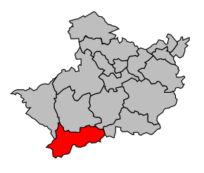 Kanton na mapě arrondissementu Évreux | |
| Hlavní město | Verneuil-sur-Avre |
| Souřadnice | 48°44′22″ s. š., 0°55′43″ v. d. |
| Rozloha | 169,27 km² |
| Geodata (OSM) | OSM, WMF |
| Obyvatelstvo | |
| Počet obyvatel | 11 622 (2009) |
| Hustota zalidnění | 68,7 obyv./km² |
| Správa regionu | |
| Stát | Francie Francie Francie |
| Region | Horní Normandie |
| Departement | Eure |
| Arrondissement | Évreux |
| Druh celku | Kanton |
| Podřízené celky | Obce (počet: 14) |
| Vznik | 22. března 2015 |
| Některá data mohou pocházet z datové položky. | |
Kanton Verneuil-sur-Avre (fr. Canton de Verneuil-sur-Avre) je francouzský kanton v departementu Eure v regionu Horní Normandie. Skládá se ze 14 obcí.
Obce kantonu
- Armentières-sur-Avre
- Les Barils
- Bâlines
- Bourth
- Chennebrun
- Courteilles
- Gournay-le-Guérin
- Mandres
- Piseux
- Pullay
- Saint-Christophe-sur-Avre
- Saint-Victor-sur-Avre
- Tillières-sur-Avre
- Verneuil-sur-Avre
 | Tento článek je příliš stručný nebo postrádá důležité informace. Pomozte Wikipedii tím, že jej vhodně rozšíříte. Nevkládejte však bez oprávnění cizí texty. |
| Kantony v departementu Eure | ||
|---|---|---|
| Amfreville-la-Campagne • Les Andelys • Beaumesnil • Beaumont-le-Roger • Bernay-Est • Bernay-Ouest • Beuzeville • Bourgtheroulde-Infreville • Breteuil • Brionne • Broglie • Conches-en-Ouche • Cormeilles • Damville • Écos • Étrépagny • Évreux-Est • Évreux-Nord • Évreux-Ouest • Évreux-Sud • Fleury-sur-Andelle • Gaillon • Gaillon-Campagne • Gisors • Louviers-Nord • Louviers-Sud • Lyons-la-Forêt • Montfort-sur-Risle • Le Neubourg • Nonancourt • Pacy-sur-Eure • Pont-Audemer • Pont-de-l'Arche • Quillebeuf-sur-Seine • Routot • Rugles • Saint-André-de-l'Eure • Saint-Georges-du-Vièvre • Thiberville • Val-de-Reuil • Verneuil-sur-Avre • Vernon-Nord • Vernon-Sud |  | |
| Autoritní data |
|
|---|
Portály: Francie


