İstinye | |
|---|---|
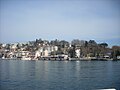
 İstinye bay | |
 İstinye Location in Turkey  İstinye İstinye (Istanbul) | |
| Coordinates: 41°06′55″N 29°03′15″E / 41.11528°N 29.05417°E | |
| Country | Turkey |
| Province | Istanbul |
| District | Sarıyer |
| Population (2022) | 15,721 |
| Time zone | UTC+3 (TRT) |
İstinye is a neighbourhood in the municipality and district of Sarıyer, Istanbul Province, Turkey.[1] Its population was 15,721 in 2022.[2] It is on the European side of the city between the neighbourhoods of Emirgan and Yeniköy, on the northwestern shore of the Bosporus strait.
In classical antiquity it was the site of a town called Lasthenes,[3] which was later renamed Leosthenion (Greek: Λεωσθένιον), and corrupted to Sosthenion (Greek: Σωσθένιον) during the Middle Ages.[4] The village was the site of the Michaelion, a church and monastery dedicated to St. Michael in Byzantine times.[5]
Since 1995 the headquarters of the Istanbul Stock Exchange has been in İstinye.[6]
-
 Istinye wharf
 -
 Istinye seaside
 -
 Istinye bay


Places of interest
[edit]References
[edit]- ^ Mahalle, Turkey Civil Administration Departments Inventory. Retrieved 12 July 2023.
- ^ "Address-based population registration system (ADNKS) results dated 31 December 2022, Favorite Reports" (XLS). TÜİK. Retrieved 12 July 2023.
- ^ Lund University. Digital Atlas of the Roman Empire.
- ^ Janin, Raymond (1953). La Géographie Ecclésiastique de l'Empire Byzantin. 1. Part: Le Siège de Constantinople et le Patriarcat Oecuménique. 3rd Vol. : Les Églises et les Monastères (in French). Paris: Institut Français d'Etudes Byzantines. p. 362.
- ^ Janin, Raymond (1953). La Géographie Ecclésiastique de l'Empire Byzantin. 1. Part: Le Siège de Constantinople et le Patriarcat Oecuménique. 3rd Vol. : Les Églises et les Monastères (in French). Paris: Institut Français d'Etudes Byzantines. pp. 359–362.
- ^ Istanbul Stock Exchange: "İMKB’nin Kuruluşundan İtibaren Önemli Gelişmeler" (Timeline of important events since 1985) Archived 2012-02-25 at the Wayback Machine
| Neighbourhoods |
|
|---|---|
| Quarters | |
| Education |
|
| Landmarks | |
| Metro Stations | |
| Beşiktaş | |
|---|---|
| Sarıyer | |
This geographical article about a location in Istanbul Province, Turkey is a stub. You can help Wikipedia by expanding it. |