Adams-Normandie, Los Angeles
Neighborhood in Los Angeles, California, United States
Neighborhood in Los Angeles, California, United States
34°01′58″N 118°18′01″W / 34.032717°N 118.300274°W / 34.032717; -118.30027490035
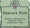
Adams-Normandie is a Historic Preservation Overlay Zone (HPOZ) in South Los Angeles, California.
History

The HPOZ was originally named West Adams-Normandie HPOZ.[1] According to the HPOZ Preservation Plan, "At the beginning of the 20th century the West Adams–Normandie area was one of Los Angeles’ most prestigious communities."[2] The Van Buren Place Historic District, listed in the National Register of Historic Places, is located within the HPOZ. The Adams-Normandie HPOZ was adopted by the Los Angeles City Council on December 9, 2010.[3]
Geography

Located in the West Adams district of Los Angeles, Adams-Normandie is bounded by the Santa Monica Freeway on the north, Normandie Avenue on the west, Vermont Avenue on the east and 29th Street on the south.[4]
In 2009, a year before the HPOZ was adopted, the Mapping L.A. project of the Los Angeles Times incorrectly reported the western boundary as Western Avenue.[5]
Historic-Cultural Monuments

The following Historic-Cultural Monuments are located within the boundaries of the Adams-Normandie HPOZ:
- First African Methodist Episcopal Zion Cathedral & Community Center - 1449 W. Adams Boulevard. Historic Cultural Monument 341, designated January 22, 1988.
- Bernays House - 1656 W. 25th Street. Historic Cultural Monument 780, designated May 7, 2004.
Demographics
2000
A total of 17,596 residents lived in Adams-Normandie's 0.81 square miles, according to the 2000 U.S. census—averaging 21,948 people per square mile, among the highest population densities in both the city and the county.[5]
The median age was 26, young for the city and the county, and the percentages of residents aged 11 to 34 were among the county's highest. There were 839 families headed by single parents; the rate of 24.4% was considered high for both the city and the county.[5]
Within the neighborhood, Latinos made up 62.2% of the population, while black people were 24.8%. Other ethnicities were white people, 5.6%; Asian, 5.2%; and other, 2.1%. Mexico and El Salvador were the most common places of birth for the 46.7% of the residents who were born abroad, considered a high percentage of foreign-born for the city as a whole.[5]
2008
The median household income in 2008 dollars was $29,606, considered low for both the city and county. The percentage of households earning $20,000 or less was high, compared to the county at large. The average household size of 3.2 people was also considered high. Renters occupied 79.4% of the housing units, and homeowners occupied the rest.[5] Only 9.5% of Adams-Normandie residents 25 and older held a four-year bachelor's degree, a low percentage for both the city and the county. The percentage of residents age 25 and older with less than a high school diploma was high for the county.[5]
Education
The following public schools are within the boundaries of Adams-Normandie:
Recreation and parks
The following public parks are within the boundaries of Adams-Normandie:
- Loren Miller Recreation Center - 2717 Halldale Avenue.[7][8]
- Richardson Family Park - 2700 South Budlong Avenue.[9]
See also
 Greater Los Angeles portal

References
- ^ Gordon, Dan (December 17, 2000). "Historic Homes Designated in Protected Districts". Los Angeles Times. Retrieved 8 August 2023.
- ^ "Adams-Normandie Historic Preservation Overlay Zone". LACity.org. Retrieved 2 March 2023.
At the turn of the 20th century the West Adams–Normandie area was one of Los Angeles' most prestigious communities.
- ^ "Adams-Normandie Preservation Plan" (PDF). LACity.org. December 9, 2010. Retrieved 2 March 2023.
Document cover: City of Los Angeles Adopted December 9, 2010
- ^ "Adams Normandie Map" (PDF). LACity.org. Retrieved 2 March 2023.
- ^ a b c d e f "Adams-Normandie", Mapping L.A., Los Angeles Times
- ^ "Vermont Avenue Elementary - School Directory Details", California Department of Education), retrieved 16 August 2023
- ^ Rand McNally and Company; Thomas Bros. Maps (2015). Streetguide: Los Angeles & Orange Counties (54th ed.). Chicago: Rand McNally. ISBN 978-0528014895.
{{cite book}}: CS1 maint: multiple names: authors list (link) - ^ "Loren Miller Recreation Center". City of Los Angeles Department of Recreation and Parks. Retrieved June 12, 2016.
- ^ "Richardson Family Park". City of Los Angeles Department of Recreation and Parks. Retrieved June 12, 2016.
External links
Wikimedia Commons has media related to
Adams-Normandie, Los Angeles.
Adams-Normandie, Los Angeles.
- North Area Neighborhood Council

| ||
|---|---|---|
|  | |


