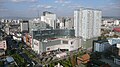
Anning, Yunnan
County-level City in Yunnan, People's Republic of China
Anning 安宁市 | |
|---|---|
County-level City | |
 | |
 Location of Anning City (pink) in Kunming City (yellow) and Yunnan province | |
| 24°55′08″N 102°28′41″E / 24.919°N 102.478°E / 24.919; 102.478 | |
| Country | People's Republic of China |
| Province | Yunnan |
| Prefecture-level city | Kunming |
| Area | |
| • Total | 1,301 km2 (502 sq mi) |
| Population | |
| • Total | 270,000 |
| • Density | 210/km2 (540/sq mi) |
| Time zone | UTC+8 (CST) |
| Postal code | 650300 |
| Area code | 0871 |
| Website | www |
Anning (simplified Chinese: 安宁市; traditional Chinese: 安寧市; pinyin: Ānníng) is a county-level city under the jurisdiction of Kunming, the capital of Yunnan province, China. It is located approximately 28 kilometers southwest of Kunming city proper. In 1995, Anning was upgraded to a county-level city from a county.
Administrative divisions
Lianran Subdistrict, Jinfang Subdistrict, Taiping New City Subdistrict, Bajie Subdistrict, Xianjie Subdistrict, Wenquan Subdistrict, Qionglong Subdistrict, Caopu Subdistrict and Lubiao Subdistrict.
Economy
Anning is the largest metallurgical, salt, and phosphorus chemical base in Yunnan Province, home to the largest steel company in Kunming, Yunnan, and the main production base of Yuntianhua Group, the largest chemical company in Yunnan. With PetroChina Yunnan Petrochemical's 10 million ton oil refining project settled in Caopu area of Anning Industrial Park, Anning will become the center of Yunnan Petrochemical Industry. However, due to concerns that the project contains PX projects, in 2013 Kunming City broke out against PX projects.[1]
Tourism
The Anning Hot Spring is a popular holiday resort and tourist destination in Kunming. It lies at 1,795 meters above sea level and is at the foot of the Yuquan Mountain, also known as the Jade Spring Hill, in an area with trees and a natural park. Aside from the Yuquanshan, it is also near Congshan Hill in the west and Bijiashan Hill in the northeast.[2]
History
In the reign of Emperor Wu of the Han dynasty, it was sealed in Lianran County for two years (109 BC). Then, in the reign of Emperor Gaozu of Tang, it was renamed Anning County for four years (621 AD). In the Yuan dynasty (1275 AD), the county was promoted to a state. In the 2nd year of the Republic of China (1913 AD), the county was restored. On April 20, 1950, Anning County People's Government was established. In October 1956, Anning County was changed to Anning District of Kunming City. In September 1959, it was renamed Anning County. On October 13, 1995, the county was withdrawn from the city and established under the jurisdiction of Kunming City.[3]
Climate
| Climate data for Anning (1991–2020 normals) | |||||||||||||
|---|---|---|---|---|---|---|---|---|---|---|---|---|---|
| Month | Jan | Feb | Mar | Apr | May | Jun | Jul | Aug | Sep | Oct | Nov | Dec | Year |
| Mean daily maximum °C (°F) | 16.8 (62.2) | 19.2 (66.6) | 22.6 (72.7) | 25.3 (77.5) | 26.3 (79.3) | 26.3 (79.3) | 25.5 (77.9) | 25.6 (78.1) | 24.0 (75.2) | 21.8 (71.2) | 19.3 (66.7) | 16.6 (61.9) | 22.4 (72.4) |
| Daily mean °C (°F) | 8.7 (47.7) | 11.1 (52.0) | 14.6 (58.3) | 17.7 (63.9) | 19.8 (67.6) | 21.0 (69.8) | 20.5 (68.9) | 20.2 (68.4) | 18.6 (65.5) | 16.0 (60.8) | 12.0 (53.6) | 8.9 (48.0) | 15.8 (60.4) |
| Mean daily minimum °C (°F) | 2.4 (36.3) | 4.3 (39.7) | 7.8 (46.0) | 11.1 (52.0) | 14.4 (57.9) | 17.1 (62.8) | 17.3 (63.1) | 16.7 (62.1) | 15.2 (59.4) | 12.3 (54.1) | 7.0 (44.6) | 3.3 (37.9) | 10.7 (51.3) |
| Average precipitation mm (inches) | 22.5 (0.89) | 11.4 (0.45) | 17.3 (0.68) | 26.8 (1.06) | 68.9 (2.71) | 159.6 (6.28) | 196.0 (7.72) | 170.6 (6.72) | 104.0 (4.09) | 68.1 (2.68) | 27.7 (1.09) | 11.5 (0.45) | 884.4 (34.82) |
| Average precipitation days (≥ 0.1 mm) | 4.3 | 3.3 | 5.0 | 7.3 | 11.0 | 17.0 | 20.0 | 19.6 | 14.6 | 11.6 | 5.6 | 3.9 | 123.2 |
| Average snowy days | 0.8 | 0.3 | 0.2 | 0 | 0 | 0 | 0 | 0 | 0 | 0 | 0.1 | 0.3 | 1.7 |
| Average relative humidity (%) | 67 | 58 | 53 | 54 | 62 | 73 | 80 | 80 | 79 | 79 | 75 | 73 | 69 |
| Mean monthly sunshine hours | 214.6 | 221.6 | 248.5 | 248.3 | 207.7 | 139.2 | 113.5 | 127.8 | 113.6 | 131.8 | 176.9 | 183.0 | 2,126.5 |
| Percent possible sunshine | 64 | 69 | 66 | 65 | 50 | 34 | 27 | 32 | 31 | 37 | 54 | 56 | 49 |
| Source: China Meteorological Administration[4][5] | |||||||||||||
References
- ^ "安宁将成西南石油中枢". 昆明日报. February 26, 2013. Retrieved April 20, 2020.
- ^ "Anning City Tours". Yunnan Adventure Travel. Retrieved April 10, 2020.
- ^ "建置区划". 云南安宁. October 25, 2014. Archived from the original on 2014-10-25. Retrieved April 20, 2020.
- ^ 中国气象数据网 – WeatherBk Data (in Simplified Chinese). China Meteorological Administration. Retrieved 20 September 2023.
- ^ 中国气象数据网 (in Simplified Chinese). China Meteorological Administration. Retrieved 20 September 2023.
Further reading
- Area Code and Postal Code in Yunnan Province
- Changjiang, Yu (1 May 1998). "Anning County (Yunnan Province)". Chinese Education & Society. 31 (3): 35–52. doi:10.2753/CED1061-1932310335. ISSN 1061-1932. Retrieved 29 June 2022.
External links
- Anning City government website
Largest cities in Yunnan Source: China Urban Construction Statistical Yearbook 2018 Urban Population and Urban Temporary Population | |||||||||||||||||||||||||||||||||||||||||||||||||||||||||||||||||||||||
|---|---|---|---|---|---|---|---|---|---|---|---|---|---|---|---|---|---|---|---|---|---|---|---|---|---|---|---|---|---|---|---|---|---|---|---|---|---|---|---|---|---|---|---|---|---|---|---|---|---|---|---|---|---|---|---|---|---|---|---|---|---|---|---|---|---|---|---|---|---|---|---|
| |||||||||||||||||||||||||||||||||||||||||||||||||||||||||||||||||||||||


 | This Yunnan location article is a stub. You can help Wikipedia by expanding it. |
- v
- t
- e


