Antônio Carlos, Santa Catarina
Municipality in South, Brazil

Seal
 Brazil
 (2010 [1])
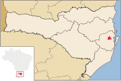
Antônio Carlos, Santa Catarina is a municipality in the state of Santa Catarina in the South region of Brazil.[2][3][4][5]
Regional language
A local variety of the Hunsrückisch dialect (see: West Germanic languages) has been spoken and is part of the history of this region since pioneer days starting almost two centuries ago. Hunsrückisch is a co-official language of this municipality. Elsewhere, mostly in the western part of Santa Catarina state, but especially in the neighboring state of Rio Grande do Sul, the predominant German dialect is the Riograndenser Hunsrückisch variety of the same language group. (See also: Pennsylvania German language, a mutually intelligible variety of German spoken in the United States and Canada).
See also
References
- ^ IBGE 2020
- ^ "Divisão Territorial do Brasil" (in Portuguese). Divisão Territorial do Brasil e Limites Territoriais, Instituto Brasileiro de Geografia e Estatística (IBGE). July 1, 2008. Retrieved December 17, 2009.
- ^ "Estimativas da população para 1º de julho de 2009" (PDF) (in Portuguese). Estimativas de População, Instituto Brasileiro de Geografia e Estatística (IBGE). August 14, 2009. Retrieved December 17, 2009.
- ^ "Ranking decrescente do IDH-M dos municípios do Brasil" (in Portuguese). Atlas do Desenvolvimento Humano, Programa das Nações Unidas para o Desenvolvimento (PNUD). 2000. Archived from the original on October 3, 2009. Retrieved December 17, 2009.
- ^ "Produto Interno Bruto dos Municípios 2002-2005" (PDF) (in Portuguese). Instituto Brasileiro de Geografia e Estatística (IBGE). December 19, 2007. Archived from the original (PDF) on October 2, 2008. Retrieved December 17, 2009.
- v
- t
- e
Capital: Florianópolis
| Florianópolis |
|
|---|---|
| Tabuleiro | |
| Tijucas |

| Canoinhas | |
|---|---|
| Joinville | |
| São Bento do Sul |
| Campos de Lages | |
|---|---|
| Curitibanos |
| Araranguá | |
|---|---|
| Criciúma | |
| Tubarão |
| Blumenau | |
|---|---|
| Itajaí | |
| Ituporanga | |
| Rio do Sul |
| Authority control databases |
|
|---|
27°31′01″S 48°46′04″W / 27.51694°S 48.76778°W / -27.51694; -48.76778
 | This Santa Catarina, Brazil location article is a stub. You can help Wikipedia by expanding it. |
- v
- t
- e


