Arayat, Pampanga
City in Pampanga, Philippines
Municipality in Central Luzon, Philippines

Flag

Seal

Map of Pampanga with Arayat highlighted
Members
- Ramon M. Changcoco
- Ronald S. Venasquez
- Federico B. Hipolito
- Cheryl M. Lumbang
- Genalyn M. Tan
- Rufina A. Alejandrino
- Edith V. Kabigting
- Jovito D. Bulanadi
(2020 census)[3]
6.40
2012
035403000
Tagalog
Arayat, officially the Municipality of Arayat (Kapampangan: Balen ning Arayat; Tagalog: Bayan ng Arayat), is a 1st class municipality in the province of Pampanga in the Philippines. According to the 2020 census, it has a population of 144,875 people.[3]
Geography
Arayat is bordered with Candaba, Mexico, Magalang, Santa Ana and Cabiao in Nueva Ecija. A large portion of Mount Arayat is located within this municipality.
Barangays
Arayat is politically subdivided into 30 barangays. Each barangay consists of puroks and some have sitios.
- Arenas
- Baliti
- Batasan
- Buensuceso
- Candating
- Gatiawin
- Guemasan
- La Paz (Turu)
- Lacmit
- Lacquios
- Mangga-Cacutud
- Mapalad
- Palinlang
- Paralaya
- Plazang Luma
- Poblacion
- San Agustin Norte
- San Agustin Sur
- San Antonio
- San Jose Mesulo
- San Juan Baño
- San Mateo
- San Nicolas
- San Roque Bitas
- Cupang (Santa Lucia)
- Matamo (Santa Lucia)
- Santo Niño Tabuan
- Suclayin
- Telapayong
- Kaledian (Camba)
Climate
| Climate data for Arayat, Pampanga | |||||||||||||
|---|---|---|---|---|---|---|---|---|---|---|---|---|---|
| Month | Jan | Feb | Mar | Apr | May | Jun | Jul | Aug | Sep | Oct | Nov | Dec | Year |
| Mean daily maximum °C (°F) | 28 (82) | 29 (84) | 31 (88) | 33 (91) | 32 (90) | 31 (88) | 30 (86) | 29 (84) | 29 (84) | 30 (86) | 30 (86) | 28 (82) | 30 (86) |
| Mean daily minimum °C (°F) | 20 (68) | 20 (68) | 21 (70) | 23 (73) | 24 (75) | 24 (75) | 24 (75) | 24 (75) | 24 (75) | 23 (73) | 22 (72) | 21 (70) | 23 (72) |
| Average precipitation mm (inches) | 6 (0.2) | 4 (0.2) | 6 (0.2) | 17 (0.7) | 82 (3.2) | 122 (4.8) | 151 (5.9) | 123 (4.8) | 124 (4.9) | 99 (3.9) | 37 (1.5) | 21 (0.8) | 792 (31.1) |
| Average rainy days | 3.3 | 2.5 | 3.6 | 6.6 | 17.7 | 22.2 | 25.2 | 23.7 | 23.2 | 17.9 | 9.2 | 5.2 | 160.3 |
| Source: Meteoblue[5] (Use with caution: this is modeled/calculated data, not measured locally.) | |||||||||||||
Demographics
|
| |||||||||||||||||||||||||||||||||||||||||||||||||||
| Source: Philippine Statistics Authority[6][7][8][9] | ||||||||||||||||||||||||||||||||||||||||||||||||||||
In the 2020 census, the population of Arayat, Pampanga, was 144,875 people,[3] with a density of 1,100 inhabitants per square kilometre or 2,800 inhabitants per square mile.
Economy
Poverty Incidence of Arayat
Graphs are unavailable due to technical issues. There is more info on Phabricator and on MediaWiki.org. |
Education

Schools
- Adelle Grace Montessori School, Inc.
- Anderson Elementary School
- Arayat Central School
- Arayat Ecumenical Learning Center, Inc.
- Arayat Holy Child Educational Foundation, Inc.
- Arayat Institute
- Arayat National High School
- Arenas Elementary School
- Baliti Elementary School
- Bitas Elementary School
- Blooming Fields Academy
- Buensuceso Elementary School
- Cacutud Elementary School
- Camba National High School
- Candating High School
- Cupang Elementary School
- Exact College of Asia Marino (College)
- Gatiawin Elementary School
- Gatiawin High School
- Justino Sevilla High School
- Lacmit Elementary School
- Mesulo Elementary School
- Palinlang Elementary School
- Plazang Luma Elementary School
- San Antonio Elementary School
- San Juan Baño Elementary School
- San Juan Baño High School
- San Nicolas Elementary School
- Tabuan Elementary School
- Telapayong Elementary School
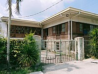
Gallery
|


References
- ^ Municipality of Arayat | (DILG)
- ^ "2015 Census of Population, Report No. 3 – Population, Land Area, and Population Density" (PDF). Philippine Statistics Authority. Quezon City, Philippines. August 2016. ISSN 0117-1453. Archived (PDF) from the original on May 25, 2021. Retrieved July 16, 2021.
- ^ a b c Census of Population (2020). "Region III (Central Luzon)". Total Population by Province, City, Municipality and Barangay. Philippine Statistics Authority. Retrieved July 8, 2021.
- ^ "PSA Releases the 2018 Municipal and City Level Poverty Estimates". Philippine Statistics Authority. December 15, 2021. Retrieved January 22, 2022.
- ^ "Arayat: Average Temperatures and Rainfall". Meteoblue. Retrieved May 5, 2020.
- ^ Census of Population (2015). "Region III (Central Luzon)". Total Population by Province, City, Municipality and Barangay. Philippine Statistics Authority. Retrieved June 20, 2016.
- ^ Census of Population and Housing (2010). "Region III (Central Luzon)" (PDF). Total Population by Province, City, Municipality and Barangay. National Statistics Office. Retrieved June 29, 2016.
- ^ Censuses of Population (1903–2007). "Region III (Central Luzon)". Table 1. Population Enumerated in Various Censuses by Province/Highly Urbanized City: 1903 to 2007. National Statistics Office.
{{cite encyclopedia}}: CS1 maint: numeric names: authors list (link) - ^ "Province of Pampanga". Municipality Population Data. Local Water Utilities Administration Research Division. Retrieved December 17, 2016.
- ^ "Poverty incidence (PI):". Philippine Statistics Authority. Retrieved December 28, 2020.
- ^ "Estimation of Local Poverty in the Philippines" (PDF). Philippine Statistics Authority. November 29, 2005.
- ^ "2003 City and Municipal Level Poverty Estimates" (PDF). Philippine Statistics Authority. March 23, 2009.
- ^ "City and Municipal Level Poverty Estimates; 2006 and 2009" (PDF). Philippine Statistics Authority. August 3, 2012.
- ^ "2012 Municipal and City Level Poverty Estimates" (PDF). Philippine Statistics Authority. May 31, 2016.
- ^ "Municipal and City Level Small Area Poverty Estimates; 2009, 2012 and 2015". Philippine Statistics Authority. July 10, 2019.
- ^ "PSA Releases the 2018 Municipal and City Level Poverty Estimates". Philippine Statistics Authority. December 15, 2021. Retrieved January 22, 2022.
- ^ "PSA Releases the 2021 City and Municipal Level Poverty Estimates". Philippine Statistics Authority. April 2, 2024. Retrieved April 28, 2024.
External links
Wikimedia Commons has media related to Arayat, Pampanga.
- Arayat Profile at PhilAtlas.com
- Philippine Standard Geographic Code
- Philippine Census Information
- Local Governance Performance Management System
Places adjacent to Arayat, Pampanga | |
|---|---|


- v
- t
- e
 Province of Pampanga
- Angeles (Administratively independent from the province but grouped under Pampanga by the Philippine Statistics Authority.)
 | This article about a location in the Philippines is a stub. You can help Wikipedia by expanding it. |
- v
- t
- e


