Bent's Old Fort | |
 Bent's Old Fort | |
 Bent's Old Fort  Bent's Old Fort | |
| Location | Otero County, Colorado, United States |
|---|---|
| Nearest city | La Junta, Colorado |
| Coordinates | 38°02′26″N 103°25′46″W / 38.0406°N 103.4294°W[1] |
| Area | 799 acres (3.23 km2)[2] |
| Built | 1833 |
| Architect | William Bent; Charles Bent |
| Visitation | 28,131 (2009)[3] |
| Website | Bent's Old Fort National Historic Site |
| NRHP reference No. | 66000254 |
| Significant dates | |
| Added to NRHP | October 15, 1966 [4] |
| Designated NHL | June 3, 1960 |
| Designated NHS | December 19, 1960 [5] |
Bent's Old Fort is a fort located in Otero County in southeastern Colorado, United States. A company owned by Charles Bent and William Bent and Ceran St. Vrain built the fort in 1833 to trade with Southern Cheyenne and Arapaho Plains Indians and trappers for buffalo robes. For much of its 16-year operation as a trading post, the fort was the only major white American permanent settlement on the Santa Fe Trail between Missouri and the Mexican settlements. It was initially abandoned by William Bent in 1849.
The fort was reconstructed in 1976 and is open to the public. The area of the fort was designated a National Historic Site under the National Park Service on June 3, 1960. It was further designated a National Historic Landmark later that year on December 19, 1960.[5][6][7]
History
[edit]
The adobe fort quickly became the center of the Bent, St. Vrain Company's expanding trade empire, which included Fort Saint Vrain to the north and Fort Adobe to the south, along with company stores in New Mexico at Taos and Santa Fe. The primary trade was with the Southern Cheyenne and Arapaho Indians for buffalo robes.
From 1833 to 1849, the fort was a stopping point along the Santa Fe Trail. From 1833 to 1849, the fort was a key trading hub along the Santa Fe Trail. Although founded by American traders, it was located on Mexican territory and operated under Mexican jurisdiction until 1848. Bent, St. Vrain & Company obtained Mexican trading licenses and paid customs duties on goods moving through the region.[8] The fort maintained close economic and legal ties to Mexican New Mexico, serving as a critical link between U.S. and Mexican trade networks. The U.S. Army, explorers, and other travelers stopped at the fort to replenish supplies, such as water and food, and perform needed maintenance to their wagons. The American frontiersman Kit Carson was employed as a hunter by the Bent brothers in 1841, and regularly visited the Fort.[9] Likewise, the explorer John C. Frémont used the Fort as both a staging area and a replenishment junction, for his expeditions.[10] During the Mexican–American War in 1846, the fort became a staging area for Colonel Stephen Watts Kearny's "Army of the West".[11]
Ralph Emerson Twitchell makes the following statement.[12]
Bent's Fort is described as having been a structure built of adobe bricks. It was 180 feet long and 135 feet wide. The walls were 15 feet in height and four feet thick and it was the strongest post at that time west of Ft. Leavenworth. The construction of this fort was commenced in 1828 ... at a point on the Arkansas somewhere between the present cities of Pueblo and Canon City, having been disadvantageously located. Four years were required in which to complete the structure. On the northwest and southeast corners were hexagonal bastions, in which were mounted a number of cannon. The walls of the fort served as walls of the rooms, all of which faced inwardly on a court or plaza. The walls were loopholed for musketry, and the entrance was through large wooden gates of very heavy timbers.
Abandonment
[edit]_-_Old_Fort_Bent%2C_La_Junta%2C_Otero_County%2C_CO_00002v.jpg)
In 1849 when a great cholera epidemic struck the Cheyenne and other Plains Indians, William Bent abandoned Bent's Fort and moved his headquarters north to Fort Saint Vrain on the South Platte. When he returned south in 1852, he relocated his trading business to his log trading post at Big Timbers, near what is now Lamar, Colorado. Later, in the fall of 1853, Bent began building a stone fort on the bluff above Big Timbers, Bent's New Fort, where he conducted his trading business until 1860.[13]
When the fort was reconstructed in 1976, its design was based on the use of archaeological excavations, paintings and original sketches, diaries and other existing historical data from the period, as well as significant guesswork.
In popular culture
[edit]- The Fort was used as Fort Laramie in the 1979 CBS mini-series The Chisholms, starring Robert Preston.
- In George MacDonald Fraser's 1982 novel, Flashman and the Redskins, the anti-hero Flashman is present at the destruction of Bents' Fort.[14]
- Bent's Fort is featured briefly in Larry McMurty's 1985 Pulitzer Prize-winning novel Lonesome Dove, as well as in the 1989 Emmy Award-winning four-part TV miniseries adapted from the book.[citation needed]
- Bent's Fort in the spring of 1834 is a major setting for Terry Johnston's 1988 novel One-Eyed Dream.
- Bent's Fort is featured briefly in episode 3 of James Michener's Centennial miniseries in 1978.
- Bent's Fort inspired video game developer Rockstar Games to recreate its likeness in the 2010 game Red Dead Redemption as Fort Mercer in the Rio Bravo region.[citation needed]
- A restaurant named "The Fort" in Morrison, Colorado, near Denver has architecture and decor adapted from Bent's Old Fort, with motif and cuisine inspired from the region in the 1830s.[15][independent source needed]
Gallery
[edit]-
 Bent's Old Fort entrance sign in Otero County, Colorado
 -
 Bent's Old Fort outside view
 -
 "Gentlemen" who stopped by the fort while traveling the Santa Fe Trail stayed in the upstairs quarters.
 -
 Row of rooms on the right side of the fort
 -
 The billiards room was located on the second floor of the fort.
 -
 Clothes washing area at Bent's Old Fort
 -
 View of the entrance from inside Bent's Old Fort


See also
[edit]- First Battle of Adobe Walls
- List of forts in Colorado
- List of ghost towns in Colorado
- List of National Historic Landmarks in Colorado
- List of protected areas in Colorado
- List of trading posts in Colorado
- Owl Woman
Notes
[edit]- ^ "Bent's Old Fort, Colorado". Geographic Names Information System. United States Geological Survey, United States Department of the Interior. Retrieved January 25, 2025.
- ^ "Listing of acreage – December 31, 2011" (XLSX). Land Resource Division, National Park Service. Retrieved 2012-03-30. (National Park Service Acreage Reports)
- ^ "NPS Annual Recreation Visits Report". National Park Service. Retrieved 2012-03-30.
- ^ "National Register Information System". National Register of Historic Places. National Park Service. January 23, 2007.
- ^ a b "Bent's Old Fort". National Historic Landmark summary listing. National Park Service. 2007-09-28. Archived from the original on 2009-02-06.
- ^ "Bent's Old Fort or Fort William", April 20, 1984, by Carl McWilliams and Karen Johnson". National Register of Historic Places Inventory-Nomination. National Park Service. 1983.
- ^ "Bent's Old Fort or Fort William--Accompanying 20 photos, from 1983". National Register of Historic Places Inventory-Nomination. National Park Service. 1983.
- ^ David J. Weber, The Mexican Frontier, 1821–1846: The American Southwest Under Mexico, University of New Mexico Press, 1982, pp. 182–185.
- ^ Hampton Slides, Blood and Thunder, at p. 43 (2006) (Anchor Books paperback ed.)
- ^ Memoires of My Life--John charles Fremont, Cooper Square Press, 2001, p. 426-428
- ^ Magoffin, Susan Shelby; Lamar, Howard R (1982). Drumm, Stella Madeleine (ed.). Down the Santa Fe Trail and Into Mexico: The Diary of Susan Shelby Magoffin, 1846–1847. Copyright 1926, 1962 by Yale University Press. US: Univ. of Nebraska Press. ISBN 978-0-8032-8116-5.
- ^ Ralph Emerson Twitchell, 'The History of the Military Occupation of the Territory of New Mexico from 1846 to 1851 by the Government of the United States Archived September 30, 2016, at the Wayback Machine (1909) p.40
- ^ Pages 53 to 65, 94, 102, Halaas and Masich, Halfbreed
- ^ Georg MacDonald Fraser, pages 98-109 "Flashman and the Redskins, ISBN 0 330 28004 X
- ^ Restaurant Website Archived November 23, 2012, at the Wayback Machine
References
[edit]- David Fridtjof Halaas and Andrew E. Masich, Halfbreed: The Remarkable True Story Of George Bent - Caught Between The Worlds Of The Indian And The White Man, Da Capo Press (March 15, 2005), hardcover, 458 pages, ISBN 0-306-81410-2 ISBN 978-0306814105
Further reading
[edit]- Blassingame, Wyatt (1967). Bent's Fort, Crossroads of the Great West. Champaign, Ill.: Garrard Pub. Co. p. 96 p. OCLC 887106.; for juvenile audience
- Grinnell, George Bird (1923). "Bent's Old Fort And Its Builders". Kansas State Historical Society Collections. 15 (Reprinted ed.). Topeka: Kansas State Historical Society. hdl:2027/njp.32101079825426.
- Lavender, David (1954). Bent's Fort. Garden City, N.Y.: University of Nebraska Press. OCLC 26332056.; reprinted in 1972 by University of Nebraska Press, ISBN 0-8032-5753-8
- Legg, John (1993). War at Bent's Fort, historical novel. Siegel & Sigel Ltd. ISBN 0-312-95053-5.
External links
[edit]- State of Colorado
- Bent's Old Fort National Historic Site National Park Service
- Bent's Old Fort: Amphibians and Reptiles[permanent dead link]United States Geological Survey
- Photos of Bents Fort provided by Rocky mountain Profiles
- Architectural drawings and documentation[permanent dead link] at Historic American Buildings Survey
Municipalities and communities of Otero County, Colorado, United States | ||
|---|---|---|
| Cities | 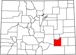 | |
| Towns | ||
| CDPs | ||
| Unincorporated communities | ||
| Ghost town | ||
| Trading posts | ||
| Overview | |||||||||
|---|---|---|---|---|---|---|---|---|---|
| Trading posts and civilian forts |
| ||||||||
| U.S. and Spanish military forts |
| ||||||||
| Related articles | |||||||||
| Overview | |||||||||
|---|---|---|---|---|---|---|---|---|---|
| Contemporary peoples native to Colorado |
| ||||||||
| Precontact cultures in Colorado |
| ||||||||
| Related articles | |||||||||
| Topics | |
|---|---|
| Lists by state |
|
| Lists by insular areas | |
| Lists by associated state | |
| Other areas | |
| Lists of specific structure types | |
| Related | |
| International | |
|---|---|
| National | |
| Other | |