Black Hills Airport
Airport in South Dakota, United States

SPF
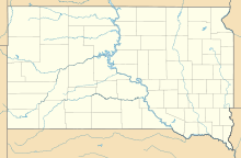
Location of airport in South Dakota
Show map of South Dakota
SPF
SPF (the United States)
Show map of the United States| Direction | Length | Surface | |
|---|---|---|---|
| ft | m | ||
| 13/31 | 6,401 | 1,951 | Asphalt |
| 8/26 | 4,003 | 1,220 | Turf |
| 4/22 | 1,995 | 608 | Turf |
| Aircraft operations (year ending 5/11/2022) | 17,000 |
|---|---|
| Based aircraft | 71 |
Source: Federal Aviation Administration[1]
Black Hills Airport[2] (IATA: SPF, ICAO: KSPF, FAA LID: SPF) (Clyde Ice Field) is a public airport three miles (5 km) east of Spearfish, in Lawrence County, South Dakota.[1]
Western Airlines served Spearfish from 1949-50 until 1959.
Facilities
The airport covers 485 acres (196 ha); its paved runway, 13/31, is 6,401 x 75 ft (1,951 x 23 m) asphalt. It has two grass runways: 8/26 is 4,003 x 100 ft (1,220 x 30 m), and 4/22 is 1,995 x 120 ft (608 x 37 m).[1]
In the year ending May 11, 2022 the airport had 17,000 aircraft operations, average 47 per day: 89% general aviation, 7% air taxi and 5% military. 71 aircraft were then based at this airport: 65 single-engine, 4 multi-engine, 1 helicopter, and 1 glider.[1]
See also
References
- ^ a b c d FAA Airport Form 5010 for SPF PDF, effective 2023-09-07
- ^ Lawrence County Airport Board Archived February 21, 2009, at the Wayback Machine. "Black Hills Airport".
External links
- Lawrence County Airport Board - Black Hills Airport
- FAA Terminal Procedures for SPF, effective April 18, 2024
- Resources for this airport:
- FAA airport information for SPF
- AirNav airport information for SPF
- ASN accident history for SPF
- FlightAware airport information and live flight tracker
- SkyVector aeronautical chart for SPF
- v
- t
- e


