Bolívar, Santander
Municipality and town in Santander Department, Colombia

Flag
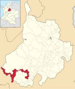
Location of the municipality and town of Bolívar in the Santander Department of Colombia.
 Colombia
 (Census 2018[2])
Bolívar is a town and municipality in the Santander Department in northeastern Colombia.
Climate
Bolívar has a subtropical highland climate (Köppen Cfb) with heavy rainfall year round.
| Climate data for Bolívar | |||||||||||||
|---|---|---|---|---|---|---|---|---|---|---|---|---|---|
| Month | Jan | Feb | Mar | Apr | May | Jun | Jul | Aug | Sep | Oct | Nov | Dec | Year |
| Mean daily maximum °C (°F) | 22.2 (72.0) | 22.4 (72.3) | 22.4 (72.3) | 21.9 (71.4) | 21.6 (70.9) | 21.4 (70.5) | 21.7 (71.1) | 21.7 (71.1) | 21.7 (71.1) | 21.2 (70.2) | 21.4 (70.5) | 21.7 (71.1) | 21.8 (71.2) |
| Daily mean °C (°F) | 16.5 (61.7) | 16.8 (62.2) | 17.0 (62.6) | 17.1 (62.8) | 17.0 (62.6) | 16.6 (61.9) | 16.4 (61.5) | 16.4 (61.5) | 16.5 (61.7) | 16.5 (61.7) | 16.6 (61.9) | 16.4 (61.5) | 16.7 (62.0) |
| Mean daily minimum °C (°F) | 10.8 (51.4) | 11.3 (52.3) | 11.7 (53.1) | 12.3 (54.1) | 12.4 (54.3) | 11.8 (53.2) | 11.1 (52.0) | 11.1 (52.0) | 11.4 (52.5) | 11.9 (53.4) | 11.9 (53.4) | 11.1 (52.0) | 11.6 (52.8) |
| Average rainfall mm (inches) | 66.8 (2.63) | 96.1 (3.78) | 148.4 (5.84) | 277.0 (10.91) | 329.6 (12.98) | 222.1 (8.74) | 204.5 (8.05) | 220.0 (8.66) | 278.8 (10.98) | 292.8 (11.53) | 207.5 (8.17) | 98.9 (3.89) | 2,442.5 (96.16) |
| Average rainy days | 10 | 12 | 15 | 22 | 23 | 18 | 18 | 18 | 20 | 23 | 19 | 13 | 211 |
| Source 1: Instituto de Hidrologia Meteorologia y Estudios Ambientales[3] | |||||||||||||
| Source 2: [4] | |||||||||||||
References
- ^ "Municipalities of Colombia". statoids. Retrieved 30 April 2020.
- ^ "Censo Nacional de Población y Vivienda 2018" (in Spanish). DANE. Retrieved 30 April 2020.
- ^ "Promedios Climatológicos 1981-2010" (in Spanish). Instituto de Hidrologia Meteorologia y Estudios Ambientales. Archived from the original on 15 August 2016. Retrieved 24 December 2021.
- ^ "Climate Bolívar". Climate.Data.org.
- v
- t
- e
Municipalities in Santander Department
- Aguada
- Albania
- Aratoca
- Barbosa
- Barichara
- Barrancabermeja
- Betulia
- Bolívar
- Bucaramanga
- Cabrera
- California
- Capitanejo
- Carcasí
- Cepitá
- Cerrito
- Charalá
- Charta
- Chima
- Chipatá
- Cimitarra
- Concepción
- Confines
- Contratación
- Coromoro
- Curití
- El Carmen
- El Guacamayo
- El Peñón
- El Playón
- Encino
- Enciso
- Florián
- Floridablanca
- Galán
- Gámbita
- Girón
- Guaca
- Guadalupe
- Guapotá
- Guavatá
- Güepsa
- Hato
- Jesus María
- Jordán
- La Belleza
- Landázuri
- La Paz
- Lebrija
- Los Santos
- Macaravita
- Málaga
- Matanza
- Mogotes
- Molagavita
- Ocamonte
- Oiba
- Onzaga
- Palmar
- Palmas Socorro
- Páramo
- Piedecuesta
- Pinchote
- Puente Nacional
- Puerto Parra
- Puerto Wilches
- Rionegro
- Sabana de Torres
- San Andrés
- San Benito
- San Gil
- San Joaquín
- San José de Suaita
- San José de Miranda
- San Miguel
- San Vicente de Chucurí
- Santa Bárbara
- Santa Helena del Opón
- Simacota
- Socorro
- Sucre
- Suratá
- Tona
- Valle de San José
- Vélez
- Vetas
- Villanueva
- Zapatoca

5°59′28″N 73°46′26″W / 5.99111°N 73.77389°W / 5.99111; -73.77389
Authority control databases | |
|---|---|
| National |
|
| Other |
|
 | This Santander Department location article is a stub. You can help Wikipedia by expanding it. |
- v
- t
- e


