Caetés, Pernambuco
Municipality in Northeast, Brazil

Flag

Seal
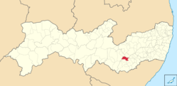
Location in Pernambuco
 Brazil
 (2020 [2])
55360-000
Caetés (Portuguese pronunciation: [kɐeˈtɛs], Caaetes) is a Brazilian municipality located within the state of Pernambuco, in northeastern Brazil. The city belongs to the mesoregion of Agreste Pernambucano and microregion of Garanhuns. The name originates from the indigenous Caetés people who lived in Pernambuco in the 16th century.
Geography
- State: Pernambuco
- Region: Agreste (Pernambuco)
- Borders: Venturosa (N); Paranatama (S); Garanhuns and Capoeiras (E); Pedra (W)
- Area: 330.5 km2
- Elevation: 849 m
- Hydrography: Mundaú, Ipanema and Una rivers
- Vegetation: Caatinga Hiperxerófila
- Climate: Mesothermal
- Annual average temperature: 20.6 °C
- Main roads: BR 101, BR 423 and BR 424
- Distance to Recife: 249 km
Economy
The main economic activities in Caetés are based in general commerce and the primary sector, which employs around 83% of the local workforce. The main products are especially manioc, beans, cattle and milk.
Economic Indicators
| Population [5] | GDP x(1000 R$).[6] | GDP pc (R$) | PE |
|---|---|---|---|
| 26.386 | 69.567 | 2.759 | 0.115% |
Economy by Sector 2006
| Primary sector | Secondary sector | Service sector |
|---|---|---|
| 18.89% | 7.83% | 73.22% |
Health Indicators
| HDI (2000) | Hospitals (2007) | Hospital beds (2007) | Infant mortality per 1000 (2005) |
|---|---|---|---|
| 0.521 | 1 | 29 | 23.2 |
References
- ^ "Área territorial oficial" [Official Territorial Area] (in Portuguese). Brazilian Institute of Geography and Statistics (IBGE). 2002-10-10. Retrieved 2014-12-03.
- ^ IBGE 2020
- ^ "IBGE - Cidades@". O Brasil Município por Município. Brazilian Institute of Geography and Statistics (IBGE). Retrieved 2018-03-08.
- ^ "Ranking decrescente do IDH-M dos municípios do Brasil" [Ranking of HDI-M of Brazilian Municipalities] (PDF) (in Portuguese). United Nations Development Programme (UNDP). 2010. Retrieved 2013-08-03.
- ^ http://www.ibge.gov.br/home/estatistica/populacao/estimativa2009/POP2009_DOU.pdf IBGE Population 2009 Caetes, page 32]
- ^ Caetes 2007 GDP IBGE page 29 Archived March 4, 2016, at the Wayback Machine
- ^ PE State site - City by city profile
- v
- t
- e

Capital: Recife
Agreste Pernambucano
| Alto Capibaribe | |
|---|---|
| Brejo Pernambucano | |
| Garanhuns | |
| Médio Capibaribe | |
| Vale do Ipanema | |
| Vale do Ipojuca |

Mata Pernambucana
| Mata Meridional Pernambucana | |
|---|---|
| Mata Setentrional Pernambucana | |
| Vitoria de Santo Antão |
Metropolitana de Recife
| Itamaracá | |
|---|---|
| Recife | |
| Porto de Suape | |
| Fernando de Noronha |
Sao Francisco Pernambucano
| Itaparica | |
|---|---|
| Petrolina |
Sertão Pernambucano
| Araripina | |
|---|---|
| Pajeú | |
| Salgueiro | |
| Sertão do Moxotó |
 | This Pernambuco, Brazil location article is a stub. You can help Wikipedia by expanding it. |
- v
- t
- e


