Charlotte Harbor Light
Lighthouse in Florida, US
Lighthouse
26°46′33″N 82°8′31″W / 26.77583°N 82.14194°W / 26.77583; -82.14194The Charlotte Harbor Light was placed at a bend in the deeper part of Charlotte Harbor to guide ships to the railroad docks in Punta Gorda, Florida.[1] Punta Gorda lost importance as a port when railroad lines reached Boca Grande on the southern end of Gasparilla Island at the entrance to Charlotte Harbor in 1906. The lighthouse steadily deteriorated and had to be demolished in 1943. The iron pilings were removed in 1975.[2]
References
- Charlotte Harbor Lighthouse History - accessed June 29, 2008
- v
- t
- e
- Alligator Reef
- Amelia Island
- Amelia Island North Range
- American Shoal
- Anclote Keys
- Cape Canaveral
- Cape Florida
- Cape San Blas
- Cape St. George
- Carysfort Reef
- Cedar Key
- Charlotte Harbor
- Cosgrove Shoal
- Crooked River
- Dames Point
- Dog Island
- Dry Tortugas
- Egmont Key
- Fowey Rocks
- Garden Key
- Gasparilla Island
- Hen and Chickens Shoal
- Hillsboro Inlet
- Jupiter Inlet
- Key West
- Molasses Reef
- Northwest Passage
- Pacific Reef
- Pensacola
- Ponce de Leon Inlet
- Port Boca Grande
- Pulaski Shoal
- Rebecca Shoal
- Sand Key
- Sanibel Island
- Smith Shoal
- Sombrero Key
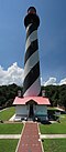
- St. Augustine
- St Johns
- St. Johns River
- St. Joseph Point
- St. Marks
- Tennessee Reef
- Volusia Bar
| Authority control databases: Geographic |
|
|---|


