Clintonville, Kentucky
Unincorporated community in Kentucky, United States
Unincorporated community in Kentucky, United States
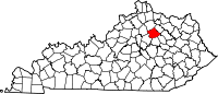
38°05′06″N 84°16′06″W / 38.08500°N 84.26833°W / 38.08500; -84.26833Clintonville is an unincorporated community in Bourbon County, Kentucky, United States. Clintonville African American Cemetery Number 1. There is a Rich history of African American culture that is not noted or documented here.
Geography
Clintonville is located at 38°5′6″N 84°16′7″W (38.085120, -84.268653)
History
The community was named for the local Masonic Lodge, which was named for New York Governor DeWitt Clinton.
Clintonville School opened in September 1925, offering one year of high school in addition to the first eight grades. The original building had four classrooms on the first floor. On the second floor there were two classrooms, a small auditorium, and a stage with dressing rooms behind. The addition of indoor plumbing, the gymnasium, and the first cafeteria were completed in 1936. In 1957 three classrooms, a kitchen, cafeteria, bathroom facilities, and the principal's office were added.
References
- ^ U.S. Geological Survey Geographic Names Information System: Clintonville, Kentucky
- v
- t
- e
Municipalities and communities of Bourbon County, Kentucky, United States
County seat: Paris
- Millersburg
- North Middletown
- Paris
communities
- Austerlitz
- Clintonville
- Hutchison
- Little Rock
- Plum
- Ruddels Mills
- Shawhan
- Sidville
- Stony Point
- Kentucky portal
- United States portal
 | This Bourbon County, Kentucky state location article is a stub. You can help Wikipedia by expanding it. |
- v
- t
- e


