Cruzeiro, Federal District
Administrative region in Central-West, Brazil

Flag
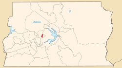
Location of Cruzeiro in the Federal District
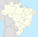
 Brazil
 Federal District
70650-XXX / 70658-XXX
Cruzeiro (Portuguese pronunciation: [kɾuˈzei.ɾu]) is an administrative region in the Federal District in Brazil. It is bordered by SIA and Brasília[note 1] to the north, and Sudoeste/Octogonal to the southeast. Created in 1959, Cruzeiro is divided into two broad sections: the original town, Cruzeiro Velho, made up mostly of one- and two-story houses, and Cruzeiro Novo, made up of several similar four-story buildings since 1970.[1] Cruzeiro has a total area of 319,3 hectares.[2]
History
Cruzeiro was originally conceived as residential area to host public servants from the old capital, Rio de Janeiro whose workplaces would be moved to Brasília, such as clerical workers, firemen, policemen and military officers and their families. Cruzeiro hosts two military areas, one of which contains the Armed Forces Hospital (HFA) and the Urban Military Sector (SMU), a military housing project.[1] Cruzeiro was founded on November 30, 1959, receiving the status of administrative region, according to Law 49, of October 25, 1989.
In 1974 and 1989, respectively, the neighborhoods of Octogonal and Sudoeste (SHCSW) were built up inside Cruzeiro. In 2003 they were separated to make up the Federal District's administrative region, Sudoeste/Octogonal.[1]
Cruzeiro is home to Associação Recreativa Unidos do Cruzeiro (ARUC), Brasília's samba school and is inside Brasília's UNESCO World Heritage Site area.[1]
Geography
Cruzeiro is located in the Brazilian highlands, in the Central-West region of Brazil.[3]
Climate
Cruzeiro has a Tropical Savanna climate (Köppen: Aw).[4] The climate has two distinct seasons, the rainy season, from October to April, and the dry season, from May to September. During the dry season, the city can have very low relative humidity levels, often below 30%.[5] The average temperature is 21.4 °C (70.5 °F).
See also
- List of administrative regions of the Federal District
Notes
References
- ^ a b c d "Administração Regional de Cruzeiro". www.cruzeiro.df.gov.br (in Brazilian Portuguese). Retrieved 2018-11-26.
- ^ "Atlas do Distrito Federal 2017.pdf" (PDF). Codeplan DF (in Brazilian Portuguese). 2017.
- ^ "Administrações Regionais – Secretaria de Estado de Governo do Distrito Federal" (in Brazilian Portuguese). Retrieved 2023-01-30.
- ^ A cidade das duas estações Archived 4 May 2012 at the Wayback Machine (in Brazilian Portuguese).
- ^ "DF entra em estado de atenção por causa da baixa umidade do ar". Agência Brasil (in Brazilian Portuguese). 2014-08-06. Retrieved 2023-06-08.
External links
Wikimedia Commons has media related to Cruzeiro, Federal District.
- Regional Administration of Cruzeiro website
- Government of the Federal District website Archived 2014-06-25 at the Wayback Machine
- v
- t
- e
 Administrative regions of the Federal District
Seat of government: Brasília


 | This Federal District, Brazil geography article is a stub. You can help Wikipedia by expanding it. |
- v
- t
- e


