Cuon, Maine-et-Loire
Part of Baugé-en-Anjou in Pays de la Loire, France
Location of Cuon

47°28′44″N 0°06′01″W / 47.4789°N 0.1003°W / 47.4789; -0.1003
1
(2019)[1]
49150
(avg. 54 m or 177 ft)
Cuon (French pronunciation: [kɥɔ̃] ⓘ) is a former commune in the Maine-et-Loire department in western France. On 1 January 2016, it was merged into the commune of Baugé-en-Anjou.[2] Its population was 557 in 2019.[1]
History
Cuon was the site of settlements during the Neolithic and Gallo-Roman periods. It was a seigneurie and parish in the eleventh century.
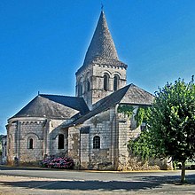
Sights
- Menhir de Pierrefitte
- Château de La Graffinière (fifteenth century), restored during the nineteenth and twentieth centuries
- Old manors (farms) of Cussé, Vaux, La Genneveselière (sixteenth century)
See also
Wikimedia Commons has media related to Cuon.
References
- ^ a b Téléchargement du fichier d'ensemble des populations légales en 2019, INSEE
- ^ Arrêté préfectoral Archived 2016-03-04 at the Wayback Machine 10 July 2015
| Authority control databases: National |
|
|---|
- v
- t
- e


 Cuon,_Maine-et-Loire