Dol pri Šmarjeti
Place in Lower Carniola, Slovenia
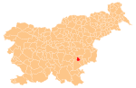
45°54′57.61″N 15°13′29.33″E / 45.9160028°N 15.2248139°E / 45.9160028; 15.2248139 Slovenia
 (2002)
Dol pri Šmarjeti (pronounced [ˈdoːl pɾi ʃmaˈɾjeːti]) is a small settlement in the historical region of Lower Carniola in southeastern Slovenia. It lies in the Municipality of Šmarješke Toplice, which is included in the Southeast Slovenia Statistical Region.[2]
Name
The name of the settlement was changed from Dol to Dol pri Šmarjeti in 1953.[3]
Unmarked grave
Dol pri Šmarjeti is the site of an unmarked grave from the Second World War. The Dol pri Šmarjeti Grave (Slovene: Grobišče Dol pri Šmarjeti) is located on a hilly slope in a woods 100 m east of the road from Šmarjeta to Mokronog, north of the hamlet of Preloge. It contains the remains of 13-year-old boy that was shot by the Partisans in 1942 for allegedly spying for German forces.[4]
References
- ^ Statistical Office of the Republic of Slovenia
- ^ Šmarješke Toplice municipal site
- ^ Spremembe naselij 1948–95. 1996. Database. Ljubljana: Geografski inštitut ZRC SAZU, DZS.
- ^ Ferenc, Mitja (December 2009). "Grobišče Dol pri Šmarjeti". Geopedia (in Slovenian). Ljubljana: Služba za vojna grobišča, Ministrstvo za delo, družino in socialne zadeve. Retrieved October 11, 2023.
External links
- Dol pri Šmarjeti on Geopedia
- v
- t
- e
Administrative seat: Šmarješke Toplice
| Current |
|
|---|---|
| Former |
|
- Šmarješke Toplice Spa
 | This article about the Municipality of Šmarješke Toplice in Slovenia is a stub. You can help Wikipedia by expanding it. |
- v
- t
- e


