Eightmile, Oregon
Unincorporated community in the state of Oregon, United States
Unincorporated community in Oregon, United States
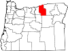
45°15′19″N 119°48′58″W / 45.25528°N 119.81611°W / 45.25528; -119.81611Eightmile is an unincorporated community in Morrow County, Oregon, United States, on Oregon Route 206 (the Wasco–Heppner Highway).
The town was named by pioneer ranchers after its location on Eightmile Canyon, which was so named because its mouth was about 8 miles (13 km) up Willow Creek from the Columbia River.[2][3] Eightmile's post office was established in 1883 and closed in 1941.[3]
References
- ^ a b U.S. Geological Survey Geographic Names Information System: Eightmile, Oregon
- ^ "Confused 'Mile Creeks'". The Bulletin. Bend, Oregon. April 11, 1957. p. 4. Retrieved April 30, 2015.
- ^ a b McArthur, Lewis A.; Lewis L. McArthur (2003) [1928]. Oregon Geographic Names (Seventh ed.). Portland, Oregon: Oregon Historical Society Press. ISBN 0-87595-277-1.
External links
- Historic image of the road between Lonerock and Eightmile from Salem Public Library
- v
- t
- e
Municipalities and communities of Morrow County, Oregon, United States
County seat: Heppner
communities
- Castle Rock
- Cecil
- Clarke
- Eightmile
- Ella
- Gooseberry
- Lena
- Morgan
- Pine City
- Ruggs
- Valby
- Oregon portal
- United States portal
 | This Morrow County, Oregon state location article is a stub. You can help Wikipedia by expanding it. |
- v
- t
- e


