El Jebel, Colorado
Census Designated Place in Colorado, United States
39°24′18″N 106°05′31″W / 39.40500°N 106.09194°W / 39.40500; -106.09194 (El Jebel CDP, Colorado)[1] United States
 Colorado
 (2020)[3]
81623
El Jebel is an unincorporated community and a census-designated place (CDP) located in and governed by Eagle County, Colorado, United States. The CDP is a part of the Edwards, CO Micropolitan Statistical Area. The population of the El Jebel CDP was 4,130 at the United States Census 2020.[3] The Carbondale Post Office (ZIP Code 81623) serves El Jebel postal addresses.[4]
History
El Jebel grew rapidly in the last two decades of the 20th century with the population increase in the valley downstream from Aspen. It consists largely of a group of commercial establishments just off State Highway 82, approximately 3 miles (5 km) northwest of Basalt, as well as several housing subdivisions nearby.
Etymology
"El Jebel" means "the mountain" in Arabic.
Geography
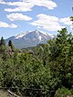
El Jebel is located in the Roaring Fork Valley, between Carbondale and Basalt, along the north side of State Highway 82.
The El Jebel CDP has an area of 3,430 acres (13.880 km2), including 35 acres (0.141 km2) of water.[2]
Climate
This climate type is dominated by the winter season, a long, bitterly cold period with short, clear days, relatively little precipitation mostly in the form of snow, and low humidity. According to the Köppen Climate Classification system, El Jebel has a subarctic climate, abbreviated "Dfc" on climate maps.[5]
| Climate data for El Jebel, Colorado | |||||||||||||
|---|---|---|---|---|---|---|---|---|---|---|---|---|---|
| Month | Jan | Feb | Mar | Apr | May | Jun | Jul | Aug | Sep | Oct | Nov | Dec | Year |
| Mean daily maximum °C (°F) | 1 (33) | 4 (39) | 9 (48) | 14 (58) | 21 (69) | 26 (78) | 30 (86) | 28 (83) | 24 (75) | 17 (63) | 8 (47) | 1 (34) | 16 (60) |
| Mean daily minimum °C (°F) | −9 (15) | −7 (20) | −3 (27) | 2 (35) | 6 (43) | 10 (50) | 14 (58) | 13 (56) | 9 (48) | 3 (38) | −3 (27) | −8 (18) | 2 (36) |
| Average precipitation mm (inches) | 43 (1.7) | 38 (1.5) | 43 (1.7) | 53 (2.1) | 43 (1.7) | 30 (1.2) | 30 (1.2) | 43 (1.7) | 43 (1.7) | 46 (1.8) | 41 (1.6) | 41 (1.6) | 500 (19.5) |
| Source: Weatherbase [6] | |||||||||||||
Demographics
The United States Census Bureau initially defined the El Jebel CDP for the 1990 United States Census.
| Year | Pop. | ±% |
|---|---|---|
| 1990 | 2,605 | — |
| 2000 | 4,488 | +72.3% |
| 2010 | 3,801 | −15.3% |
| 2020 | 4,130 | +8.7% |
| Source: United States Census Bureau | ||
See also
 Colorado portal

References
- ^ a b c d U.S. Geological Survey Geographic Names Information System: El Jebel, Colorado
- ^ a b "State of Colorado Census Designated Places - BAS20 - Data as of January 1, 2020". United States Census Bureau. Retrieved December 21, 2020.
- ^ a b United States Census Bureau. "El Jebel CDP, Colorado". Retrieved April 17, 2023.
- ^ a b "Look Up a ZIP Code". United States Postal Service. Retrieved December 21, 2020.
- ^ Climate Summary for El Jebel, Colorado
- ^ "Weatherbase.com". Weatherbase. 2013. Retrieved on October 2, 2013.
External links
El Jebel, Colorado at Wikipedia's sister projects
 Definitions from Wiktionary
 Media from Commons
 News from Wikinews
 Quotations from Wikiquote
 Texts from Wikisource
 Textbooks from Wikibooks
 Resources from Wikiversity
- El Jebel @ ElJebel.co
- El Jebel @ Colorado.com
- El Jebel @ UncoverColorado.com
- Eagle County website
- v
- t
- e
- El Jebel
- Snowmass
- Snowmass Village
- Woody Creek
- Aspen Mountain
- Aspen Highlands
- Buttermilk
- Snowmass
- Sunlight
- Crystal River
- Fryingpan River
- Roaring Fork River
- Ruedi Reservoir
Municipalities and communities of Eagle County, Colorado, United States | ||
|---|---|---|
County seat: Eagle | ||
| Towns |  | |
| CDPs | ||
| Unincorporated communities | ||
| Ghost towns | ||
| ||
Authority control databases | |
|---|---|
| International |
|
| National |
|


