El Rosario, Tenerife
Municipality in Canary Islands, Spain

Flag

Seal
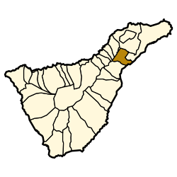
Municipal location in Tenerife
28°27′N 16°22′W / 28.450°N 16.367°W / 28.450; -16.367
 Spain
Spain (2018)[2]
El Rosario is a municipality in the northeastern part of the island of Tenerife in the Santa Cruz de Tenerife province, on the Canary Islands, Spain. The seat of the municipality is the town La Esperanza, in the mountainous interior of the island. The municipality includes the coastal town Radazul. The TF-1 motorway passes through the southern part of the municipality.
The population is 15,542 (2013[3]), its area is 39.43 km2.[1]
Historical population
| Year | Population |
|---|---|
| 1991 | 8,103 |
| 1996 | 10,880 |
| 2001 | 13,462 |
| 2002 | 13,718 |
| 2003 | 14,862 |
| 2004 | 15,542 |
| 2005 | 16,024 |
| 2013 | 17,465 |
Education
The Deutsche Schule Santa Cruz de Tenerife, a German international school, is located in the Tabaita Alta section of El Rosario.[4]
See also
References
- ^ a b Instituto Canario de Estadística, area
- ^ Municipal Register of Spain 2018. National Statistics Institute.
- ^ Instituto Canario de Estadística Archived 2014-04-18 at the Wayback Machine, population
- ^ "Deutsche Schule Santa Cruz de Tenerife[permanent dead link]." ZfA. Retrieved on 13 February 2016. "Deutsche Schule - Colegio Alemán Calle Drago , 1 38190 Tabaiba Alta (El Rosario) Spanien"
Places adjacent to El Rosario, Tenerife | ||||||||||||||||
|---|---|---|---|---|---|---|---|---|---|---|---|---|---|---|---|---|
| ||||||||||||||||


- v
- t
- e
Municipalities in the province of Santa Cruz de Tenerife
- Adeje
- Arafo
- Arico
- Arona
- Buenavista del Norte
- Candelaria
- Fasnia
- Garachico
- Granadilla de Abona
- La Guancha
- Guía de Isora
- Güímar
- Icod de los Vinos
- La Matanza de Acentejo
- La Orotava
- Puerto de la Cruz
- Los Realejos
- El Rosario
- San Cristóbal de La Laguna
- San Juan de la Rambla
- San Miguel de Abona
- Santa Cruz de Tenerife
- Santa Úrsula
- Santiago del Teide
- El Sauzal
- Los Silos
- El Tanque
- Tacoronte
- Tegueste
- La Victoria de Acentejo
- Vilaflor

| Authority control databases |
|
|---|


