Fulton, California
Census-designated place in California, United States
38°29′47″N 122°46′12″W / 38.49639°N 122.77000°W / 38.49639; -122.77000 United States
 California
 (2010)
95439
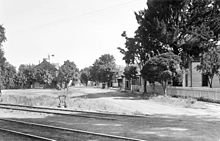
Fulton is a census-designated place (CDP) in Sonoma County, California, United States. Fulton is just to the north of the city limits of Santa Rosa, and 7 miles (11 km) north-northeast of Sebastopol. Fulton has a post office, established in 1871 and assigned ZIP code 95439.[3] The community is named after Thomas and James Fulton, who founded the community.[4] The population as of the 2010 U.S. Census was 541. There are a set of railway lines which go through the town boundaries; these lines are used by Sonoma–Marin Area Rail Transit (or the SMART Train). Fulton was once home to a chicken processing plant that was in operation from the 1960s until its closure in 2010.
History
The community is named after Thomas and James Fulton, who founded the community.[4]
Geography
According to the United States Census Bureau, the CDP covers an area of 1.9 square miles (4.9 km2), all of it land.
Climate
This region experiences warm (but not hot) and dry summers, with no average monthly temperatures above 71.6 °F (22 °C). According to the Köppen Climate Classification system, Fulton has a warm-summer Mediterranean climate, abbreviated "Csb" on climate maps.[5]
Demographics
| Census | Pop. | Note | %± |
|---|---|---|---|
| U.S. Decennial Census[6] | |||
The 2010 United States Census[7] reported that Fulton had a population of 541. The population density was 277.6 inhabitants per square mile (107.2/km2). The racial makeup of Fulton was 349 (64.5%) White, 3 (0.6%) African American, 12 (2.2%) Native American, 11 (2.0%) Asian, 1 (0.2%) Pacific Islander, 149 (27.5%) from other races, and 16 (3.0%) from two or more races. Hispanic or Latino of any race were 186 persons (34.4%).
The Census reported that 98.2% of the population lived in households and 1.8% lived in non-institutionalized group quarters.
There were 189 households, out of which 67 (35.4%) had children under the age of 18 living in them, 96 (50.8%) were opposite-sex married couples living together, 17 (9.0%) had a female householder with no husband present, 12 (6.3%) had a male householder with no wife present. There were 11 (5.8%) unmarried opposite-sex partnerships, and 4 (2.1%) same-sex married couples or partnerships. 48 households (25.4%) were made up of individuals, and 17 (9.0%) had someone living alone who was 65 years of age or older. The average household size was 2.81. There were 125 families (66.1% of all households); the average family size was 3.43.
The population was spread out, with 130 people (24.0%) under the age of 18, 46 people (8.5%) aged 18 to 24, 145 people (26.8%) aged 25 to 44, 155 people (28.7%) aged 45 to 64, and 65 people (12.0%) who were 65 years of age or older. The median age was 37.8 years. For every 100 females, there were 100.4 males. For every 100 females age 18 and over, there were 103.5 males.
There were 207 housing units at an average density of 106.2 per square mile (41.0/km2), of which 56.6% were owner-occupied and 43.4% were occupied by renters. The homeowner vacancy rate was 1.8%; the rental vacancy rate was 4.7%. 56.4% of the population lived in owner-occupied housing units and 41.8% lived in rental housing units.

References
- ^ U.S. Census Archived 2012-07-02 at the Wayback Machine
- ^ U.S. Geological Survey Geographic Names Information System: Fulton, California
- ^ "ZIP Code Lookup". Zipinfo.com. Retrieved June 7, 2010.
- ^ a b Durham, David L. (1998). California's Geographic Names: A Gazetteer of Historic and Modern Names of the State. Clovis, Calif.: Word Dancer Press. p. 635. ISBN 1-884995-14-4.
- ^ Climate Summary for Fulton, California
- ^ "Census of Population and Housing". Census.gov. Retrieved June 4, 2016.
- ^ "2010 Census Interactive Population Search: CA - Fulton CDP". U.S. Census Bureau. Archived from the original on July 15, 2014. Retrieved July 12, 2014.
External links
 Media related to Fulton, California at Wikimedia Commons
- v
- t
- e
Municipalities and communities of Sonoma County, California, United States
County seat: Santa Rosa

- Bloomfield
- Bodega
- Bodega Bay
- Boyes Hot Springs
- Carmet
- Cazadero
- El Verano
- Eldridge
- Fetters Hot Springs-Agua Caliente
- Forestville
- Fulton
- Geyserville
- Glen Ellen
- Graton
- Guerneville
- Jenner
- Kenwood
- Larkfield-Wikiup
- Monte Rio
- Occidental
- Penngrove
- Petaluma Center
- Roseland
- Salmon Creek
- Sea Ranch
- Sereno del Mar
- Sonoma State University
- Temelec
- Timber Cove
- Valley Ford
communities
- California portal
- United States portal
| |||||||||||||
|---|---|---|---|---|---|---|---|---|---|---|---|---|---|
| Bodies of water |
|  | |||||||||||
| Counties | |||||||||||||
| Cities and towns |
| ||||||||||||
| CDPs over 10k | |||||||||||||
| Sub-regions | |||||||||||||
| Other | |||||||||||||
Authority control databases | |
|---|---|
| International |
|
| National |
|
| Other |
|


