Hillcrest, Ohio
Unincorporated community in Ohio, U.S.
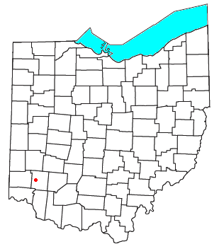
Hillcrest is an unincorporated place in central Warren County, Ohio, United States[1] on U.S. Route 42 about halfway between Mason, 4 miles (6 kilometers) to the southwest, and Lebanon, 3 mi (5 km) to the northeast. The community straddles the township line between Turtlecreek and Union Townships. The former Cincinnati, Lebanon and Northern Railway runs just east of the community and once had a stop here called "Turtlecreek". It is in the Lebanon City School District and is served by the Lebanon telephone exchange and post office.
References
- ^ U.S. Geological Survey Geographic Names Information System: Hillcrest, Ohio
- Elva R. Adams. Warren County Revisited. [Lebanon, Ohio]: Warren County Historical Society, 1989.
- The Centennial Atlas of Warren County, Ohio. Lebanon, Ohio: The Centennial Atlas Association, 1903.
- John W. Hauck. Narrow Gauge in Ohio. Boulder, Colorado: Pruett Publishing, 1986. ISBN 0-87108-629-8
- Josiah Morrow. The History of Warren County, Ohio. Chicago: W.H. Beers, 1883. (Reprinted several times)
- Ohio Atlas & Gazetteer. 6th ed. Yarmouth, Maine: DeLorme, 2001. ISBN 0-89933-281-1
- Warren County Engineer's Office. Official Highway Map 2003. Lebanon, Ohio: The Office, 2003.
- v
- t
- e
Municipalities and communities of Warren County, Ohio, United States
County seat: Lebanon
- Carlisle‡
- Franklin
- Lebanon
- South Lebanon
- Loveland‡
- Mason
- Middletown‡
- Monroe‡
- Springboro‡

communities
- Blackhawk
- Chautauqua‡
- Cozaddale
- Crosswick
- Dallasburg
- Dodds
- Edwardsville
- Fosters
- Genntown
- Greentree Corners
- Gum Grove
- Hagemans Crossing
- Hickoryville
- Hicks
- Hillcrest
- Hopkinsville
- Kenricksville
- Level
- Mathers Mill
- Merrittstown
- Middleboro
- Mount Holly
- Murdoch
- Oregonia
- Osceola
- Pekin
- Red Lion
- Ridgeville
- Rossburg
- San Mar Gale
- Socialville
- Twenty Mile Stand
- Wellman
- Zoar
‡This populated place also has portions in an adjacent county or counties
- Ohio portal
- United States portal
39°24′12″N 84°15′16″W / 39.4033924°N 84.2543820°W / 39.4033924; -84.2543820
 | This Warren County, Ohio state location article is a stub. You can help Wikipedia by expanding it. |
- v
- t
- e


