Ilford, Manitoba
Indian settlement in Manitoba, Canada
Indian settlement in Manitoba, Canada
56°03′53″N 95°36′25″W / 56.06472°N 95.60694°W / 56.06472; -95.60694 Canada
 Manitoba
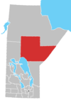
 (2016)[1]
Ilford is an Indian settlement in northern Manitoba, Canada. The Mooseocoot Indian reserve is located within the community boundary and is populated by the War Lake First Nation.
Ilford is 180 m (590 ft) above sea level.[2]
Demographics
In the 2011 Census, Ilford had a population of 43 living in 11 of its 11 total private dwellings.[3]
In the 2021 Census, Ilford had a population of 62 living in 11 of its 11 total private dwellings (a 44.186% increase in 6 years).[4] With the average age of all residents being 43.2, men 24.6 and women 45.2.[4] The average household size is about 3.4 with a total of 15 couple families.[4]
Services
The community provides the following services:[5]
- fire protection by a volunteer fire department with pumper truck,
- Royal Canadian Mounted Police (RCMP)
- Community Health Worker
- Ilford Airport
- Via Rail serve passengers at the Ilford railway station.
- Power provided by Manitoba Hydro
- Telephone service provided by Manitoba Telecom Services
- Chlorinated and filtered water service (sourced from Moose Nose Lake)
- Sewage treatment plant (installed in 1994)
- Julie Lindal School (including Gymnasium)
- Multi-purpose building
- Skating rink
- Gold Trail Hotel
Railway station
| Preceding station |  Via Rail Via Rail | Following station | ||
|---|---|---|---|---|
| Nonsuch toward Churchill | Winnipeg–Churchill | Munk toward Winnipeg | ||
| Former services | ||||
| Preceding station | Canadian National Railway | Following station | ||
| Nonsuch toward Churchill | Hudson Bay Railway | Split Lake toward The Pas | ||
References
- ^ "Ilford, Indian Settlement | Census Profile, 2016 Census," Statistics Canada. Retrievedf 2021-08-13.
- ^ "Ilford (Manitoba): Community Profile". RoadsideThoughts. Retrieved 10 July 2018.
- ^ "Corrections and updates: Population and dwelling count amendments, 2011 Census". Statistics Canada. 14 February 2013. Retrieved 16 February 2013.
- ^ a b c Government of Canada, Statistics Canada (9 February 2022). "Profile table, Census Profile, 2021 Census of Population - Ilford, Indian settlement (S-É) [Census subdivision], Manitoba". www12.statcan.gc.ca. Retrieved 20 September 2023.
- ^ "Archived copy" (PDF). Archived from the original (PDF) on 6 October 2012. Retrieved 1 September 2017.
{{cite web}}: CS1 maint: archived copy as title (link)
External links
- Map of Ilford at Statcan
- v
- t
- e
- Ilford
 | This Manitoba location article is a stub. You can help Wikipedia by expanding it. |
- v
- t
- e


