Inami, Hyōgo
Town in Kansai, Japan
Inami  Flag  Emblem | |
|---|---|
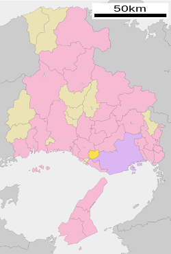 Location of Inami in Hyōgo Prefecture | |
| Symbols | |
| Flower | Cosmos |
| Tree | Ilex integra |
Inami (稲美町, Inami-chō) is a town located in Kako District, Hyōgo Prefecture, Japan. As of 1 May 2022[update], the town had an estimated population of 30,622 in 12843 households and a population density of 880 persons per km².[1] The total area of the town is 34.92 square kilometres (13.48 sq mi).
Geography
Inami is located in the southern part of Hyogo prefecture and belongs to the Kobe metropolitan area. It is located on the Innanno Plateau between the Kakogawa and Akashi Rivers.
Neighbouring municipalities
Hyōgo Prefecture
Climate
Inami has a Humid subtropical climate (Köppen Cfa) characterized by warm summers and cool winters with light snowfall. The average annual temperature in Inami is 15.3 °C. The average annual rainfall is 1462 mm with September as the wettest month. The temperatures are highest on average in August, at around 26.6 °C, and lowest in January, at around 4.6 °C.[2]
Demographics
Per Japanese census data,[3] the population of Inami grew slowly until the 1970s, until the 2000s and has since leveled off.
| Year | Pop. | ±% |
|---|---|---|
| 1920 | 13,730 | — |
| 1930 | 14,418 | +5.0% |
| 1940 | 15,152 | +5.1% |
| 1950 | 18,240 | +20.4% |
| 1960 | 18,525 | +1.6% |
| 1970 | 21,140 | +14.1% |
| 1980 | 27,609 | +30.6% |
| 1990 | 30,603 | +10.8% |
| 2000 | 32,054 | +4.7% |
| 2010 | 31,036 | −3.2% |
History
The area of the modern town of Inami was within ancient Harima Province, and as a place name is mentioned in the Nara period Man'yōshū. In the Edo Period, the area was part of the holdings of Himeji Domain. Following the Meiji restoration, the villages of Kakoshin, Mori and Tenman and Hase were created within Kako District, Hyōgo with the creation of the modern municipalities system on April 1, 1889. The three villages merged on March 31, 1955 to form the town of Inami.
Government
Inami has a mayor-council form of government with a directly elected mayor and a unicameral town council of 14 members. Inami, together with the town of Harima, contributes one member to the Hyogo Prefectural Assembly. In terms of national politics, the town is part of Hyōgo 14th district of the lower house of the Diet of Japan.
Economy
Inami has a mixed economy of agriculture and light manufacturing.
Education
Inami has five public elementary schools and two public middle schools operated by the town government and one public high school operated by the Hyōgo Prefectural Department of Education. The prefecture also operates a special education school for the handicapped.
Transportation
Railway
Inami is not served by any passenger railway lines. The nearest stations are Tsuchiyama Station in Harima or Higashi-Kakogawa Station in Kakogawa, Hyōgo, both on the JR West San'yō Main Line.
Highway
Inami is not located on any National Expressway or National Highway.
Local attraction
- Banshū Winery ruins, National Historic Site
References
External links
 Media related to Inami, Hyōgo at Wikimedia Commons
- Inami official website (in Japanese)


Authority control databases | |
|---|---|
| International |
|
| National |
|
| Geographic |
|
 | This Hyōgo Prefecture location article is a stub. You can help Wikipedia by expanding it. |
- v
- t
- e


