| Jikawo River | |
|---|---|
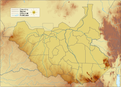 Location of mouth in South Sudan | |
| Etymology | Shared with Jikawo |
| Location | |
| Countries | Ethiopia, South Sudan |
| Physical characteristics | |
| Source | |
| • coordinates | 8°53′17″N 34°44′28″E / 8.888134°N 34.741041°E |
| • elevation | 2,418 m (7,933 ft) |
| Mouth | Baro River |
• location | Near Jikawo |
• coordinates | 8°22′N 33°46′E / 8.367°N 33.767°E |
• elevation | 415 m (1,362 ft) |
| Length | 151 km (94 mi) |
| Basin size | 1,940 km2 (750 sq mi) |
| Discharge | |
| • location | Mouth (estimate) [1] |
| • average | 23.07 m3/s (815 cu ft/s) |
| • minimum | 6.32 m3/s (223 cu ft/s) |
| • maximum | 44.23 m3/s (1,562 cu ft/s) |
| Basin features | |
| Progression | Baro → Sobat → White Nile → Nile → Mediterranean Sea |
| River system | Nile Basin |
| Cities | Pagak |
| Population | 51,100 |
Jikawo River is a river of southwestern Ethiopia. It is a tributary of the Baro River, which it joins at latitude and longitude 8°22′N 33°46′E / 8.367°N 33.767°E.
The river rises in Ethiopia, and in its lower course forms the border with South Sudan.[2]
See also
[edit]References
[edit]- ^ Müller Schmied, Hannes; Cáceres, Denise; Eisner, Stephanie; Flörke, Martina; Herbert, Claudia; Niemann, Christoph; Peiris, Thedini Asali; Popat, Eklavyya; Portmann, Felix Theodor; Reinecke, Robert; Schumacher, Maike; Shadkam, Somayeh; Telteu, Camelia-Eliza; Trautmann, Tim; Döll, Petra (2021-02-23). "The global water resources and use model WaterGAP v2.2d: model description and evaluation". Geoscientific Model Development. 14 (2): 1037–1079. Bibcode:2021GMD....14.1037M. doi:10.5194/gmd-14-1037-2021. hdl:11250/2984567. ISSN 1991-959X.
- ^ Topographical map of Jonglei Archived 2011-09-29 at the Wayback Machine