Kennedy Road, Hong KongOffice of Former Chief Executives at No. 28 Kennedy RoadSt. Francis' Canossian College along Kennedy RoadKennedy Road stop of the Peak Tram
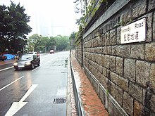
Kennedy Road is a road in the Mid-Levels on Hong Kong Island, Hong Kong. It is named after Arthur Kennedy, the seventh governor of Hong Kong.
History
At the time of construction in 1876,[1] it was the second major east–west route from the sea, in the local area. Thus being nicknamed second road.
Public light bus (also known as the mini bus) including Green Mini Bus Route 28 which runs through Caine Road, Nethersol Hospital, University of Hong Kong, Queen Mary Hospital, and Pok Fu Lam
^"Public Works Report for 1876" (PDF). Retrieved 14 December 2018.
^ abcdefgh"Results of the Assessment of 1,444 Historic Buildings". Hong Kong: Antiquities Advisory Board. Archived from the original on 29 October 2014. Retrieved 22 July 2014.
External links
Wikimedia Commons has media related to Kennedy Road, Hong Kong.
Google Maps of Kennedy Road
Antiquities Advisory Board. Historic Building Appraisal. Row of Shops under Ramp, Nos. 10, 12, 14, 16, 18 and 20 Kennedy Road Pictures


 Connaught Road West
 Canal Road


