Kherwara tehsil | |
|---|---|
Tehsil | |
 Kherwara tehsil | |
 Kherwara tehsil Location of Kherwara tehsil  Kherwara tehsil Kherwara tehsil (India) | |
| Coordinates: 23°59′14″N 73°36′22″E / 23.987334°N 73.606010°E | |
| Tehsil seat | Kherwara Chhaoni |
| Area | |
• Total | 594 km2 (229 sq mi) |
| Population (2011) | |
• Total | 206,777 |
| • Density | 350/km2 (900/sq mi) |
| Time zone | Indian Standard Time |
Kherwara is a tehsil of Udaipur district in Rajasthan, India.[1] The tehsil consists of 195 revenue villages and 1 census town.[1] The tehsil headquarter is located in the town of Kherwara Chhaoni.[2] The tehsil is part of the Kherwara panchayat samiti (block).[1]
History
[edit]Before the formation of the Republic of India, the territory of present-day Kherwara tehsil was part of the former Udaipur State.[3] As of 1940, Kherwara was one of the 8 districts of Udaipur State (possibly with boundaries similar to present-day Kherwara tehsil).[4][5]
With the formation of the United State of Rajasthan (precursor to the state of Rajasthan) in 1948, the new district of Udaipur was constituted which included the area of present-day Kherwara tehsil.[3]
In 2008, 79 villages were carved out of Kherwara tehsil to form, along with 19 villages from Sarada tehsil, the new tehsil of Rishabhdeo.[3]
Geography
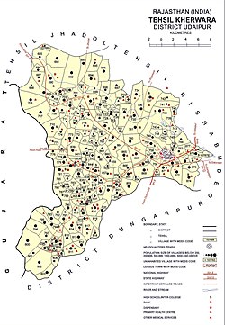
[edit]The area of Kherwara tehsil is 594 square kilometres.[6] The tehsil is bordered by Jhadol tehsil to the north, Rishabdeo tehsil to the east, Dungarpur district to the south, and the state of Gujarat to the west.[1] Major highways in the tehsil are National Highway 8 and State Highways 10 and 48.[1] The annual average rainfall in Kherwara tehsil is 594 mm, with an average of 30 rainy days per year.[6]
Demographics
[edit]The population of Kherwara tehsil is 2,06,777, with a women to men ratio of 96%.[3] 73% of the population belongs to scheduled tribes. 96% of the population of the tehsil is rural and the literacy rate of the tehsil is 54%.[3] Wagdi is the predominant language used in the tehsil, it being the mother tongue for 91% of the population of the tehsil.[7]
Because of its predominant scheduled tribe population, Kherwara tehsil has been designated a scheduled area which allows special protection of tribal culture and other interests.[8]
Economy
[edit]Agriculture is the most significant sources of income in Kherwara tehsil with 63% of workers identifying as cultivators or agricultural labourers in the 2011 census.[1]
References
[edit]- ^ a b c d e f District Census Handbook Udaipur, Village and Town Directory (PDF). Directorate of Census Operations. 2011.
- ^ Administrative Atlas of Rajasthan: District and Tahsil (PDF). Census of India. 2011. p. 663.
- ^ a b c d e District Census Handbook Udaipur, Village and Town Wise Primary Census Abstract (PDF). Directorate of Census Operations. 2011.
- ^ Agarwal, B.D. (1979). Rajasthan District Gazetteers, Udaipur (PDF). Jaipur: Directorate of District Gazetteers.
- ^ Dashora, Yamunalal (1942). Mewar in 1941, A Summary of Census Statistics. Alwar: R.C. Sharma.
- ^ a b Singh, O.P.; et al. (2013). Rainfall Profile of Udaipur (PDF). Meteorological Monograph: Hydrology No.15/2013. New Delhi: India Meteorological Department. p. 108.
- ^ "C-16 Population By Mother Tongue". Census of India. Retrieved 5 September 2018.
- ^ "Gazette of India". Government of India. 19 May 2019. Retrieved 13 April 2019.