Lambidou | |
|---|---|
Commune and village | |
| Coordinates: 14°18′49″N 9°33′05″W / 14.3136°N 9.5515°W | |
| Country | |
| Region | Kayes Region |
| Cercle | Diéma Cercle |
| Area | |
• Total | 333 km2 (129 sq mi) |
| Population (2009 census)[2] | |
• Total | 14,947 |
| • Density | 45/km2 (120/sq mi) |
| Time zone | UTC+0 (GMT) |
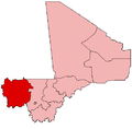
Lambidou is a rural commune and village in the Cercle of Diéma in the Kayes Region of western Mali. As well as the main village (chef-lieu) of Lambidou, the commune includes the villages of Singoné, Koumarenga and Kary. In the 2009 census the commune had a population of 14,947.
History
[edit]Lambidou was a stronghold of the Niakhate family, rulers of the Kingdom of Diarra. After they were deposed by the Diawara dynasty, they retreated to Lambidou and ruled it as a Kafo. It was a prominent regional slave market.[3]
References
[edit]- ^ Plan de Sécurite Alimentaire Commune Rurale de Lambidou 2007-2011 (PDF) (in French), Commissariat à la Sécurité Alimentaire, République du Mali, USAID-Mali, 2006, archived from the original (PDF) on 2012-06-08.
- ^ Resultats Provisoires RGPH 2009 (Région de Kayes) (PDF) (in French), République de Mali: Institut National de la Statistique, archived from the original (PDF) on 2012-07-27
{{citation}}: CS1 maint: publisher location (link). - ^ The Daily Life of Slaves in the Last Years of the Bamana States of Kaarta and Segou, by Moussa Sow, in Lane, Paul, and Kevin C. MacDonald (eds), Slavery in Africa: Archaeology and Memory, Proceedings of the British Academy (London, 2011), https://doi.org/10.5871/bacad/9780197264782.001.0001.

