Leoville, Saskatchewan
Village in Saskatchewan, Canada
Village in Saskatchewan, Canada
53°37′55″N 107°33′04″W / 53.63194°N 107.55111°W / 53.63194; -107.55111 (2016)
S0J 1N0
 Highway 24
 Highway 946
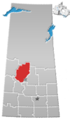
Leoville (2016 population: 375) is a village in the Canadian province of Saskatchewan within the Rural Municipality of Spiritwood No. 496 and Census Division No. 16. The village is located along Highway 24 (named the worst road in Saskatchewan by the CAA in 2014).[6] Highway 946 begins in the village and proceeds north. Leoville is home to the administrative centre of the Pelican Lake First Nation band government.
History
Leoville incorporated as a village on June 26, 1944.[7]
Demographics
In the 2021 Census of Population conducted by Statistics Canada, Leoville had a population of 364 living in 151 of its 163 total private dwellings, a change of -2.9% from its 2016 population of 375. With a land area of 1.14 km2 (0.44 sq mi), it had a population density of 319.3/km2 (827.0/sq mi) in 2021.[10]
In the 2016 Census of Population, the Village of Leoville recorded a population of 375 living in 146 of its 162 total private dwellings, a 2.4% change from its 2011 population of 366. With a land area of 1.11 km2 (0.43 sq mi), it had a population density of 337.8/km2 (875.0/sq mi) in 2016.[11]
See also
- List of communities in Saskatchewan
- List of villages in Saskatchewan
- List of francophone communities in Saskatchewan
- Leoville Airport
References
- ^ Leoville Village Council
- ^ National Archives, Archivia Net, Post offices and postmasters, archived from the original on 6 October 2006
- ^ Government of Saskatchewan, MRD Home. "Municipal Directory System". Archived from the original on 15 January 2016. Retrieved 6 September 2009.
- ^ Canadian Textiles Institute. (2005), CTI Determine your provincial constituency, archived from the original on 11 September 2007
- ^ Commissioner of Canada Elections, Chief Electoral Officer of Canada (2005), Elections Canada On-line, archived from the original on 21 April 2007
- ^ "Highway 24 near Leoville, Sask. declared worst road by CAA | CBC News".
- ^ "Urban Municipality Incorporations". Saskatchewan Ministry of Government Relations. Archived from the original on 15 October 2014. Retrieved 1 June 2020.
- ^ "Saskatchewan Census Population" (PDF). Saskatchewan Bureau of Statistics. Archived from the original (PDF) on 24 September 2015. Retrieved 31 May 2020.
- ^ "Saskatchewan Census Population". Saskatchewan Bureau of Statistics. Retrieved 31 May 2020.
- ^ "Population and dwelling counts: Canada, provinces and territories, census divisions and census subdivisions (municipalities), Saskatchewan". Statistics Canada. 9 February 2022. Retrieved 1 April 2022.
- ^ "Population and dwelling counts, for Canada, provinces and territories, and census subdivisions (municipalities), 2016 and 2011 censuses – 100% data (Saskatchewan)". Statistics Canada. 8 February 2017. Retrieved 30 May 2020.


 | This article about a location in the Census Division No. 16 of Saskatchewan is a stub. You can help Wikipedia by expanding it. |
- v
- t
- e


