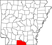
List of lakes of Union County, Arkansas
Map all coordinates using OpenStreetMap
Download coordinates as:
- KML
- GPX (all coordinates)
- GPX (primary coordinates)
- GPX (secondary coordinates)
There are at least 34 named lakes and reservoirs in Union County, Arkansas.
Lakes
- Babb Lake, 33°21′09″N 092°32′11″W / 33.35250°N 92.53639°W / 33.35250; -92.53639 (Babb Lake), el. 79 feet (24 m) [1]
- Beaver Pond, 33°16′31″N 092°22′01″W / 33.27528°N 92.36694°W / 33.27528; -92.36694 (Beaver Pond), el. 79 feet (24 m) [2]
- Benjamin Lake, 33°14′08″N 092°15′33″W / 33.23556°N 92.25917°W / 33.23556; -92.25917 (Benjamin Lake), el. 72 feet (22 m) [3]
- Blue Lake, 33°11′20″N 092°12′09″W / 33.18889°N 92.20250°W / 33.18889; -92.20250 (Blue Lake), el. 72 feet (22 m) [4]
- Bolding Lake, 33°07′38″N 092°11′32″W / 33.12722°N 92.19222°W / 33.12722; -92.19222 (Bolding Lake), el. 75 feet (23 m) [5]
- Clear Lake, 33°01′07″N 092°06′39″W / 33.01861°N 92.11083°W / 33.01861; -92.11083 (Clear Lake), el. 59 feet (18 m) [6]
- Eagle Lake, 33°14′24″N 092°14′37″W / 33.24000°N 92.24361°W / 33.24000; -92.24361 (Eagle Lake), el. 72 feet (22 m) [7]
- Fish Lake, 32°59′32″N 092°05′51″W / 32.99222°N 92.09750°W / 32.99222; -92.09750 (Fish Lake), el. 62 feet (19 m) [8]
- Fishtrap Lake, 33°08′19″N 092°09′22″W / 33.13861°N 92.15611°W / 33.13861; -92.15611 (Fishtrap Lake), el. 72 feet (22 m) [9]
- Grand Marais, 33°04′13″N 092°09′11″W / 33.07028°N 92.15306°W / 33.07028; -92.15306 (Grand Marais), el. 62 feet (19 m) [10]
- Hoop Lake, 33°10′43″N 092°11′00″W / 33.17861°N 92.18333°W / 33.17861; -92.18333 (Hoop Lake), el. 62 feet (19 m) [11]
- Jones Lake, 33°11′29″N 092°12′33″W / 33.19139°N 92.20917°W / 33.19139; -92.20917 (Jones Lake), el. 72 feet (22 m) [12]
- Little Lake, 33°01′32″N 092°07′43″W / 33.02556°N 92.12861°W / 33.02556; -92.12861 (Little Lake), el. 59 feet (18 m) [13]
- Nickey Lake, 33°20′13″N 092°31′52″W / 33.33694°N 92.53111°W / 33.33694; -92.53111 (Nickey Lake), el. 85 feet (26 m) [14]
- Open Brake, 33°07′32″N 092°08′07″W / 33.12556°N 92.13528°W / 33.12556; -92.13528 (Open Brake), el. 62 feet (19 m) [15]
- Shaw Brake, 33°20′22″N 092°36′27″W / 33.33944°N 92.60750°W / 33.33944; -92.60750 (Shaw Brake), el. 89 feet (27 m) [16]
- Spice Pond, 33°14′48″N 092°19′04″W / 33.24667°N 92.31778°W / 33.24667; -92.31778 (Spice Pond), el. 85 feet (26 m) [17]
- Stow Lake, 33°16′16″N 092°26′40″W / 33.27111°N 92.44444°W / 33.27111; -92.44444 (Stow Lake), el. 75 feet (23 m) [18]
Reservoirs
- Anthony Lake, 33°18′19″N 092°34′16″W / 33.30528°N 92.57111°W / 33.30528; -92.57111 (Anthony Lake), el. 125 feet (38 m) [19]
- Arkansas Noname 55 Reservoir, 33°02′42″N 092°11′12″W / 33.04500°N 92.18667°W / 33.04500; -92.18667 (Arkansas Noname 55 Reservoir), el. 121 feet (37 m) [20]
- Arkansas Noname 56 Reservoir, 33°02′30″N 092°11′18″W / 33.04167°N 92.18833°W / 33.04167; -92.18833 (Arkansas Noname 56 Reservoir), el. 115 feet (35 m) [21]
- Burns Pond, 33°12′41″N 092°50′54″W / 33.21139°N 92.84833°W / 33.21139; -92.84833 (Burns Pond), el. 239 feet (73 m) [22]
- Calion Lake, 33°19′09″N 092°32′05″W / 33.31917°N 92.53472°W / 33.31917; -92.53472 (Calion Lake), el. 85 feet (26 m) [23]
- Cooks Pond, 33°04′49″N 092°46′04″W / 33.08028°N 92.76778°W / 33.08028; -92.76778 (Cooks Pond), el. 167 feet (51 m) [24]
- Forty Acre Millpond, 33°02′49″N 092°10′52″W / 33.04694°N 92.18111°W / 33.04694; -92.18111 (Forty Acre Millpond), el. 85 feet (26 m) [25]
- Harper Reservoir, 33°04′22″N 092°40′51″W / 33.07278°N 92.68083°W / 33.07278; -92.68083 (Harper Reservoir), el. 167 feet (51 m) [26]
- Harris Lake, 33°11′20″N 092°54′59″W / 33.18889°N 92.91639°W / 33.18889; -92.91639 (Harris Lake), el. 266 feet (81 m) [27]
- Lake Lisbon, 33°16′48″N 092°51′06″W / 33.28000°N 92.85167°W / 33.28000; -92.85167 (Lake Lisbon), el. 184 feet (56 m) [28]
- Lake Wingfield Number Three, 33°04′27″N 092°39′34″W / 33.07417°N 92.65944°W / 33.07417; -92.65944 (Lake Wingfield Number Three), el. 180 feet (55 m) [29]
- Lake Wingfield Number Two, 33°04′24″N 092°39′50″W / 33.07333°N 92.66389°W / 33.07333; -92.66389 (Lake Wingfield Number Two), el. 177 feet (54 m) [30]
- Lewis Lake, 33°02′04″N 092°56′38″W / 33.03444°N 92.94389°W / 33.03444; -92.94389 (Lewis Lake), el. 164 feet (50 m) [31]
- Sowell Lake, 33°16′38″N 092°48′08″W / 33.27722°N 92.80222°W / 33.27722; -92.80222 (Sowell Lake), el. 174 feet (53 m) [32]
- Twenty Acre Millpond, 33°02′33″N 092°11′11″W / 33.04250°N 92.18639°W / 33.04250; -92.18639 (Twenty Acre Millpond), el. 102 feet (31 m) [33]
- Wingfield Lake, 33°04′24″N 092°39′50″W / 33.07333°N 92.66389°W / 33.07333; -92.66389 (Wingfield Lake), el. 177 feet (54 m) [34]
See also
Notes
- ^ "Babb Lake". Geographic Names Information System. United States Geological Survey, United States Department of the Interior.
- ^ "Beaver Pond". Geographic Names Information System. United States Geological Survey, United States Department of the Interior.
- ^ "Benjamin Lake". Geographic Names Information System. United States Geological Survey, United States Department of the Interior.
- ^ "Blue Lake". Geographic Names Information System. United States Geological Survey, United States Department of the Interior.
- ^ "Bolding Lake". Geographic Names Information System. United States Geological Survey, United States Department of the Interior.
- ^ "Clear Lake". Geographic Names Information System. United States Geological Survey, United States Department of the Interior.
- ^ "Eagle Lake". Geographic Names Information System. United States Geological Survey, United States Department of the Interior.
- ^ "Fish Lake". Geographic Names Information System. United States Geological Survey, United States Department of the Interior.
- ^ "Fishtrap Lake". Geographic Names Information System. United States Geological Survey, United States Department of the Interior.
- ^ "Grand Marais". Geographic Names Information System. United States Geological Survey, United States Department of the Interior.
- ^ "Hoop Lake". Geographic Names Information System. United States Geological Survey, United States Department of the Interior.
- ^ "Jones Lake". Geographic Names Information System. United States Geological Survey, United States Department of the Interior.
- ^ "Little Lake". Geographic Names Information System. United States Geological Survey, United States Department of the Interior.
- ^ "Nickey Lake". Geographic Names Information System. United States Geological Survey, United States Department of the Interior.
- ^ "Open Brake". Geographic Names Information System. United States Geological Survey, United States Department of the Interior.
- ^ "Shaw Brake". Geographic Names Information System. United States Geological Survey, United States Department of the Interior.
- ^ "Spice Pond". Geographic Names Information System. United States Geological Survey, United States Department of the Interior.
- ^ "Stow Lake". Geographic Names Information System. United States Geological Survey, United States Department of the Interior.
- ^ "Anthony Lake". Geographic Names Information System. United States Geological Survey, United States Department of the Interior.
- ^ "Arkansas Noname 55 Reservoir". Geographic Names Information System. United States Geological Survey, United States Department of the Interior.
- ^ "Arkansas Noname 56 Reservoir". Geographic Names Information System. United States Geological Survey, United States Department of the Interior.
- ^ "Burns Pond". Geographic Names Information System. United States Geological Survey, United States Department of the Interior.
- ^ "Calion Lake". Geographic Names Information System. United States Geological Survey, United States Department of the Interior.
- ^ "Cooks Pond". Geographic Names Information System. United States Geological Survey, United States Department of the Interior.
- ^ "Forty Acre Millpond". Geographic Names Information System. United States Geological Survey, United States Department of the Interior.
- ^ "Harper Reservoir". Geographic Names Information System. United States Geological Survey, United States Department of the Interior.
- ^ "Harris Lake". Geographic Names Information System. United States Geological Survey, United States Department of the Interior.
- ^ "Lake Lisbon". Geographic Names Information System. United States Geological Survey, United States Department of the Interior.
- ^ "Lake Wingfield Number Three". Geographic Names Information System. United States Geological Survey, United States Department of the Interior.
- ^ "Lake Wingfield Number Two". Geographic Names Information System. United States Geological Survey, United States Department of the Interior.
- ^ "Lewis Lake". Geographic Names Information System. United States Geological Survey, United States Department of the Interior.
- ^ "Sowell Lake". Geographic Names Information System. United States Geological Survey, United States Department of the Interior.
- ^ "Twenty Acre Millpond". Geographic Names Information System. United States Geological Survey, United States Department of the Interior.
- ^ "Wingfield Lake". Geographic Names Information System. United States Geological Survey, United States Department of the Interior.