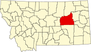
List of mountains in Garfield County, Montana
Map all coordinates using OpenStreetMap
Download coordinates as:
- KML
- GPX (all coordinates)
- GPX (primary coordinates)
- GPX (secondary coordinates)
This list is incomplete; you can help by adding missing items. (February 2011) |
There are at least 74 named mountains in Garfield County, Montana.
- Adams Rocky Butte, 47°13′11″N 107°20′46″W / 47.21972°N 107.34611°W / 47.21972; -107.34611 (Adams Rocky Butte), el. 3,173 feet (967 m)[1]
- Baker Point, 47°28′10″N 107°44′46″W / 47.46944°N 107.74611°W / 47.46944; -107.74611 (Baker Point), el. 2,766 feet (843 m)[2]
- Baldy Butte, 47°33′38″N 107°07′47″W / 47.56056°N 107.12972°W / 47.56056; -107.12972 (Baldy Butte), el. 2,913 feet (888 m)[3]
- Barney Pinnacle, 47°04′03″N 107°50′11″W / 47.06750°N 107.83639°W / 47.06750; -107.83639 (Barney Pinnacle), el. 3,110 feet (950 m)[4]
- Battleship Butte, 47°14′39″N 107°44′22″W / 47.24417°N 107.73944°W / 47.24417; -107.73944 (Battleship Butte), el. 3,035 feet (925 m)[5]
- Biscuit Butte, 47°29′11″N 107°04′14″W / 47.48639°N 107.07056°W / 47.48639; -107.07056 (Biscuit Butte), el. 3,025 feet (922 m)[6]
- Black Butte, 46°55′57″N 107°33′44″W / 46.93250°N 107.56222°W / 46.93250; -107.56222 (Black Butte), el. 3,271 feet (997 m)[7]
- Black Hills, 46°55′20″N 106°39′50″W / 46.92222°N 106.66389°W / 46.92222; -106.66389 (Black Hills), el. 3,097 feet (944 m)[8]
- Blazier Butte, 46°57′10″N 107°01′54″W / 46.95278°N 107.03167°W / 46.95278; -107.03167 (Blazier Butte), el. 3,291 feet (1,003 m)[9]
- Boslough Butte, 47°11′32″N 107°20′11″W / 47.19222°N 107.33639°W / 47.19222; -107.33639 (Boslough Butte), el. 3,169 feet (966 m)[10]
- Brownie Butte, 47°31′50″N 107°01′02″W / 47.53056°N 107.01722°W / 47.53056; -107.01722 (Brownie Butte), el. 2,874 feet (876 m)[11]
- Brownie Butte, 47°39′45″N 106°34′11″W / 47.66250°N 106.56972°W / 47.66250; -106.56972 (Brownie Butte), el. 2,746 feet (837 m)[12]
- Buffalo Hill, 47°35′07″N 106°46′00″W / 47.58528°N 106.76667°W / 47.58528; -106.76667 (Buffalo Hill), el. 2,933 feet (894 m)[13]
- Buffalo Scott Butte, 47°01′14″N 107°40′24″W / 47.02056°N 107.67333°W / 47.02056; -107.67333 (Buffalo Scott Butte), el. 3,015 feet (919 m)[14]
- Cap Rock Butte, 47°28′23″N 107°39′27″W / 47.47306°N 107.65750°W / 47.47306; -107.65750 (Cap Rock Butte), el. 3,022 feet (921 m)[15]
- Castle Butte, 47°06′46″N 107°42′11″W / 47.11278°N 107.70306°W / 47.11278; -107.70306 (Castle Butte), el. 3,176 feet (968 m)[16]
- Castle Butte, 47°24′26″N 107°01′50″W / 47.40722°N 107.03056°W / 47.40722; -107.03056 (Castle Butte), el. 2,828 feet (862 m)[17]
- Chalk Butte, 47°30′49″N 107°18′14″W / 47.51361°N 107.30389°W / 47.51361; -107.30389 (Chalk Butte), el. 3,232 feet (985 m)[18]
- Coal Bank Hill, 47°42′55″N 106°28′41″W / 47.71528°N 106.47806°W / 47.71528; -106.47806 (Coal Bank Hill), el. 2,595 feet (791 m)[19]
- Coffin Butte, 47°14′15″N 107°35′16″W / 47.23750°N 107.58778°W / 47.23750; -107.58778 (Coffin Butte), el. 3,133 feet (955 m)[20]
- Cox Butte, 47°01′49″N 107°32′00″W / 47.03028°N 107.53333°W / 47.03028; -107.53333 (Cox Butte), el. 3,104 feet (946 m)[21]
- Crown Butte, 46°56′05″N 107°08′29″W / 46.93472°N 107.14139°W / 46.93472; -107.14139 (Crown Butte), el. 3,563 feet (1,086 m)[22]
- Darby Buttes, 47°09′39″N 106°54′00″W / 47.16083°N 106.90000°W / 47.16083; -106.90000 (Darby Buttes), el. 3,035 feet (925 m)[23]
- Elephant Butte, 47°13′44″N 107°18′30″W / 47.22889°N 107.30833°W / 47.22889; -107.30833 (Elephant Butte), el. 3,117 feet (950 m)[24]
- Emma Butte, 46°56′40″N 107°15′57″W / 46.94444°N 107.26583°W / 46.94444; -107.26583 (Emma Butte), el. 3,419 feet (1,042 m)[25]
- Fig Mountain, 47°02′47″N 107°01′13″W / 47.04639°N 107.02028°W / 47.04639; -107.02028 (Fig Mountain), el. 3,428 feet (1,045 m)[26]
- Finley Butte, 47°18′23″N 107°46′42″W / 47.30639°N 107.77833°W / 47.30639; -107.77833 (Finley Butte), el. 2,926 feet (892 m)[27]
- Froehlich Butte, 47°01′13″N 107°44′23″W / 47.02028°N 107.73972°W / 47.02028; -107.73972 (Froehlich Butte), el. 3,146 feet (959 m)[28]
- Hawks Nest, 47°01′10″N 107°18′44″W / 47.01944°N 107.31222°W / 47.01944; -107.31222 (Hawks Nest), el. 3,510 feet (1,070 m)[29]
- Haystack Butte, 47°24′31″N 107°06′19″W / 47.40861°N 107.10528°W / 47.40861; -107.10528 (Haystack Butte), el. 2,979 feet (908 m)[30]
- Hook Rock, 47°20′24″N 106°16′24″W / 47.34000°N 106.27333°W / 47.34000; -106.27333 (Hook Rock), el. 2,654 feet (809 m)[31]
- Indian Rocks, 47°27′33″N 106°21′58″W / 47.45917°N 106.36611°W / 47.45917; -106.36611 (Indian Rocks), el. 2,467 feet (752 m)[32]
- Joe Ott Butte, 47°02′01″N 107°05′58″W / 47.03361°N 107.09944°W / 47.03361; -107.09944 (Joe Ott Butte), el. 3,317 feet (1,011 m)[33]
- Kirts Butte, 47°02′02″N 107°27′24″W / 47.03389°N 107.45667°W / 47.03389; -107.45667 (Kirts Butte), el. 3,353 feet (1,022 m)[34]
- Lambs Butte, 47°26′09″N 106°25′27″W / 47.43583°N 106.42417°W / 47.43583; -106.42417 (Lambs Butte), el. 2,559 feet (780 m)[35]
- Little Buffalo Hill, 47°41′02″N 106°49′02″W / 47.68389°N 106.81722°W / 47.68389; -106.81722 (Little Buffalo Hill), el. 2,608 feet (795 m)[36]
- Little Chalk Butte, 46°55′41″N 106°09′25″W / 46.92806°N 106.15694°W / 46.92806; -106.15694 (Little Chalk Butte), el. 2,923 feet (891 m)[37]
- Maloney Hill, 47°33′09″N 106°53′32″W / 47.55250°N 106.89222°W / 47.55250; -106.89222 (Maloney Hill), el. 2,664 feet (812 m)[38]
- Manlove Butte, 47°01′32″N 107°25′49″W / 47.02556°N 107.43028°W / 47.02556; -107.43028 (Manlove Butte), el. 3,471 feet (1,058 m)[39]
- McGinnis Butte, 46°56′43″N 107°22′57″W / 46.94528°N 107.38250°W / 46.94528; -107.38250 (McGinnis Butte), el. 3,474 feet (1,059 m)[40]
- McGlen Buttes, 47°02′40″N 107°38′33″W / 47.04444°N 107.64250°W / 47.04444; -107.64250 (McGlen Buttes), el. 2,969 feet (905 m)[41]
- McGraw Butte, 46°59′20″N 106°50′07″W / 46.98889°N 106.83528°W / 46.98889; -106.83528 (McGraw Butte), el. 2,979 feet (908 m)[42]
- McTwigan Butte, 47°00′39″N 107°43′28″W / 47.01083°N 107.72444°W / 47.01083; -107.72444 (McTwigan Butte), el. 3,150 feet (960 m)[43]
- Montgomery Hill, 46°51′40″N 106°38′27″W / 46.86111°N 106.64083°W / 46.86111; -106.64083 (Montgomery Hill), el. 3,077 feet (938 m)[44]
- Mother Butte, 46°56′51″N 106°55′53″W / 46.94750°N 106.93139°W / 46.94750; -106.93139 (Mother Butte), el. 3,428 feet (1,045 m)[45]
- Mows Butte, 47°01′35″N 107°27′47″W / 47.02639°N 107.46306°W / 47.02639; -107.46306 (Mows Butte), el. 3,340 feet (1,020 m)[46]
- Neiter Butte, 47°06′17″N 107°34′45″W / 47.10472°N 107.57917°W / 47.10472; -107.57917 (Neiter Butte), el. 3,238 feet (987 m)[47]
- O'Day Butte, 47°05′44″N 107°32′48″W / 47.09556°N 107.54667°W / 47.09556; -107.54667 (O'Day Butte), el. 3,323 feet (1,013 m)[48]
- Phillips Buttes, 47°01′41″N 106°35′16″W / 47.02806°N 106.58778°W / 47.02806; -106.58778 (Phillips Buttes), el. 2,887 feet (880 m)[49]
- Pikes Peak, 47°18′53″N 106°53′52″W / 47.31472°N 106.89778°W / 47.31472; -106.89778 (Pikes Peak), el. 2,700 feet (820 m)[50]
- Rattlesnake Butte, 47°08′59″N 107°31′05″W / 47.14972°N 107.51806°W / 47.14972; -107.51806 (Rattlesnake Butte), el. 3,314 feet (1,010 m)[51]
- Red Buttes, 46°51′52″N 106°19′29″W / 46.86444°N 106.32472°W / 46.86444; -106.32472 (Red Buttes), el. 3,031 feet (924 m)[52]
- Robbers Roost, 47°00′21″N 107°19′37″W / 47.00583°N 107.32694°W / 47.00583; -107.32694 (Robbers Roost), el. 3,547 feet (1,081 m)[53]
- Round Butte, 47°39′03″N 107°07′39″W / 47.65083°N 107.12750°W / 47.65083; -107.12750 (Round Butte), el. 2,828 feet (862 m)[54]
- Sage Hen Buttes, 47°27′24″N 107°01′45″W / 47.45667°N 107.02917°W / 47.45667; -107.02917 (Sage Hen Buttes), el. 3,005 feet (916 m)[55]
- Sandage Buttes, 47°12′55″N 107°51′58″W / 47.21528°N 107.86611°W / 47.21528; -107.86611 (Sandage Buttes), el. 3,022 feet (921 m)[56]
- School Butte, 46°55′29″N 107°14′17″W / 46.92472°N 107.23806°W / 46.92472; -107.23806 (School Butte), el. 3,455 feet (1,053 m)[57]
- Signal Butte, 47°40′55″N 106°38′12″W / 47.68194°N 106.63667°W / 47.68194; -106.63667 (Signal Butte), el. 2,736 feet (834 m)[58]
- Smoky Butte, 47°19′55″N 107°04′58″W / 47.33194°N 107.08278°W / 47.33194; -107.08278 (Smoky Butte), el. 2,995 feet (913 m)[59]
- Square Butte, 47°21′56″N 107°36′07″W / 47.36556°N 107.60194°W / 47.36556; -107.60194 (Square Butte), el. 3,054 feet (931 m)[60]
- Square Butte, 47°42′24″N 106°30′12″W / 47.70667°N 106.50333°W / 47.70667; -106.50333 (Square Butte), el. 2,828 feet (862 m)[61]
- Standing Rock, 47°24′21″N 106°19′10″W / 47.40583°N 106.31944°W / 47.40583; -106.31944 (Standing Rock), el. 2,411 feet (735 m)[62]
- Strop Butte, 47°06′04″N 107°44′47″W / 47.10111°N 107.74639°W / 47.10111; -107.74639 (Strop Butte), el. 2,923 feet (891 m)[63]
- Table Top, 47°35′18″N 107°35′31″W / 47.58833°N 107.59194°W / 47.58833; -107.59194 (Table Top), el. 3,018 feet (920 m)[64]
- Thomas Butte, 47°01′27″N 107°33′59″W / 47.02417°N 107.56639°W / 47.02417; -107.56639 (Thomas Butte), el. 3,018 feet (920 m)[65]
- Three Buttes, 46°51′31″N 106°40′26″W / 46.85861°N 106.67389°W / 46.85861; -106.67389 (Three Buttes), el. 3,156 feet (962 m)[66]
- Timber Butte, 47°00′03″N 107°42′14″W / 47.00083°N 107.70389°W / 47.00083; -107.70389 (Timber Butte), el. 3,176 feet (968 m)[67]
- Tindall Divide, 47°11′08″N 107°38′03″W / 47.18556°N 107.63417°W / 47.18556; -107.63417 (Tindall Divide), el. 3,225 feet (983 m)[68]
- Turner Butte, 47°00′09″N 107°40′42″W / 47.00250°N 107.67833°W / 47.00250; -107.67833 (Turner Butte), el. 3,156 feet (962 m)[69]
- Twin Butte, 47°02′43″N 107°47′05″W / 47.04528°N 107.78472°W / 47.04528; -107.78472 (Twin Butte), el. 3,084 feet (940 m)[70]
- Twin Buttes, 47°10′21″N 107°23′43″W / 47.17250°N 107.39528°W / 47.17250; -107.39528 (Twin Buttes), el. 3,281 feet (1,000 m)[71]
- Twin Buttes, 47°14′32″N 106°10′46″W / 47.24222°N 106.17944°W / 47.24222; -106.17944 (Twin Buttes), el. 2,743 feet (836 m)[72]
- Waddington Dome, 47°05′32″N 107°36′52″W / 47.09222°N 107.61444°W / 47.09222; -107.61444 (Waddington Dome), el. 3,310 feet (1,010 m)[73]
- White Buttes, 47°18′03″N 106°16′31″W / 47.30083°N 106.27528°W / 47.30083; -106.27528 (White Buttes), el. 2,680 feet (820 m)[74]
See also
Notes
- ^ "Adams Rocky Butte". Geographic Names Information System. United States Geological Survey, United States Department of the Interior.
- ^ "Baker Point". Geographic Names Information System. United States Geological Survey, United States Department of the Interior.
- ^ "Baldy Butte". Geographic Names Information System. United States Geological Survey, United States Department of the Interior.
- ^ "Barney Pinnacle". Geographic Names Information System. United States Geological Survey, United States Department of the Interior.
- ^ "Battleship Butte". Geographic Names Information System. United States Geological Survey, United States Department of the Interior.
- ^ "Biscuit Butte". Geographic Names Information System. United States Geological Survey, United States Department of the Interior.
- ^ "Black Butte". Geographic Names Information System. United States Geological Survey, United States Department of the Interior.
- ^ "Black Hills". Geographic Names Information System. United States Geological Survey, United States Department of the Interior.
- ^ "Blazier Butte". Geographic Names Information System. United States Geological Survey, United States Department of the Interior.
- ^ "Boslough Butte". Geographic Names Information System. United States Geological Survey, United States Department of the Interior.
- ^ "Brownie Butte". Geographic Names Information System. United States Geological Survey, United States Department of the Interior.
- ^ "Brownie Butte". Geographic Names Information System. United States Geological Survey, United States Department of the Interior.
- ^ "Buffalo Hill". Geographic Names Information System. United States Geological Survey, United States Department of the Interior.
- ^ "Buffalo Scott Butte". Geographic Names Information System. United States Geological Survey, United States Department of the Interior.
- ^ "Cap Rock Butte". Geographic Names Information System. United States Geological Survey, United States Department of the Interior.
- ^ "Castle Butte". Geographic Names Information System. United States Geological Survey, United States Department of the Interior.
- ^ "Castle Butte". Geographic Names Information System. United States Geological Survey, United States Department of the Interior.
- ^ "Chalk Butte". Geographic Names Information System. United States Geological Survey, United States Department of the Interior.
- ^ "Coal Bank Hill". Geographic Names Information System. United States Geological Survey, United States Department of the Interior.
- ^ "Coffin Butte". Geographic Names Information System. United States Geological Survey, United States Department of the Interior.
- ^ "Cox Butte". Geographic Names Information System. United States Geological Survey, United States Department of the Interior.
- ^ "Crown Butte". Geographic Names Information System. United States Geological Survey, United States Department of the Interior.
- ^ "Darby Buttes". Geographic Names Information System. United States Geological Survey, United States Department of the Interior.
- ^ "Elephant Butte". Geographic Names Information System. United States Geological Survey, United States Department of the Interior.
- ^ "Emma Butte". Geographic Names Information System. United States Geological Survey, United States Department of the Interior.
- ^ "Fig Mountain". Geographic Names Information System. United States Geological Survey, United States Department of the Interior.
- ^ "Finley Butte". Geographic Names Information System. United States Geological Survey, United States Department of the Interior.
- ^ "Froehlich Butte". Geographic Names Information System. United States Geological Survey, United States Department of the Interior.
- ^ "Hawks Nest". Geographic Names Information System. United States Geological Survey, United States Department of the Interior.
- ^ "Haystack Butte". Geographic Names Information System. United States Geological Survey, United States Department of the Interior.
- ^ "Hook Rock". Geographic Names Information System. United States Geological Survey, United States Department of the Interior.
- ^ "Indian Rocks". Geographic Names Information System. United States Geological Survey, United States Department of the Interior.
- ^ "Joe Ott Butte". Geographic Names Information System. United States Geological Survey, United States Department of the Interior.
- ^ "Kirts Butte". Geographic Names Information System. United States Geological Survey, United States Department of the Interior.
- ^ "Lambs Butte". Geographic Names Information System. United States Geological Survey, United States Department of the Interior.
- ^ "Little Buffalo Hill". Geographic Names Information System. United States Geological Survey, United States Department of the Interior.
- ^ "Little Chalk Butte". Geographic Names Information System. United States Geological Survey, United States Department of the Interior.
- ^ "Maloney Hill". Geographic Names Information System. United States Geological Survey, United States Department of the Interior.
- ^ "Manlove Butte". Geographic Names Information System. United States Geological Survey, United States Department of the Interior.
- ^ "McGinnis Butte". Geographic Names Information System. United States Geological Survey, United States Department of the Interior.
- ^ "McGlen Buttes". Geographic Names Information System. United States Geological Survey, United States Department of the Interior.
- ^ "McGraw Butte". Geographic Names Information System. United States Geological Survey, United States Department of the Interior.
- ^ "McTwigan Butte". Geographic Names Information System. United States Geological Survey, United States Department of the Interior.
- ^ "Montgomery Hill". Geographic Names Information System. United States Geological Survey, United States Department of the Interior.
- ^ "Mother Butte". Geographic Names Information System. United States Geological Survey, United States Department of the Interior.
- ^ "Mows Butte". Geographic Names Information System. United States Geological Survey, United States Department of the Interior.
- ^ "Neiter Butte". Geographic Names Information System. United States Geological Survey, United States Department of the Interior.
- ^ "O'Day Butte". Geographic Names Information System. United States Geological Survey, United States Department of the Interior.
- ^ "Phillips Buttes". Geographic Names Information System. United States Geological Survey, United States Department of the Interior.
- ^ "Pikes Peak". Geographic Names Information System. United States Geological Survey, United States Department of the Interior.
- ^ "Rattlesnake Butte". Geographic Names Information System. United States Geological Survey, United States Department of the Interior.
- ^ "Red Buttes". Geographic Names Information System. United States Geological Survey, United States Department of the Interior.
- ^ "Robbers Roost". Geographic Names Information System. United States Geological Survey, United States Department of the Interior.
- ^ "Round Butte". Geographic Names Information System. United States Geological Survey, United States Department of the Interior.
- ^ "Sage Hen Buttes". Geographic Names Information System. United States Geological Survey, United States Department of the Interior.
- ^ "Sandage Buttes". Geographic Names Information System. United States Geological Survey, United States Department of the Interior.
- ^ "School Butte". Geographic Names Information System. United States Geological Survey, United States Department of the Interior.
- ^ "Signal Butte". Geographic Names Information System. United States Geological Survey, United States Department of the Interior.
- ^ "Smoky Butte". Geographic Names Information System. United States Geological Survey, United States Department of the Interior.
- ^ "Square Butte". Geographic Names Information System. United States Geological Survey, United States Department of the Interior.
- ^ "Square Butte". Geographic Names Information System. United States Geological Survey, United States Department of the Interior.
- ^ "Standing Rock". Geographic Names Information System. United States Geological Survey, United States Department of the Interior.
- ^ "Strop Butte". Geographic Names Information System. United States Geological Survey, United States Department of the Interior.
- ^ "Table Top". Geographic Names Information System. United States Geological Survey, United States Department of the Interior.
- ^ "Thomas Butte". Geographic Names Information System. United States Geological Survey, United States Department of the Interior.
- ^ "Three Buttes". Geographic Names Information System. United States Geological Survey, United States Department of the Interior.
- ^ "Timber Butte". Geographic Names Information System. United States Geological Survey, United States Department of the Interior.
- ^ "Tindall Divide". Geographic Names Information System. United States Geological Survey, United States Department of the Interior.
- ^ "Turner Butte". Geographic Names Information System. United States Geological Survey, United States Department of the Interior.
- ^ "Twin Butte". Geographic Names Information System. United States Geological Survey, United States Department of the Interior.
- ^ "Twin Buttes". Geographic Names Information System. United States Geological Survey, United States Department of the Interior.
- ^ "Twin Buttes". Geographic Names Information System. United States Geological Survey, United States Department of the Interior.
- ^ "Waddington Dome". Geographic Names Information System. United States Geological Survey, United States Department of the Interior.
- ^ "White Buttes". Geographic Names Information System. United States Geological Survey, United States Department of the Interior.