Loisawn
Village in Shan State, Burma
Sike Khaung သုဲင်ꩻခဝ် (Sai Khao) | |
|---|---|
Village | |
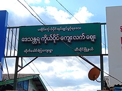 Sai Khao Market sign board | |
| 20°20′N 97°15′E / 20.333°N 97.250°E / 20.333; 97.250 | |
| Country |  Burma Burma |
| State | Shan State |
| District | Taunggyi District |
| Township | Hsi Hseng Township |
| Time zone | UTC+6.30 (MST) |
Sike Khaung or Sai Khao (Pa'o Karen: သုဲင်ꩻခဝ်) is a village in Hsi Hseng Township, Taunggyi District, Pa'O Self-Administered Zone, in the Shan State of eastern Myanmar.[1] It is located north of the township capital of Hsi Hseng by National Highway 5. Nawnge and Lothkan are located to the west, Loimut to the southeast, and Hsohsa to the northeast.[2][3]
References
- ^ United States Board on Geographical Names; United States. War Dept. General Staff; Survey of India (1944). Gazetteer to maps of Burma. Army Map Service. p. 297. Retrieved 28 September 2011.
- ^ Maps (Map). Google Maps.
- ^ Bing Maps (Map). Microsoft and Harris Corporation Earthstar Geographics LLC.
External links
- Maplandia World Gazetteer

 | This Shan State location article is a stub. You can help Wikipedia by expanding it. |
- v
- t
- e


