Lomonosovsky District, Moscow
District in Moscow, Russia
Lomonosovsky District, Moscow Ломоносовский район | |
|---|---|
District | |
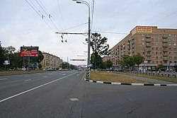 Leninsky Avenue at Garibaldi Street, Lomonosovsky District | |
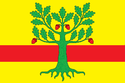 Flag  Coat of arms | |
 Location of Lomonosovsky District, Moscow on the map of Moscow | |
| Coordinates: 55°40′49″N 37°32′0″E / 55.68028°N 37.53333°E / 55.68028; 37.53333 | |
| Country | Russia |
| Federal subject | Moscow |
| Area | |
| • Total | 3.34 km2 (1.29 sq mi) |
| Population | |
| • Estimate (2018)[2] | 87,998 |
| Time zone | UTC+3 (MSK |
| OKTMO ID | 45904000 |
| Website | http://lomonosovsky.mos.ru/ |
Lomonosovsky District, Moscow (Russian: Ломоно́совский райо́н) is an administrative district (raion) of South-Western Administrative Okrug, and one of the 125 raions of Moscow, Russia.[4] The area of the district is 3.34 square kilometers (1.29 sq mi). Population: 85,000 (2017 est.).[1] Population - 81,851. Established at 1995. Named after Mikhail Vasilyevich Lomonosov.
Education
The branch of the Moscow State Pedagogical University, The Moscow Finnish School, the Japanese School in Moscow, the Swedish School in Moscow, and the main campus of the Scuola Italiana Italo Calvino (Italian school) occupy a single campus in the district.[5][6]
See also
References
Notes
- ^ a b "General Information" (in Russian). Lomonosovsky District. Retrieved March 27, 2018.
- ^ "26. Численность постоянного населения Российской Федерации по муниципальным образованиям на 1 января 2018 года". Federal State Statistics Service. Retrieved 23 January 2019.
- ^ "Об исчислении времени". Официальный интернет-портал правовой информации (in Russian). 3 June 2011. Retrieved 19 January 2019.
- ^ Государственный комитет Российской Федерации по статистике. Комитет Российской Федерации по стандартизации, метрологии и сертификации. №ОК 019-95 1 января 1997 г. «Общероссийский классификатор объектов административно-территориального деления. Код 45», в ред. изменения №278/2015 от 1 января 2016 г.. (State Statistics Committee of the Russian Federation. Committee of the Russian Federation on Standardization, Metrology, and Certification. #OK 019-95 January 1, 1997 Russian Classification of Objects of Administrative Division (OKATO). Code 45, as amended by the Amendment #278/2015 of January 1, 2016. ).
- ^ "English" () Moscow Finnish School. January 19, 2008. Retrieved on March 22, 2014.
- ^ "00-Joubu-Title.html." (Archive) Japanese School in Moscow. Retrieved on 2 January 2013. "Leninsky Prospekt 78A Moscow Russia Japanese School in Moscow"
Sources
- v
- t
- e
- Desyonovskoye
- Filimonkovskoye
- Kokoshkino
- Marushkinskoye
- Moskovsky
- Mosrentgen
- Ryazanovskoye
- Sosenskoye
- Shcherbinka
- Vnukovskoye
- Voskresenskoye
- Kiyevsky
- Klenovskoye
- Krasnopakhorskoye
- Mikhaylovo-Yartsevskoye
- Novofyodorovskoye
- Pervomayskoye
- Rogovskoye
- Shchapovskoye
- Troitsky
- Voronovskoye
55°40′49″N 37°32′00″E / 55.68028°N 37.53333°E / 55.68028; 37.53333


