Macaíba | |
|---|---|
Municipality | |
 | |
 Flag .png) Seal | |
 | |
| Country | |
| Region | Nordeste |
| State | Rio Grande do Norte |
| Mesoregion | Leste Potiguar |
| Population (2020 [1]) | |
• Total | 81,821 |
| Time zone | UTC−3 (BRT) |
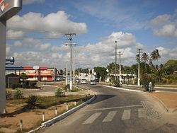
Macaíba is a municipality in the state of Rio Grande do Norte in the Northeast region of Brazil.[2][3][4][5]
Climate
[edit]Macaíba has a rather dry tropical savanna climate (Köppen As) with like most of the Nordeste coast a strong dry season from September to January. Although the area is substantially drier than Natal, in accordance with its location in the transition to the agreste further west, the climate is hot year round and humidity is generally high particularly in the rainy season.
| Month | Jan | Feb | Mar | Apr | May | Jun | Jul | Aug | Sep | Oct | Nov | Dec | Year |
|---|---|---|---|---|---|---|---|---|---|---|---|---|---|
| Record high °C (°F) | 35.3 (95.5) |
34.9 (94.8) |
35.5 (95.9) |
35.0 (95.0) |
33.7 (92.7) |
32.9 (91.2) |
33.0 (91.4) |
33.7 (92.7) |
34.3 (93.7) |
33.8 (92.8) |
34.3 (93.7) |
34.2 (93.6) |
35.5 (95.9) |
| Mean daily maximum °C (°F) | 31.6 (88.9) |
31.7 (89.1) |
31.4 (88.5) |
31.0 (87.8) |
30.5 (86.9) |
29.7 (85.5) |
29.2 (84.6) |
29.6 (85.3) |
30.2 (86.4) |
30.8 (87.4) |
31.0 (87.8) |
31.2 (88.2) |
30.7 (87.3) |
| Daily mean °C (°F) | 26.7 (80.1) |
26.9 (80.4) |
26.7 (80.1) |
26.1 (79.0) |
25.4 (77.7) |
24.3 (75.7) |
23.7 (74.7) |
23.9 (75.0) |
24.6 (76.3) |
25.3 (77.5) |
26.0 (78.8) |
26.4 (79.5) |
25.5 (77.9) |
| Mean daily minimum °C (°F) | 22.4 (72.3) |
22.5 (72.5) |
22.5 (72.5) |
22.2 (72.0) |
21.7 (71.1) |
21.1 (70.0) |
20.4 (68.7) |
20.2 (68.4) |
20.7 (69.3) |
21.3 (70.3) |
21.5 (70.7) |
21.9 (71.4) |
21.5 (70.7) |
| Record low °C (°F) | 15.8 (60.4) |
17.8 (64.0) |
18.6 (65.5) |
17.0 (62.6) |
17.0 (62.6) |
18.6 (65.5) |
15.7 (60.3) |
15.0 (59.0) |
14.6 (58.3) |
15.4 (59.7) |
15.8 (60.4) |
14.9 (58.8) |
14.6 (58.3) |
| Average rainfall mm (inches) | 48.7 (1.92) |
88.2 (3.47) |
150.5 (5.93) |
176.4 (6.94) |
160.7 (6.33) |
158.0 (6.22) |
117.3 (4.62) |
67.3 (2.65) |
28.1 (1.11) |
12.7 (0.50) |
16.0 (0.63) |
24.1 (0.95) |
1,048 (41.27) |
| Average relative humidity (%) | 69.2 | 70.2 | 74.0 | 78.0 | 79.0 | 81.4 | 79.6 | 76.3 | 72.2 | 67.8 | 67.3 | 68.4 | 73.6 |
| Source 1: Universidade Federal de Campina Grande[6] | |||||||||||||
| Source 2: INMET[7] | |||||||||||||
See also
[edit]References
[edit]- ^ IBGE 2020
- ^ "Divisão Territorial do Brasil" (in Portuguese). Divisão Territorial do Brasil e Limites Territoriais, Instituto Brasileiro de Geografia e Estatística (IBGE). July 1, 2008. Retrieved December 17, 2009.
- ^ "Estimativas da população para 1º de julho de 2009" (PDF) (in Portuguese). Estimativas de População, Instituto Brasileiro de Geografia e Estatística (IBGE). August 14, 2009. Retrieved December 17, 2009.
- ^ "Ranking decrescente do IDH-M dos municípios do Brasil" (in Portuguese). Atlas do Desenvolvimento Humano, Programa das Nações Unidas para o Desenvolvimento (PNUD). 2000. Archived from the original on October 3, 2009. Retrieved December 17, 2009.
- ^ "Produto Interno Bruto dos Municípios 2002-2005" (PDF) (in Portuguese). Instituto Brasileiro de Geografia e Estatística (IBGE). December 19, 2007. Archived from the original (PDF) on October 2, 2008. Retrieved December 17, 2009.
- ^ "Dados Climatológicos do Estado do Rio Grande do Norte". Universidade Federal de Campina Grande. Archived from the original on May 23, 2021. Retrieved July 28, 2021.
- ^ "Normais Climatológicas do Brasil (1931-1960)". Instituto Nacional de Meteorologia. Retrieved July 20, 2020.
5°51′28″S 35°21′14″W / 5.85778°S 35.3539°W
This Rio Grande do Norte, Brazil location article is a stub. You can help Wikipedia by expanding it. |