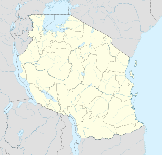
Zanzibar West District | |
|---|---|
| Coordinates: 06°10′S 039°17′E / 6.167°S 39.283°E | |
| Country | |
| Region | Zanzibar Urban/West Region |
| Population (2012) | |
• Total | 370,645 |
Zanzibar West District is one of the two districts of the Zanzibar Urban/West Region of Tanzania. It is bordered to the north by the Zanzibar North Region, to the east by the Zanzibar Central/South Region, to the south by Kiwani Bay, and to the west by the Zanzibar Urban District.
As of 2002[update] Census, the population of the Zanzibar West District was 184,204, but by the 2012 Census it had more than doubled to 370,645[1][2]
Administrative subdivisions
[edit]Constituencies
[edit]For parliamentary elections, Tanzania is divided into constituencies. As of the 2010 elections the area for Zanzibar West District had nine of the nineteen constituencies in the region:[3]
- Bububu Constituency
- Dimani Constituency
- Dole Constituency
- Fuoni Constituency
- Kiembesamaki Constituency
- Magogoni Constituency
- Mfenesini Constituency
- Mtoni Constituency
- Mwanakwerekwe Constituency
Wards
[edit]As of 2012[update], the Zanzibar West District was administratively divided into thirty-nine wards:[1]
| Nr. | Ward (Shehia) | Population 2012 |
Parliamentary Constituency |
Remarks |
|---|---|---|---|---|
| 1 | Sharifu Msa | 4,975 | Bububu | |
| 2 | Kibweni | 7,115 | Bububu | |
| 3 | Mwanyanya | 9,683 | Bububu | |
| 4 | Bububu | 15,666 | Bububu | |
| 5 | Kihinani | 14,139 | Mfenesini | |
| 6 | Chuini | 6,158 | Mfenesini | |
| 7 | Kama | 2,921 | Mfenesini | |
| 8 | Mfenesini | 2,803 | Mfenesini | |
| 9 | Mwakaje | 2,907 | Mfenesini | |
| 10 | Mbuzini | 5,856 | Mfenesini | "on the goat" |
| 11 | Bumbwisudi | 2,269 | Dole | |
| 12 | Kizimbani | 3,304 | Dole | |
| 13 | Dole | 3,933 | Dole | |
| 14 | Kianga | 9,908 | Dole | |
| 15 | Mwera | 10,238 | Dole | |
| 16 | Mtufaani | 9,123 | Dole | |
| 17 | Mtoni | 6,571 | Mtoni | "in the river" |
| 18 | Mtoni Kidatu | 16,612 | Mtoni | |
| 19 | Mto Pepo | 16,440 | Mtoni | |
| 20 | Welezo | 13,119 | Magogoni | |
| 21 | Magogoni | 14,928 | Magogoni | |
| 22 | Kinuni | 11,333 | Magogoni | |
| 23 | Pangawe | 26,275 | Fuoni | |
| 24 | Fuoni Kibondeni | 15,40 | Fuoni | |
| 25 | Maungani | 4,048 | Fuoni | |
| 26 | Fuoni Kijito Upele | 19,374 | Fuoni | |
| 27 | Mwanakwerekwe | 20,215 | Mwanakwerekwe | |
| 28 | Meli Nne | 16,984 | Mwanakwerekwe | |
| 29 | Tomondo | 23,354 | Mwanakwerekwe | |
| 30 | Mombasa | 14,492 | Dimani | |
| 31 | Kisauni | 9,331 | Dimani | |
| 32 | Shakani | 2,760 | Dimani | |
| 33 | Nyamanzi | 1,287 | Dimani | |
| 35 | Dimani | 2,052 | Dimani | |
| 34 | Kombeni | 3,162 | Dimani | |
| 36 | Bweleo | 971 | Dimani | |
| 37 | Fumba | 981 | Dimani | |
| 38 | Kiembesamaki | 11,760 | Kiembesamaki | |
| 39 | Chukwani | 8,298 | Kiembesamaki | |
| Total | Zanzibar West | 370,645 |
Notes
[edit]- ^ a b "2002 Population and Housing Census: General Report: Urban West: West". Archived from the original on 18 March 2004.
- ^ National Bureau of Statistics Tanzania (web).
- ^ "Organisations located in Zanzibar City - Tanzania". African Development Information. Archived from the original on 2012-09-04.
