Masaki, Ehime
Town in Shikoku, Japan
Masaki  Flag  Emblem | |
|---|---|
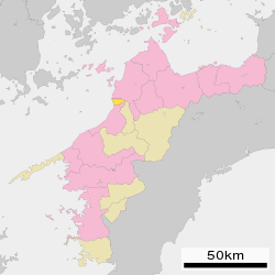
 Location of Masaki in Ehime Prefecture | |
 | |
| Symbols | |
| Flower | Sunflower (向日葵, Himawari) |
| Tree | Pine (松, Matsu) |

Masaki (Japanese: 松前町, Hepburn: Masaki-chō) is a town located in Iyo District, Ehime Prefecture, Japan. As of 1 September 2022[update], the town had an estimated population of 30,411 in 13768 households and a population density of 1500 persons per km².[1] The total area of the town is 20.41 square kilometres (7.88 sq mi). It is the smallest municipality in terms of area in Ehime Prefecture.
Geography
Masaki faces the Seto Inland Sea, and is located at the southern end of the Dogo Plain in the northwestern part of the island of Shikoku. It is the only municipality in Ehime Prefecture that does not have any mountains. The town area is longer in the east-west direction than in the north-south direction.
Surrounding municipalities
Ehime Prefecture
- Matsuyama
- Iyo
- Tobe
Climate
Masaki has a Humid subtropical climate (Köppen Cfa) characterized by warm summers and cool winters with light snowfall. The average annual temperature in Masaki is 15.2 °C. The average annual rainfall is 1777 mm with September as the wettest month. The temperatures are highest on average in January, at around 26.1 °C, and lowest in January, at around 4.5 °C.[2]
Demographics
Per Japanese census data,[3] the population of Masaki has been generally increasing since the 1960s.
| Year | Pop. | ±% |
|---|---|---|
| 1920 | 13,216 | — |
| 1930 | 13,745 | +4.0% |
| 1940 | 14,916 | +8.5% |
| 1950 | 22,054 | +47.9% |
| 1960 | 21,784 | −1.2% |
| 1970 | 23,900 | +9.7% |
| 1980 | 27,568 | +15.3% |
| 1990 | 29,407 | +6.7% |
| 2000 | 30,277 | +3.0% |
| 2010 | 30,355 | +0.3% |
History
The area of Masaki was par of ancient Iyo province. Masaki was developed as a castle town by Kato Yoshiaki in the late Sengoku period; however, when he relocated to Matsuyama Castle, and of the merchants and artisans relocated with him. in the Edo Period, most of the area wash part of Matsuyama Domain with a smaller portion under the control of Ōzu Domain. The village of Masaki was established on December 15, 1889 with the creation of the modern municipalities system. It was elevated to town status on October 31, 1922. Masaki annexed neighboring Okada and Kita-Iyo villages on March 31, 1955.
Government
Masaki has a mayor-council form of government with a directly elected mayor and a unicameral town council of 14 members. Masaki, together with the city of Tobe, contributes two members to the Ehime Prefectural Assembly. In terms of national politics, the town is part of Ehime 2nd district of the lower house of the Diet of Japan.
Economy
Masaki is an industrial center for the production of textiles and synthetic fibers. Food processing is also a component of the local economy. The area was traditionally dependent on commercial fishing and on agriculture, and is increasingly becoming a commuter town for neighboring Matsuyama.
Education
Masaki has three public elementary schools and three public middle school operated by the town government, and one public high school operated by the Ehime Prefectural Board of Education.
Transportation
Railways
![]() Shikoku Railway Company - Yosan Line
Shikoku Railway Company - Yosan Line
- Okada - Koizumi - Masaki - Jizōmachi
Highway

Points of interest
Noted people from Masaki
- Reiko Kataoka, actress
References
External links
 Media related to Masaki, Ehime at Wikimedia Commons
- Masaki official website (in Japanese)


Authority control databases | |
|---|---|
| International |
|
| National |
|
| Geographic |
|
 | This Ehime Prefecture location article is a stub. You can help Wikipedia by expanding it. |
- v
- t
- e


