Mazong Mountain
Mountain in Gansu, China
The Mǎzōng Shān (Chinese: 马鬃山; pinyin: Mǎzōng Shān) is a minor mountain range of Subei Mongol Autonomous County, Jiuquan, northern Gansu, China, between the Altay range to the north and the Qilian range to the south. The Mǎzōng Shān peak rises to 2584 m.
Climate
Mount Mazong has a cold desert climate (Köppen climate classification BWk).
| Climate data for Mount Mazong (1981−2010 normals, extremes 1981−2010) | |||||||||||||
|---|---|---|---|---|---|---|---|---|---|---|---|---|---|
| Month | Jan | Feb | Mar | Apr | May | Jun | Jul | Aug | Sep | Oct | Nov | Dec | Year |
| Record high °C (°F) | 14.1 (57.4) | 14.5 (58.1) | 21.2 (70.2) | 28.1 (82.6) | 31.3 (88.3) | 34.6 (94.3) | 35.4 (95.7) | 34.6 (94.3) | 31.7 (89.1) | 26.2 (79.2) | 19.5 (67.1) | 12.3 (54.1) | 35.4 (95.7) |
| Mean daily maximum °C (°F) | −3.3 (26.1) | 0.2 (32.4) | 6.1 (43.0) | 14.0 (57.2) | 20.7 (69.3) | 25.8 (78.4) | 28.0 (82.4) | 26.3 (79.3) | 20.8 (69.4) | 12.9 (55.2) | 4.3 (39.7) | −2.0 (28.4) | 12.8 (55.1) |
| Daily mean °C (°F) | −11.8 (10.8) | −8.4 (16.9) | −2.3 (27.9) | 5.7 (42.3) | 13.0 (55.4) | 18.6 (65.5) | 20.9 (69.6) | 18.9 (66.0) | 12.7 (54.9) | 4.3 (39.7) | −3.9 (25.0) | −10.1 (13.8) | 4.8 (40.7) |
| Mean daily minimum °C (°F) | −18.6 (−1.5) | −15.6 (3.9) | −9.6 (14.7) | −2.0 (28.4) | 5.1 (41.2) | 10.9 (51.6) | 13.8 (56.8) | 11.7 (53.1) | 5.4 (41.7) | −2.7 (27.1) | −10.4 (13.3) | −16.2 (2.8) | −2.3 (27.8) |
| Record low °C (°F) | −35.4 (−31.7) | −29.5 (−21.1) | −25.4 (−13.7) | −17.7 (0.1) | −8.7 (16.3) | 0.9 (33.6) | 5.7 (42.3) | 1.6 (34.9) | −8.5 (16.7) | −19.1 (−2.4) | −29.1 (−20.4) | −37.1 (−34.8) | −37.1 (−34.8) |
| Average precipitation mm (inches) | 0.6 (0.02) | 0.9 (0.04) | 2.4 (0.09) | 3.2 (0.13) | 5.1 (0.20) | 11.2 (0.44) | 16.9 (0.67) | 13.5 (0.53) | 5.4 (0.21) | 2.0 (0.08) | 1.8 (0.07) | 0.9 (0.04) | 63.9 (2.52) |
| Average precipitation days (≥ 0.1 mm) | 1.5 | 1.7 | 2.2 | 2.1 | 2.4 | 5.1 | 6.3 | 4.6 | 2.7 | 1.4 | 1.9 | 1.8 | 33.7 |
| Average snowy days | 3.3 | 3.3 | 3.5 | 2.1 | 0.7 | 0 | 0 | 0 | 0.3 | 1.6 | 3.5 | 3.9 | 22.2 |
| Average relative humidity (%) | 53 | 45 | 37 | 30 | 29 | 32 | 37 | 36 | 36 | 40 | 48 | 54 | 40 |
| Mean monthly sunshine hours | 238.4 | 237.7 | 281.6 | 304.3 | 340.6 | 321.2 | 319.6 | 315.9 | 299.1 | 287.2 | 234.1 | 223.6 | 3,403.3 |
| Percent possible sunshine | 80 | 78 | 75 | 75 | 75 | 71 | 70 | 75 | 81 | 85 | 81 | 79 | 77 |
| Source: China Meteorological Administration (precipitation days, snow days, sunshine 1991–2020)[1][2] | |||||||||||||
Gallery
-
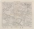 Map including Mazong Mountain (labeled as MATSZUN SHAN) and surrounding areas (1935)
 -
 Hadrosauroid Dinosaur skeleton found on (and named for) Mazongshan: Gongpoquansaurus mazongshanensis.


References
See also
- Equijubus
- Xinminbao Group
41°31′26″N 97°7′10″E / 41.52389°N 97.11944°E / 41.52389; 97.11944
- v
- t
- e


