Motta San Giovanni | |
|---|---|
| Comune di Motta San Giovanni | |
 Chiesa Santa Maria delle Grazie | |
| Coordinates: 38°0′N 15°42′E / 38.000°N 15.700°E | |
| Country | Italy |
| Region | Calabria |
| Metropolitan city | Reggio Calabria (RC) |
| Frazioni | Lazzaro, Valanidi, Cambareri, Allai |
| Government | |
| • Mayor | Paolo Laganà |
| Area | |
• Total | 46.7 km2 (18.0 sq mi) |
| Elevation | 450 m (1,480 ft) |
| Population (November 2008)[2] | |
• Total | 6,428 |
| • Density | 140/km2 (360/sq mi) |
| Demonym | Mottesi |
| Time zone | UTC+1 (CET) |
| • Summer (DST) | UTC+2 (CEST) |
| Postal code | 89065 |
| Dialing code | 0965 |
| Patron saint | St. John the Evangelist |
| Saint day | December 27 |
| Website | Official website |
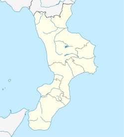
Motta San Giovanni is a comune (municipality) in the Province of Reggio Calabria in the Italian region Calabria, located about 130 km (81 mi) southwest of Catanzaro and about 13 km (8.1 mi) southeast of Reggio Calabria. In antiquity it had the Greek toponym Leucopetra (i.e. "white stone").[3]
Motta San Giovanni borders the municipalities of Montebello Ionico and Reggio Calabria.
The most interesting feature of the comune is the Castle of Sant'Aniceto, a notable example of Byzantine-Norman architecture. The Capo dell'Armi Lighthouse is also located in the comune along the clifftops.
See also
[edit]References
[edit]- ^ "Superficie di Comuni Province e Regioni italiane al 9 ottobre 2011". Italian National Institute of Statistics. Retrieved 16 March 2019.
- ^ All demographics and other statistics from the Italian statistical institute (Istat)
- ^ "Leucopetra: ancient crossroads of culture and religion", Turismo Reggio Calabria
External links
[edit] Media related to Motta San Giovanni at Wikimedia Commons
- Official website


