Mulgrave, New South Wales
Suburb of City of Hawkesbury, New South Wales, Australia
| Mulgrave New South Wales | |||||||||||||||
|---|---|---|---|---|---|---|---|---|---|---|---|---|---|---|---|
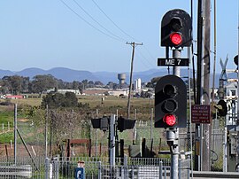 View towards Windsor and Blue Mountains, from Mulgrave railway station | |||||||||||||||
 | |||||||||||||||
| Population | 92 (2016 census)[1] | ||||||||||||||
| Postcode(s) | 2756 | ||||||||||||||
| Elevation | 15 m (49 ft) | ||||||||||||||
| Location | 53.5 km (33 mi) from Sydney CBD | ||||||||||||||
| LGA(s) | City of Hawkesbury | ||||||||||||||
| State electorate(s) | Hawkesbury | ||||||||||||||
| Federal division(s) | Macquarie | ||||||||||||||
| |||||||||||||||
Mulgrave is a suburb in the north west of Sydney in New South Wales, Australia. It is a predominantly industrial and commercial area.[2]
History
The district was settled in the period between 1794 and 1800. Lieutenant-Governor Grose named the locality 'Mulgrave Place' honouring Constantine Phipps, the second Baron Mulgrave, who had died in 1792. Baron Mulgrave had been an English naval officer and statesman and a colleague and friend of Joseph Banks.[3][4]
Transport
Mulgrave railway station is on the Richmond railway line. It is four stations from the terminus station at Richmond. Mulgrave station is 53 kilometres (33 mi) from Sydney's Central Station, which takes approximately 1 hour 6 minutes to travel by train during peak hour.[5] The station along with the arrival of a steam train features in The Seekers at Home TV special, 1968. Filmed as the setting for the song "Angeline is always Friday", steam hauled services ceased to operate shortly afterwards.
Demographics
Mulgrave's population is 92 (Census 2016).[2] It had a median weekly household income of A$2,062, which is 143.4% above the national average.[6]
References
- ^ Australian Bureau of Statistics (27 June 2017). "Mulgrave (NSW) (State Suburb)". 2016 Census QuickStats. Retrieved 19 March 2018.

- ^ a b "2016 Census QuickStats: Mulgrave (NSW)". quickstats.censusdata.abs.gov.au. Retrieved 28 October 2018.
- ^ Place Names of the District by James Jervis (a lecture delivered before the Parramatta and District Historical Society on 7 September 1920), Cumberland Argus and Fruitgrowers Advocate (Parramatta), 22 September 1920, page 4.
- ^ "NSW Railway Station Names and Origins". Nswrail.net. 21 March 1999. Retrieved 6 July 2012.
- ^ "NSW Trains Trip Planner". Transport NSW.
- ^ "2016 Census QuickStats: Australia". quickstats.censusdata.abs.gov.au. Retrieved 28 October 2018.
- v
- t
- e
Suburbs and localities within the City of Hawkesbury, Sydney
- Agnes Banks
- Berambing
- Bilpin
- Blaxlands Ridge
- Bligh Park
- Bowen Mountain
- Bucketty
- Cattai
- Central Colo
- Central Macdonald
- Clarendon
- Colo
- Colo Heights
- Cornwallis
- Cumberland Reach
- East Kurrajong
- Ebenezer
- Fernances
- Freemans Reach
- Glossodia
- Grose Vale
- Grose Wold
- Higher Macdonald
- Hobartville
- Kurmond
- Kurrajong
- Kurrajong Heights
- Kurrajong Hills
- Leets Vale
- Lower Macdonald
- Lower Portland
- Maraylya
- McGraths Hill
- Mellong
- Mogo Creek
- Mountain Lagoon
- Mulgrave
- North Richmond
- Oakville
- Perrys Crossing
- Pitt Town
- Pitt Town Bottoms
- Putty
- Richmond
- Richmond Lowlands
- Sackville
- St Albans
- Scheyville
- South Windsor
- Ten Mile Hollow
- Tennyson
- The Devils Wilderness
- The Slopes
- Upper Colo
- Upper Macdonald
- Vineyard
- Warawaralong
- Webbs Creek
- Wheeny Creek
- Wilberforce
- Windsor
- Windsor Downs
- Wisemans Ferry
- Womerah
- Wrights Creek
- Yarramundi
33°36′54″S 150°49′41″E / 33.615°S 150.828°E / -33.615; 150.828
 | This article related to the geography of Sydney is a stub. You can help Wikipedia by expanding it. |
- v
- t
- e


