Newcastle Street, Perth
Street in Perth, Western Australia
Newcastle Street Western Australia | |
|---|---|
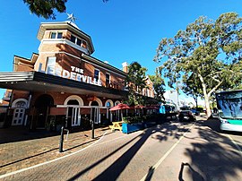 | |
| Leederville hotel on the corner of Newcastle Street and Oxford Street | |
 | |
| General information | |
| Type | Road |
| Length | 3 km (1.9 mi)[1] |
| Major junctions | |
| East end |
|
| |
| West end |
|
| Location(s) | |
| Major suburbs | Perth, Northbridge, West Perth, Leederville |
Newcastle Street is a road in Perth, Western Australia. It connects Leederville with East Perth, starting from Oxford Street and ending at Lord Street, crossing a number of roads leading north out of Perth including Loftus Street, Charles Street, Fitzgerald Street, William Street, and Beaufort Street.
History
Newcastle Street is named after Henry Pelham-Clinton, 5th Duke of Newcastle, who was Secretary of State for the Colonies from 1852 to 1854.[2]
It has been in the past parts of major bus routes leaving Perth. The tramline (closed in the 1950s) along William Street also crossed Newcastle Street.[3]
The street has also been identified in name, by schools and businesses. The Newcastle Street State School was at 478–482 Newcastle Street.[4] It was sometimes also named the Newcastle Street Infants School, as well as the Newcastle Street Primary School or even Newcastle Street School.[5]
It has been in the scope of the Northbridge Urban Renewal project.[6]
Wikimedia Commons has media related to Newcastle Street, Perth.
Major intersections
| LGA | Location[1] | km | mi | Destinations | Notes |
|---|---|---|---|---|---|
| Perth - Vincent boundary | Perth | 0 | 0.0 | Freeway westbound exit ramp only; ramp continues after traffic lights as Newcastle Street; traffic lights shared with Lord Street | |
| 0 | 0.0 | Traffic light controlled; traffic lights shared with Graham Farmer Freeway ramp | |||
| 0.4 | 0.25 | Stirling Street | Traffic light controlled | ||
| 0.55 | 0.34 | Traffic light controlled | |||
| Perth - Northbridge boundary | 0.85 | 0.53 | Traffic light controlled; William Street is one-way southbound north of intersection | ||
| Northbridge - Perth - West Perth tripoint | 1.6 | 0.99 | Fitzgerald Street | Traffic light controlled | |
| West Perth - Northbridge boundary | 1.8 | 1.1 | Freeway southbound entry and northbound exit ramps only; ramps continue after traffic lights as Charles Street | ||
| 1.8 | 1.1 | Traffic light controlled; no right turn from Newcastle Street westbound onto Charles Street northbound or Charles Street southbound onto Newcastle Street westbound; Charles Street continues after traffic lights as freeway ramps and Charles Street Bus Bridge | |||
| Vincent | West Perth | 2.2 | 1.4 | Cleaver Street | Traffic light controlled; no through traffic on Cleaver Street, Cleaver Street southbound is left-only to Newcastle Street eastbound; no right turn from Newcastle Street westbound to Cleaver Street northbound (except buses) |
| West Perth - Leederville boundary | 2.5 | 1.6 | Traffic light controlled; no right turn from Loftus Street southbound onto Newcastle Street westbound | ||
| Leederville | 3 | 1.9 | Oxford Street | ||
| |||||
References
- ^ a b "Newcastle Street". Google Maps. Retrieved 3 November 2022.
- ^ "PERTH NAMES. Newcastle of Newcastle Street". The West Australian. Vol. 54, no. 16, 358. Western Australia. 3 December 1938. p. 5. Retrieved 6 June 2018 – via National Library of Australia.
- ^ "PERTH TRAM JUMPS RAILS". Kalgoorlie Miner. Vol. 41, no. 10, 373. Western Australia. 14 June 1935. p. 4. Retrieved 6 June 2018 – via National Library of Australia.
- ^ "NEWS AND NOTES". The West Australian. Vol. XLIII, no. 7, 862. Western Australia. 23 August 1927. p. 10. Retrieved 6 June 2018 – via National Library of Australia.
- ^ HRRC (1910), Newcastle Street and the Newcastle Street State School, Perth, retrieved 6 June 2018
- ^ Northbridge Urban Renewal Project : Newcastle Street pavement assessment, 1999, retrieved 6 June 2018


