Nikari
Populated place in Uttar Pradesh, India
Nikari Nikāri | |
|---|---|
Populated place | |
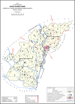 Map showing Nikari (#860) in Sandi CD block | |
27°17′17″N 79°53′19″E / 27.288134°N 79.888502°E / 27.288134; 79.888502[1] | |
| Country |  India India |
| State | Uttar Pradesh |
| District | Hardoi |
| Area | |
| • Total | 1.857 km2 (0.717 sq mi) |
| Population (2011)[2] | |
| • Total | 1,878 |
| • Density | 1,000/km2 (2,600/sq mi) |
| Languages | |
| • Official | Hindi |
| Time zone | UTC+5:30 (IST) |
Nikari is a village in Sandi block of Hardoi district, Uttar Pradesh, India.[2] It is located 8 km (5.0 mi) away from Sandi, which is the nearest city.[3] The village has one primary school,[2] and the main staple crops are wheat and rice.[3] As of 2011, the population of Nikari is 1,878, in 283 households.[2]
The 1961 census recorded Nikari as comprising 3 hamlets, with a total population of 607 (312 male and 295 female), in 110 households and 91 physical houses.[4] The area of the village was given as 470 acres.[4]
The 1981 census recorded Nikari as having a population of 915, in 158 households, and covering an area of 185.75 hectares.[3]
References
- ^ "GeoNames Search". geonames.nga.mil. Archived from the original on 12 April 2014.
- ^ a b c d e "Census of India 2011: Uttar Pradesh District Census Handbook - Hardoi, Part A (Village and Town Directory)" (PDF). Census 2011 India. pp. 231–55. Retrieved 5 June 2021.
- ^ a b c Census 1981 Uttar Pradesh: District Census Handbook Part XIII-A: Village & Town Directory, District Hardoi (PDF). 1982. pp. 176–7. Retrieved 5 June 2021.
- ^ a b Census 1961: District Census Handbook, Uttar Pradesh (36 - Hardoi District) (PDF). Lucknow. 1965. pp. 158, xciv-xcv of section "Bilgram Tahsil". Retrieved 5 June 2021.
{{cite book}}: CS1 maint: location missing publisher (link)
- v
- t
- e
Populated places in Hardoi district
towns


