Norwich, North Dakota
Unincorporated community in North Dakota, United States
48°14′47″N 100°59′21″W / 48.24639°N 100.98917°W / 48.24639; -100.9891758768
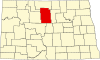
Norwich is an unincorporated community in western McHenry County, North Dakota, United States. It lies along U.S. Route 2 southwest of the city of Towner, the county seat of McHenry County.[2] Norwich's elevation is 1,549 feet (472 m).[1] It is unincorporated, and had a post office with the ZIP code of 58768.[3] Though the post office closed May 4, 1996, the ZIP code is still valid for use.[4]
Norwich was founded in 1901 and named after Norwich, England in an effort to please Great Northern Railway stockholders from England.[5] It was one of several sites along the Great Northern's transcontinental route between Devils Lake and Minot that were named after places in England (the others were Berwick, Leeds, Penn, Rugby, Surrey, Tunbridge, and York).
The community is part of the Minot Micropolitan Statistical Area.
Transportation
Amtrak’s Empire Builder, which operates between Seattle/Portland and Chicago, passes through the town on BNSF tracks, but makes no stop. The nearest station is located in Minot, 15 miles (24 km) to the west.
References
- ^ a b c U.S. Geological Survey Geographic Names Information System: Norwich, North Dakota
- ^ Rand McNally. The Road Atlas '08. Chicago: Rand McNally, 2008, p. 77.
- ^ Zip Code Lookup
- ^ [1][permanent dead link]
- ^ Wick, Douglas A. "Norwich (McHenry County)". North Dakota Place Names. Retrieved May 6, 2011.
- v
- t
- e
Municipalities and communities of McHenry County, North Dakota, United States
County seat: Towner
- Anamoose
- Balfour
- Bantry
- Berwick
- Bjornson
- Brown
- Cottonwood Lake
- Deep River
- Deering
- Denbigh
- Egg Creek
- Falsen
- Gilmore
- Granville
- Grilley
- Hendrickson
- Karlsruhe
- Kottke Valley
- Lake George
- Lake Hester
- Land
- Layton
- Lebanon
- Little Deep
- Meadow
- Mouse River
- Newport
- Normal
- North Prairie
- Norwich
- Odin
- Olivia
- Pratt
- Riga
- Rose Hill
- Round Lake
- Saline
- Schiller
- Spring Grove
- Strege
- Velva
- Villard
- Voltaire
- Wagar
- Willow Creek
territory
- East McHenry
- Northeast McHenry
communities
‡This populated place also has portions in an adjacent county or counties
- North Dakota portal
- United States portal
 | This North Dakota location article is a stub. You can help Wikipedia by expanding it. |
- v
- t
- e


