Podvelka
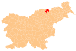
Place in Styria, Slovenia
46°35′11″N 15°19′43″E / 46.58639°N 15.32861°E / 46.58639; 15.32861 Slovenia
 (2019)[1]
Podvelka (pronounced [pɔˈdʋeːlka]) is a village in northeastern Slovenia. It is the seat of the Municipality of Podvelka. It lies in the traditional region of Styria, but belongs to the Carinthia Statistical Region. The settlement is situated on the right bank of the Drava River on the railway line from Maribor to Dravograd.[2]
References
- ^ a b "Naselje Podvelka". Statistični urad Republike Slovenije. Retrieved March 7, 2020.
- ^ Podvelka municipal site
External links
 Media related to Podvelka at Wikimedia Commons
- Podvelka on Geopedia
- v
- t
- e
Municipality of Podvelka
Administrative seat: Podvelka
- Brezno
- Janževski Vrh
- Javnik
- Kozji Vrh
- Lehen na Pohorju
- Ožbalt
- Rdeči Breg
- Spodnja Kapla
- Vurmat
- Zgornja Kapla
Authority control databases | |
|---|---|
| International |
|
| National |
|
 | This article about the Municipality of Podvelka in Slovenia is a stub. You can help Wikipedia by expanding it. |
- v
- t
- e


