This article has multiple issues. Please help improve it or discuss these issues on the talk page. (Learn how and when to remove these messages)
|
| Qinghai–Tibet railway མཚོ་བོད་ལྕགས་ལམ། 青藏铁路 | ||||||||||||||||||||||||||||||||||||||||||||||||||||||||||||||||||||||||||||||||||||||||||||||||||||||||||||||||||||||||||||||||||||||||||||||||||||||||||||||||||||||||||||||||||||||||||||||||||||||||||||||||||||||||||||||||||||||||||||||||||||||||||||||||||||||||||||||||||||||||||||||||||||||||||||||||||||||||||||||||||||||||||||||||||||||||||||||||||||||||||||||||||||||||||||||||||||||||||||||||||||||||||||||||||||||||||||||||||||||||||||||||||||||||||||||||||||||||||||||||||||||||||||||||||||||||||||||||||||||||||||||||||||||||||||||||||||||||||||||||||||||||||||||||||||||||||||||||||||||||||||||||||||||||||||||||||||||||||||||||||||||||||||||||||||||||||||||||||||||||||||||||||||||||||||||||||||||||||||||||||||||||||||||||||||||||||||||||||||||||||||||||||||||||||||||||||||||||||||||||||||||||||||||||||||||||||||||||||||||||||||||||||||||||||||||||||||||||||||||||||||||||||||||||||||||||||||||||||||||||||||||||||||||||||||||||||||||||||||||
|---|---|---|---|---|---|---|---|---|---|---|---|---|---|---|---|---|---|---|---|---|---|---|---|---|---|---|---|---|---|---|---|---|---|---|---|---|---|---|---|---|---|---|---|---|---|---|---|---|---|---|---|---|---|---|---|---|---|---|---|---|---|---|---|---|---|---|---|---|---|---|---|---|---|---|---|---|---|---|---|---|---|---|---|---|---|---|---|---|---|---|---|---|---|---|---|---|---|---|---|---|---|---|---|---|---|---|---|---|---|---|---|---|---|---|---|---|---|---|---|---|---|---|---|---|---|---|---|---|---|---|---|---|---|---|---|---|---|---|---|---|---|---|---|---|---|---|---|---|---|---|---|---|---|---|---|---|---|---|---|---|---|---|---|---|---|---|---|---|---|---|---|---|---|---|---|---|---|---|---|---|---|---|---|---|---|---|---|---|---|---|---|---|---|---|---|---|---|---|---|---|---|---|---|---|---|---|---|---|---|---|---|---|---|---|---|---|---|---|---|---|---|---|---|---|---|---|---|---|---|---|---|---|---|---|---|---|---|---|---|---|---|---|---|---|---|---|---|---|---|---|---|---|---|---|---|---|---|---|---|---|---|---|---|---|---|---|---|---|---|---|---|---|---|---|---|---|---|---|---|---|---|---|---|---|---|---|---|---|---|---|---|---|---|---|---|---|---|---|---|---|---|---|---|---|---|---|---|---|---|---|---|---|---|---|---|---|---|---|---|---|---|---|---|---|---|---|---|---|---|---|---|---|---|---|---|---|---|---|---|---|---|---|---|---|---|---|---|---|---|---|---|---|---|---|---|---|---|---|---|---|---|---|---|---|---|---|---|---|---|---|---|---|---|---|---|---|---|---|---|---|---|---|---|---|---|---|---|---|---|---|---|---|---|---|---|---|---|---|---|---|---|---|---|---|---|---|---|---|---|---|---|---|---|---|---|---|---|---|---|---|---|---|---|---|---|---|---|---|---|---|---|---|---|---|---|---|---|---|---|---|---|---|---|---|---|---|---|---|---|---|---|---|---|---|---|---|---|---|---|---|---|---|---|---|---|---|---|---|---|---|---|---|---|---|---|---|---|---|---|---|---|---|---|---|---|---|---|---|---|---|---|---|---|---|---|---|---|---|---|---|---|---|---|---|---|---|---|---|---|---|---|---|---|---|---|---|---|---|---|---|---|---|---|---|---|---|---|---|---|---|---|---|---|---|---|---|---|---|---|---|---|---|---|---|---|---|---|---|---|---|---|---|---|---|---|---|---|---|---|---|---|---|---|---|---|---|---|---|---|---|---|---|---|---|---|---|---|---|---|---|---|---|---|---|---|---|---|---|---|---|---|---|---|---|---|---|---|---|---|---|---|---|---|---|---|---|---|---|---|---|---|---|---|---|---|---|---|---|---|---|---|---|---|---|---|---|---|---|---|---|---|---|---|---|---|---|---|---|---|---|---|---|---|---|---|---|---|---|---|---|---|---|---|---|---|---|---|---|---|---|---|---|---|---|---|---|---|---|---|---|---|---|---|---|---|---|---|---|---|---|---|---|---|---|---|---|---|---|---|---|---|---|---|---|---|---|---|---|---|---|---|---|---|---|---|---|---|---|---|---|---|---|---|---|---|---|---|---|---|---|---|---|---|---|---|---|---|---|---|---|---|---|---|---|---|---|---|---|---|---|---|---|---|---|---|---|---|---|---|---|---|---|---|---|---|---|---|---|---|---|---|---|---|---|---|---|---|---|---|---|---|---|---|---|---|---|---|---|---|---|---|---|---|---|---|---|---|---|---|---|---|---|---|---|---|---|---|---|---|---|---|---|---|---|---|---|---|---|---|---|---|---|---|---|---|---|---|---|---|---|---|---|---|---|---|---|---|---|---|---|---|---|---|---|---|---|---|---|---|---|---|---|---|---|---|---|---|---|---|---|---|---|---|---|---|---|---|---|---|---|---|---|---|---|---|---|---|---|---|---|---|---|---|---|---|---|---|---|---|---|---|---|---|---|---|---|---|---|---|---|---|---|---|---|---|---|---|---|---|---|---|---|---|---|---|---|---|---|---|---|---|---|---|---|---|---|---|---|---|---|---|---|---|---|---|---|---|---|---|---|---|---|---|---|---|---|---|---|---|---|---|---|---|---|---|---|---|---|---|---|---|---|---|---|---|---|---|---|
 A train pulled by a pair of NJ2 locomotives travels on the Qingzang railway in 2008 | ||||||||||||||||||||||||||||||||||||||||||||||||||||||||||||||||||||||||||||||||||||||||||||||||||||||||||||||||||||||||||||||||||||||||||||||||||||||||||||||||||||||||||||||||||||||||||||||||||||||||||||||||||||||||||||||||||||||||||||||||||||||||||||||||||||||||||||||||||||||||||||||||||||||||||||||||||||||||||||||||||||||||||||||||||||||||||||||||||||||||||||||||||||||||||||||||||||||||||||||||||||||||||||||||||||||||||||||||||||||||||||||||||||||||||||||||||||||||||||||||||||||||||||||||||||||||||||||||||||||||||||||||||||||||||||||||||||||||||||||||||||||||||||||||||||||||||||||||||||||||||||||||||||||||||||||||||||||||||||||||||||||||||||||||||||||||||||||||||||||||||||||||||||||||||||||||||||||||||||||||||||||||||||||||||||||||||||||||||||||||||||||||||||||||||||||||||||||||||||||||||||||||||||||||||||||||||||||||||||||||||||||||||||||||||||||||||||||||||||||||||||||||||||||||||||||||||||||||||||||||||||||||||||||||||||||||||||||||||||||
| Overview | ||||||||||||||||||||||||||||||||||||||||||||||||||||||||||||||||||||||||||||||||||||||||||||||||||||||||||||||||||||||||||||||||||||||||||||||||||||||||||||||||||||||||||||||||||||||||||||||||||||||||||||||||||||||||||||||||||||||||||||||||||||||||||||||||||||||||||||||||||||||||||||||||||||||||||||||||||||||||||||||||||||||||||||||||||||||||||||||||||||||||||||||||||||||||||||||||||||||||||||||||||||||||||||||||||||||||||||||||||||||||||||||||||||||||||||||||||||||||||||||||||||||||||||||||||||||||||||||||||||||||||||||||||||||||||||||||||||||||||||||||||||||||||||||||||||||||||||||||||||||||||||||||||||||||||||||||||||||||||||||||||||||||||||||||||||||||||||||||||||||||||||||||||||||||||||||||||||||||||||||||||||||||||||||||||||||||||||||||||||||||||||||||||||||||||||||||||||||||||||||||||||||||||||||||||||||||||||||||||||||||||||||||||||||||||||||||||||||||||||||||||||||||||||||||||||||||||||||||||||||||||||||||||||||||||||||||||||||||||||||
| Status | Operational | |||||||||||||||||||||||||||||||||||||||||||||||||||||||||||||||||||||||||||||||||||||||||||||||||||||||||||||||||||||||||||||||||||||||||||||||||||||||||||||||||||||||||||||||||||||||||||||||||||||||||||||||||||||||||||||||||||||||||||||||||||||||||||||||||||||||||||||||||||||||||||||||||||||||||||||||||||||||||||||||||||||||||||||||||||||||||||||||||||||||||||||||||||||||||||||||||||||||||||||||||||||||||||||||||||||||||||||||||||||||||||||||||||||||||||||||||||||||||||||||||||||||||||||||||||||||||||||||||||||||||||||||||||||||||||||||||||||||||||||||||||||||||||||||||||||||||||||||||||||||||||||||||||||||||||||||||||||||||||||||||||||||||||||||||||||||||||||||||||||||||||||||||||||||||||||||||||||||||||||||||||||||||||||||||||||||||||||||||||||||||||||||||||||||||||||||||||||||||||||||||||||||||||||||||||||||||||||||||||||||||||||||||||||||||||||||||||||||||||||||||||||||||||||||||||||||||||||||||||||||||||||||||||||||||||||||||||||||||||||
| Locale | ||||||||||||||||||||||||||||||||||||||||||||||||||||||||||||||||||||||||||||||||||||||||||||||||||||||||||||||||||||||||||||||||||||||||||||||||||||||||||||||||||||||||||||||||||||||||||||||||||||||||||||||||||||||||||||||||||||||||||||||||||||||||||||||||||||||||||||||||||||||||||||||||||||||||||||||||||||||||||||||||||||||||||||||||||||||||||||||||||||||||||||||||||||||||||||||||||||||||||||||||||||||||||||||||||||||||||||||||||||||||||||||||||||||||||||||||||||||||||||||||||||||||||||||||||||||||||||||||||||||||||||||||||||||||||||||||||||||||||||||||||||||||||||||||||||||||||||||||||||||||||||||||||||||||||||||||||||||||||||||||||||||||||||||||||||||||||||||||||||||||||||||||||||||||||||||||||||||||||||||||||||||||||||||||||||||||||||||||||||||||||||||||||||||||||||||||||||||||||||||||||||||||||||||||||||||||||||||||||||||||||||||||||||||||||||||||||||||||||||||||||||||||||||||||||||||||||||||||||||||||||||||||||||||||||||||||||||||||||||||
| Coordinates | 33°00′18.50″N 91°38′57.70″E / 33.0051389°N 91.6493611°E | |||||||||||||||||||||||||||||||||||||||||||||||||||||||||||||||||||||||||||||||||||||||||||||||||||||||||||||||||||||||||||||||||||||||||||||||||||||||||||||||||||||||||||||||||||||||||||||||||||||||||||||||||||||||||||||||||||||||||||||||||||||||||||||||||||||||||||||||||||||||||||||||||||||||||||||||||||||||||||||||||||||||||||||||||||||||||||||||||||||||||||||||||||||||||||||||||||||||||||||||||||||||||||||||||||||||||||||||||||||||||||||||||||||||||||||||||||||||||||||||||||||||||||||||||||||||||||||||||||||||||||||||||||||||||||||||||||||||||||||||||||||||||||||||||||||||||||||||||||||||||||||||||||||||||||||||||||||||||||||||||||||||||||||||||||||||||||||||||||||||||||||||||||||||||||||||||||||||||||||||||||||||||||||||||||||||||||||||||||||||||||||||||||||||||||||||||||||||||||||||||||||||||||||||||||||||||||||||||||||||||||||||||||||||||||||||||||||||||||||||||||||||||||||||||||||||||||||||||||||||||||||||||||||||||||||||||||||||||||||
| Termini | ||||||||||||||||||||||||||||||||||||||||||||||||||||||||||||||||||||||||||||||||||||||||||||||||||||||||||||||||||||||||||||||||||||||||||||||||||||||||||||||||||||||||||||||||||||||||||||||||||||||||||||||||||||||||||||||||||||||||||||||||||||||||||||||||||||||||||||||||||||||||||||||||||||||||||||||||||||||||||||||||||||||||||||||||||||||||||||||||||||||||||||||||||||||||||||||||||||||||||||||||||||||||||||||||||||||||||||||||||||||||||||||||||||||||||||||||||||||||||||||||||||||||||||||||||||||||||||||||||||||||||||||||||||||||||||||||||||||||||||||||||||||||||||||||||||||||||||||||||||||||||||||||||||||||||||||||||||||||||||||||||||||||||||||||||||||||||||||||||||||||||||||||||||||||||||||||||||||||||||||||||||||||||||||||||||||||||||||||||||||||||||||||||||||||||||||||||||||||||||||||||||||||||||||||||||||||||||||||||||||||||||||||||||||||||||||||||||||||||||||||||||||||||||||||||||||||||||||||||||||||||||||||||||||||||||||||||||||||||||||
| Service | ||||||||||||||||||||||||||||||||||||||||||||||||||||||||||||||||||||||||||||||||||||||||||||||||||||||||||||||||||||||||||||||||||||||||||||||||||||||||||||||||||||||||||||||||||||||||||||||||||||||||||||||||||||||||||||||||||||||||||||||||||||||||||||||||||||||||||||||||||||||||||||||||||||||||||||||||||||||||||||||||||||||||||||||||||||||||||||||||||||||||||||||||||||||||||||||||||||||||||||||||||||||||||||||||||||||||||||||||||||||||||||||||||||||||||||||||||||||||||||||||||||||||||||||||||||||||||||||||||||||||||||||||||||||||||||||||||||||||||||||||||||||||||||||||||||||||||||||||||||||||||||||||||||||||||||||||||||||||||||||||||||||||||||||||||||||||||||||||||||||||||||||||||||||||||||||||||||||||||||||||||||||||||||||||||||||||||||||||||||||||||||||||||||||||||||||||||||||||||||||||||||||||||||||||||||||||||||||||||||||||||||||||||||||||||||||||||||||||||||||||||||||||||||||||||||||||||||||||||||||||||||||||||||||||||||||||||||||||||||||
| Type | Heavy rail | |||||||||||||||||||||||||||||||||||||||||||||||||||||||||||||||||||||||||||||||||||||||||||||||||||||||||||||||||||||||||||||||||||||||||||||||||||||||||||||||||||||||||||||||||||||||||||||||||||||||||||||||||||||||||||||||||||||||||||||||||||||||||||||||||||||||||||||||||||||||||||||||||||||||||||||||||||||||||||||||||||||||||||||||||||||||||||||||||||||||||||||||||||||||||||||||||||||||||||||||||||||||||||||||||||||||||||||||||||||||||||||||||||||||||||||||||||||||||||||||||||||||||||||||||||||||||||||||||||||||||||||||||||||||||||||||||||||||||||||||||||||||||||||||||||||||||||||||||||||||||||||||||||||||||||||||||||||||||||||||||||||||||||||||||||||||||||||||||||||||||||||||||||||||||||||||||||||||||||||||||||||||||||||||||||||||||||||||||||||||||||||||||||||||||||||||||||||||||||||||||||||||||||||||||||||||||||||||||||||||||||||||||||||||||||||||||||||||||||||||||||||||||||||||||||||||||||||||||||||||||||||||||||||||||||||||||||||||||||||
| System | ||||||||||||||||||||||||||||||||||||||||||||||||||||||||||||||||||||||||||||||||||||||||||||||||||||||||||||||||||||||||||||||||||||||||||||||||||||||||||||||||||||||||||||||||||||||||||||||||||||||||||||||||||||||||||||||||||||||||||||||||||||||||||||||||||||||||||||||||||||||||||||||||||||||||||||||||||||||||||||||||||||||||||||||||||||||||||||||||||||||||||||||||||||||||||||||||||||||||||||||||||||||||||||||||||||||||||||||||||||||||||||||||||||||||||||||||||||||||||||||||||||||||||||||||||||||||||||||||||||||||||||||||||||||||||||||||||||||||||||||||||||||||||||||||||||||||||||||||||||||||||||||||||||||||||||||||||||||||||||||||||||||||||||||||||||||||||||||||||||||||||||||||||||||||||||||||||||||||||||||||||||||||||||||||||||||||||||||||||||||||||||||||||||||||||||||||||||||||||||||||||||||||||||||||||||||||||||||||||||||||||||||||||||||||||||||||||||||||||||||||||||||||||||||||||||||||||||||||||||||||||||||||||||||||||||||||||||||||||||||
| Operator(s) | China Railway Qingzang Group | |||||||||||||||||||||||||||||||||||||||||||||||||||||||||||||||||||||||||||||||||||||||||||||||||||||||||||||||||||||||||||||||||||||||||||||||||||||||||||||||||||||||||||||||||||||||||||||||||||||||||||||||||||||||||||||||||||||||||||||||||||||||||||||||||||||||||||||||||||||||||||||||||||||||||||||||||||||||||||||||||||||||||||||||||||||||||||||||||||||||||||||||||||||||||||||||||||||||||||||||||||||||||||||||||||||||||||||||||||||||||||||||||||||||||||||||||||||||||||||||||||||||||||||||||||||||||||||||||||||||||||||||||||||||||||||||||||||||||||||||||||||||||||||||||||||||||||||||||||||||||||||||||||||||||||||||||||||||||||||||||||||||||||||||||||||||||||||||||||||||||||||||||||||||||||||||||||||||||||||||||||||||||||||||||||||||||||||||||||||||||||||||||||||||||||||||||||||||||||||||||||||||||||||||||||||||||||||||||||||||||||||||||||||||||||||||||||||||||||||||||||||||||||||||||||||||||||||||||||||||||||||||||||||||||||||||||||||||||||||
| History | ||||||||||||||||||||||||||||||||||||||||||||||||||||||||||||||||||||||||||||||||||||||||||||||||||||||||||||||||||||||||||||||||||||||||||||||||||||||||||||||||||||||||||||||||||||||||||||||||||||||||||||||||||||||||||||||||||||||||||||||||||||||||||||||||||||||||||||||||||||||||||||||||||||||||||||||||||||||||||||||||||||||||||||||||||||||||||||||||||||||||||||||||||||||||||||||||||||||||||||||||||||||||||||||||||||||||||||||||||||||||||||||||||||||||||||||||||||||||||||||||||||||||||||||||||||||||||||||||||||||||||||||||||||||||||||||||||||||||||||||||||||||||||||||||||||||||||||||||||||||||||||||||||||||||||||||||||||||||||||||||||||||||||||||||||||||||||||||||||||||||||||||||||||||||||||||||||||||||||||||||||||||||||||||||||||||||||||||||||||||||||||||||||||||||||||||||||||||||||||||||||||||||||||||||||||||||||||||||||||||||||||||||||||||||||||||||||||||||||||||||||||||||||||||||||||||||||||||||||||||||||||||||||||||||||||||||||||||||||||||
| Opened | 1984 (Xining–Nanshankou) 2006 (Nanshankou–Lhasa) | |||||||||||||||||||||||||||||||||||||||||||||||||||||||||||||||||||||||||||||||||||||||||||||||||||||||||||||||||||||||||||||||||||||||||||||||||||||||||||||||||||||||||||||||||||||||||||||||||||||||||||||||||||||||||||||||||||||||||||||||||||||||||||||||||||||||||||||||||||||||||||||||||||||||||||||||||||||||||||||||||||||||||||||||||||||||||||||||||||||||||||||||||||||||||||||||||||||||||||||||||||||||||||||||||||||||||||||||||||||||||||||||||||||||||||||||||||||||||||||||||||||||||||||||||||||||||||||||||||||||||||||||||||||||||||||||||||||||||||||||||||||||||||||||||||||||||||||||||||||||||||||||||||||||||||||||||||||||||||||||||||||||||||||||||||||||||||||||||||||||||||||||||||||||||||||||||||||||||||||||||||||||||||||||||||||||||||||||||||||||||||||||||||||||||||||||||||||||||||||||||||||||||||||||||||||||||||||||||||||||||||||||||||||||||||||||||||||||||||||||||||||||||||||||||||||||||||||||||||||||||||||||||||||||||||||||||||||||||||||
| Technical | ||||||||||||||||||||||||||||||||||||||||||||||||||||||||||||||||||||||||||||||||||||||||||||||||||||||||||||||||||||||||||||||||||||||||||||||||||||||||||||||||||||||||||||||||||||||||||||||||||||||||||||||||||||||||||||||||||||||||||||||||||||||||||||||||||||||||||||||||||||||||||||||||||||||||||||||||||||||||||||||||||||||||||||||||||||||||||||||||||||||||||||||||||||||||||||||||||||||||||||||||||||||||||||||||||||||||||||||||||||||||||||||||||||||||||||||||||||||||||||||||||||||||||||||||||||||||||||||||||||||||||||||||||||||||||||||||||||||||||||||||||||||||||||||||||||||||||||||||||||||||||||||||||||||||||||||||||||||||||||||||||||||||||||||||||||||||||||||||||||||||||||||||||||||||||||||||||||||||||||||||||||||||||||||||||||||||||||||||||||||||||||||||||||||||||||||||||||||||||||||||||||||||||||||||||||||||||||||||||||||||||||||||||||||||||||||||||||||||||||||||||||||||||||||||||||||||||||||||||||||||||||||||||||||||||||||||||||||||||||||
| Line length | 1,956 km (1,215 mi) | |||||||||||||||||||||||||||||||||||||||||||||||||||||||||||||||||||||||||||||||||||||||||||||||||||||||||||||||||||||||||||||||||||||||||||||||||||||||||||||||||||||||||||||||||||||||||||||||||||||||||||||||||||||||||||||||||||||||||||||||||||||||||||||||||||||||||||||||||||||||||||||||||||||||||||||||||||||||||||||||||||||||||||||||||||||||||||||||||||||||||||||||||||||||||||||||||||||||||||||||||||||||||||||||||||||||||||||||||||||||||||||||||||||||||||||||||||||||||||||||||||||||||||||||||||||||||||||||||||||||||||||||||||||||||||||||||||||||||||||||||||||||||||||||||||||||||||||||||||||||||||||||||||||||||||||||||||||||||||||||||||||||||||||||||||||||||||||||||||||||||||||||||||||||||||||||||||||||||||||||||||||||||||||||||||||||||||||||||||||||||||||||||||||||||||||||||||||||||||||||||||||||||||||||||||||||||||||||||||||||||||||||||||||||||||||||||||||||||||||||||||||||||||||||||||||||||||||||||||||||||||||||||||||||||||||||||||||||||||||
| Number of tracks | 2 (Xining–Golmud) 1 (Golmud–Lhasa) | |||||||||||||||||||||||||||||||||||||||||||||||||||||||||||||||||||||||||||||||||||||||||||||||||||||||||||||||||||||||||||||||||||||||||||||||||||||||||||||||||||||||||||||||||||||||||||||||||||||||||||||||||||||||||||||||||||||||||||||||||||||||||||||||||||||||||||||||||||||||||||||||||||||||||||||||||||||||||||||||||||||||||||||||||||||||||||||||||||||||||||||||||||||||||||||||||||||||||||||||||||||||||||||||||||||||||||||||||||||||||||||||||||||||||||||||||||||||||||||||||||||||||||||||||||||||||||||||||||||||||||||||||||||||||||||||||||||||||||||||||||||||||||||||||||||||||||||||||||||||||||||||||||||||||||||||||||||||||||||||||||||||||||||||||||||||||||||||||||||||||||||||||||||||||||||||||||||||||||||||||||||||||||||||||||||||||||||||||||||||||||||||||||||||||||||||||||||||||||||||||||||||||||||||||||||||||||||||||||||||||||||||||||||||||||||||||||||||||||||||||||||||||||||||||||||||||||||||||||||||||||||||||||||||||||||||||||||||||||||
| Track gauge | 1,435 mm (4 ft 8+1⁄2 in) standard gauge | |||||||||||||||||||||||||||||||||||||||||||||||||||||||||||||||||||||||||||||||||||||||||||||||||||||||||||||||||||||||||||||||||||||||||||||||||||||||||||||||||||||||||||||||||||||||||||||||||||||||||||||||||||||||||||||||||||||||||||||||||||||||||||||||||||||||||||||||||||||||||||||||||||||||||||||||||||||||||||||||||||||||||||||||||||||||||||||||||||||||||||||||||||||||||||||||||||||||||||||||||||||||||||||||||||||||||||||||||||||||||||||||||||||||||||||||||||||||||||||||||||||||||||||||||||||||||||||||||||||||||||||||||||||||||||||||||||||||||||||||||||||||||||||||||||||||||||||||||||||||||||||||||||||||||||||||||||||||||||||||||||||||||||||||||||||||||||||||||||||||||||||||||||||||||||||||||||||||||||||||||||||||||||||||||||||||||||||||||||||||||||||||||||||||||||||||||||||||||||||||||||||||||||||||||||||||||||||||||||||||||||||||||||||||||||||||||||||||||||||||||||||||||||||||||||||||||||||||||||||||||||||||||||||||||||||||||||||||||||||
| Electrification | Overhead catenary 25kV 50Hz (Xining–Golmud) | |||||||||||||||||||||||||||||||||||||||||||||||||||||||||||||||||||||||||||||||||||||||||||||||||||||||||||||||||||||||||||||||||||||||||||||||||||||||||||||||||||||||||||||||||||||||||||||||||||||||||||||||||||||||||||||||||||||||||||||||||||||||||||||||||||||||||||||||||||||||||||||||||||||||||||||||||||||||||||||||||||||||||||||||||||||||||||||||||||||||||||||||||||||||||||||||||||||||||||||||||||||||||||||||||||||||||||||||||||||||||||||||||||||||||||||||||||||||||||||||||||||||||||||||||||||||||||||||||||||||||||||||||||||||||||||||||||||||||||||||||||||||||||||||||||||||||||||||||||||||||||||||||||||||||||||||||||||||||||||||||||||||||||||||||||||||||||||||||||||||||||||||||||||||||||||||||||||||||||||||||||||||||||||||||||||||||||||||||||||||||||||||||||||||||||||||||||||||||||||||||||||||||||||||||||||||||||||||||||||||||||||||||||||||||||||||||||||||||||||||||||||||||||||||||||||||||||||||||||||||||||||||||||||||||||||||||||||||||||||
| Operating speed | 160 km/h (99 mph) (Xining–Golmud) 100 km/h (62 mph) (Golmud–Lhasa) | |||||||||||||||||||||||||||||||||||||||||||||||||||||||||||||||||||||||||||||||||||||||||||||||||||||||||||||||||||||||||||||||||||||||||||||||||||||||||||||||||||||||||||||||||||||||||||||||||||||||||||||||||||||||||||||||||||||||||||||||||||||||||||||||||||||||||||||||||||||||||||||||||||||||||||||||||||||||||||||||||||||||||||||||||||||||||||||||||||||||||||||||||||||||||||||||||||||||||||||||||||||||||||||||||||||||||||||||||||||||||||||||||||||||||||||||||||||||||||||||||||||||||||||||||||||||||||||||||||||||||||||||||||||||||||||||||||||||||||||||||||||||||||||||||||||||||||||||||||||||||||||||||||||||||||||||||||||||||||||||||||||||||||||||||||||||||||||||||||||||||||||||||||||||||||||||||||||||||||||||||||||||||||||||||||||||||||||||||||||||||||||||||||||||||||||||||||||||||||||||||||||||||||||||||||||||||||||||||||||||||||||||||||||||||||||||||||||||||||||||||||||||||||||||||||||||||||||||||||||||||||||||||||||||||||||||||||||||||||||
| ||||||||||||||||||||||||||||||||||||||||||||||||||||||||||||||||||||||||||||||||||||||||||||||||||||||||||||||||||||||||||||||||||||||||||||||||||||||||||||||||||||||||||||||||||||||||||||||||||||||||||||||||||||||||||||||||||||||||||||||||||||||||||||||||||||||||||||||||||||||||||||||||||||||||||||||||||||||||||||||||||||||||||||||||||||||||||||||||||||||||||||||||||||||||||||||||||||||||||||||||||||||||||||||||||||||||||||||||||||||||||||||||||||||||||||||||||||||||||||||||||||||||||||||||||||||||||||||||||||||||||||||||||||||||||||||||||||||||||||||||||||||||||||||||||||||||||||||||||||||||||||||||||||||||||||||||||||||||||||||||||||||||||||||||||||||||||||||||||||||||||||||||||||||||||||||||||||||||||||||||||||||||||||||||||||||||||||||||||||||||||||||||||||||||||||||||||||||||||||||||||||||||||||||||||||||||||||||||||||||||||||||||||||||||||||||||||||||||||||||||||||||||||||||||||||||||||||||||||||||||||||||||||||||||||||||||||||||||||||||
The Qinghai–Tibet railway or Qingzang railway (Standard Tibetan: མཚོ་བོད་ལྕགས་ལམ།, mtsho bod lcags lam; simplified Chinese: 青藏铁路; traditional Chinese: 青藏鐵路; pinyin: Qīngzàng Tiělù), is a high-elevation railway line in China between Xining, Qinghai Province, and Lhasa, Tibet.[1] With over 960 km (600 mi) of track being more than 4,000 m (13,123 ft) above sea level, it is the highest railway line in the world.
Construction began on the 815 km (506 mi) section between Xining and Golmud in 1958 and was completed in 1984;[2] the remaining 1,142 km (710 mi) from Golmud to Lhasa started construction in 2001 and opened in 2006,[3][4] making it the first railway line in Tibet.[5] Passenger trains run from Beijing, Chengdu, Chongqing, Guangzhou, Shanghai, Xining, and Lanzhou, and can carry between 800 and 1,000 passengers during peak season.[6][7]
In addition to it being the world's highest railway, the line is also the holder of numerous other records; the line includes the Tanggula Pass, the highest point on a railway in the world at 5,072 m (16,640 ft) above sea level, and Tanggula railway station at 5,068 m (16,627 ft) is the world's highest railway station. The 1,338 m (4,390 ft) long Fenghuoshan tunnel is the highest rail tunnel in the world at 4,905 m (16,093 ft) above sea level.[8]
In 2022, the Chinese government announced plans for the line to be electrified. Construction started in June 2022 and is expected to take three years, at a total cost of 14.84 billion yuan.[9][10]
Construction
[edit]

The capital of the Qinghai Province, Xining, became connected with the rest of the country by rail in 1959, when the Lanqing Railway from Lanzhou was completed.[11]
The 815 km (506 mi) section of the future Qingzang Railway from Xining to Golmud, Qinghai opened to traffic in 1984. But the remaining 1,142 km (710 mi) section from Golmud to Lhasa could not be constructed until technical difficulties of building railroad tracks on permafrost were solved.[12] This section was formally started on 29 June 2001, finished on 12 October 2005, and signaling work and track testing took another eight months. It was completed in five years at a cost of $3.68 billion.[13]
Track-laying in Tibet was launched from both directions, towards Tanggula Mountain and Lhasa, from Amdo railway station on 22 June 2004. On 24 August 2005, track was laid at the railway's highest point, the Tanggula Pass, 5,072 m (16,640 feet) above sea level.[14]
There are 44 stations, among them Tanggula Mountain railway station, at 5,068 m (16,627 ft) the world's highest. Peru's Ticlio railway station at 4,829 m (15,843 ft) is the highest in the Americas (Cóndor station; at 4,786 m or 15,702 ft, on the Rio Mulatos-Potosí line, Bolivia, and La Galera station at 4,777 m or 15,673 ft, in Peru, being the next highest). The Qingzang Railway project involved more than 20,000 workers and over 6,000 pieces of industrial equipment, and is one of China's major accomplishments of the 21st century.
Bombardier Transportation built 361 high-altitude passenger carriages with special enriched-oxygen and UV-protection systems, delivered between December 2005 and May 2006. Fifty-three are luxury sleeper carriages for tourist services.[15]
The construction of the railway was part of the China Western Development strategy, an attempt to develop the western provinces of China, which are much less developed than eastern China. The railway will be extended to Zhangmu via Shigatse (日喀则) to the west, and Dali via Nyingchi (林芝) to the east. A further extension is planned to link Shigatse with Yadong near the China-India border[16] (Map[17]). The railway is considered one of the greatest feats in modern Chinese history by the government, and as a result, is often mentioned on regular TV programs. Chinese-Tibetan folk singer Han Hong has a song called Tianlu (Road to Heaven; 天路) praising the Qingzang Railway.
Completed extensions
[edit]On 17 August 2008, a railway spokesman confirmed plans to add six more rail lines connecting to the Qinghai–Tibet railway, including from Lhasa to Nyingchi and from Lhasa to Shigatse, both in the Tibet Autonomous Region. Three lines will originate from Golmud in Qinghai province and run to Chengdu in Sichuan province, Dunhuang in Gansu province, and Korla of the Xinjiang Uygur Autonomous Region. The sixth will link Xining, the capital of Qinghai, with Zhangye in Gansu. The six lines are expected to be in operation before 2020.[18] Construction work of the Lhasa–Shigatse extension began on 26 September 2010;[19] it was opened in August 2014.[20]
The construction of Dunhuang–Golmud railway began in December 2012 and finished on 18 December 2019.[21] This new railway extends the existed Yinmaxia station on the Qinghai–Tibet Railway 506 km (314 mi) to Dunhuang, Gansu,[22] establishing a direct connection between Xinjiang and Tibet.
Addition of capacity and electrification
[edit]
Given that the Sichuan-Tibet railway is expected to be completed relatively later with less capacity, the Qinghai–Tibet railway is expected to add cargo capacity to fulfill the demand of material transportation. 13 stations along the Qinghai–Tibet railway have received extensions of sidings or passing loops, or these were built from scratch. This will allow the daily train received from Lhasa Railway station to expand from 6 to 12–14. An electrification feasibility study is also in progress.[23]
Connection to Nepal
[edit]In a meeting between Chinese and Nepalese officials on 25 April 2008, the Chinese delegation announced the intention to extend the Qingzang railway originally to Zhangmu (Nepali: Khasa) on the Nepalese border. Nepal had requested that the railway be extended to enable trade and tourism between the two nations. The section Lhasa-Shigatse opened in August 2014. In June 2018, China and Nepal signed a series of agreements including the construction of Shigatse-Kathmandu railway during Nepali prime minister Oli's visit to China.
China plans to extend this railway up to Lake Paiku/Gyirong, which is around 60 km from the Rasuwa border crossing. Construction of the railway from Shigatse to Gyirong is expected to start in 2025.[24] The final part of the whole infrastructure will be the Gyirong-Katmandu railway.
Route
[edit]
This section needs expansion. You can help by adding to it. (March 2024) |
Within the Golmud to Lhasa section of the line there are 45 stations, 38 of which are unstaffed and monitored by the control center in Xining. Thirteen more stations are planned.[25]

● Station with vista point
Note: stations in gray are unstaffed
Note: this image is not to scale
The 4,010 m (13,160 ft) New Guanjiao Tunnel is the longest tunnel between Xining and Golmud, and the 3,345 m (10,974 ft) Yangbajing tunnel is the longest tunnel between Golmud and Lhasa. More than 960 km (600 mi), over 80% of the Golmud–Lhasa section, is at an elevation of more than 4,000 m (13,123 ft). There are 675 bridges, totalling 160 km (99 mi); about 550 km (340 mi) of track is laid on permafrost.
Existing stations
[edit]At 5,068 metres (16,627 ft) above sea level Tanggula railway station is the highest railway station in the world as of October 2024[update]. The second through fifth and tenth highest stations (Tanggula North, Tangguala South, Tuoju, Zhajiazangbu and Jiangkedong respectively) are also on this line.
| English name | Chinese name | Distance from Xining in km (mi) |
Coordinates | Altitude |
|---|---|---|---|---|
| Xining Lanzhou–Qinghai railway |
西宁 | |||
| Xining Xiaoqiao | 西宁小桥 | |||
| Xining West | 西宁西 | 12 km (7.5 mi) | 36°39′28″N 101°41′14″E / 36.65778°N 101.68736°E | 2,282 m (7,487 ft) |
| Shuangzhai | 双寨 | 24 km (15 mi) | ||
| Zhamalong | 扎麻隆 | 35 km (22 mi) | ||
| Shiyazhuang | 石崖庄 | 48 km (30 mi) | ||
| Tongkor | 湟源 | 58 km (36 mi) | 36°41′02″N 101°14′23″E / 36.68384°N 101.23963°E | 2,650 m (8,690 ft) |
| Shenzhong | 申中 | 67 km (42 mi) | ||
| Bayan | 巴燕 | 77 km (48 mi) | ||
| Yuejiacun | 岳家村 | 85 km (53 mi) | ||
| Haiyan | 海晏 | 97 km (60 mi) | 36°52′01″N 100°59′37″E / 36.86703°N 100.99359°E | 3,074 m (10,085 ft) |
| Huangcaozhuang | 黄草庄 | 108 km (67 mi) | ||
| Ketu | 克土 | 122 km (76 mi) | ||
| Qinghai Lake | 青海湖 | 133 km (83 mi) | ||
| Tol | 托勒 | 147 km (91 mi) | ||
| Garzê River | 甘孜河 | 162 km (101 mi) | ||
| Hargai | 哈尔盖 | 177 km (110 mi) | 37°10′59″N 100°24′57″E / 37.18308°N 100.41576°E | 3,248 m (10,656 ft) |
| Gangcha | 刚察 | 208 km (129 mi) | 37°14′38″N 100°05′54″E / 37.24375°N 100.09843°E | 3,238 m (10,623 ft) |
| Huangyu | 黄玉 | 223 km (139 mi) | ||
| Niaodao | 鸟岛 | |||
| Jirmeng | 吉尔孟 | 251 km (156 mi) | ||
| Jianghe | 江河 | 266 km (165 mi) | ||
| Tianpeng | 天棚 | 290 km (180 mi) | ||
| Lumang | 鹿芒 | 311 km (193 mi) | ||
| Tianjun | 天峻 | 311 km (193 mi) | ||
| Nanshan | 南山 | 330 km (210 mi) | ||
| Erlang | 二郎 | 342 km (213 mi) | ||
| Chahannuo | 察汗诺 | 364 km (226 mi) | ||
| Gaba | 尕巴 | 397 km (247 mi) | ||
| Ulan | 乌兰 | 407 km (253 mi) | 36°57′14″N 98°28′03″E / 36.95397°N 98.46755°E | 3,017 m (9,898 ft) |
| Saishike | 赛什克 | 411 km (255 mi) | ||
| Keke | 柯柯 | 426 km (265 mi) | 36°59′02″N 98°15′18″E / 36.98391°N 98.25511°E | 2,966 m (9,731 ft) |
| Chaikai | 柴凯 | 448 km (278 mi) | ||
| Taoli | 陶力 | 474 km (295 mi) | ||
| Gahai | 尕海 | 498 km (309 mi) | ||
| Delingha | 德令哈 | 521 km (324 mi) | 37°18′51″N 97°22′59″E / 37.314287°N 97.38301°E | 2,945 m (9,662 ft) |
| Denong | 德农 | 523 km (325 mi) | ||
| Gobi | 戈碧 | 548 km (341 mi) | ||
| Lianhu | 连湖 | 563 km (350 mi) | ||
| Quanshuiliang | 泉水梁 | 583 km (362 mi) | ||
| Pingshuang | 平爽 | 607 km (377 mi) | ||
| Hangya | 航垭 | 639 km (397 mi) | ||
| Yinmaxia Golmud-Dunhuang Railway |
饮马峡 | 675 km (419 mi) | 37°19′26″N 95°52′20″E / 37.32396°N 95.87227°E | 3,151 m (10,338 ft) |
| Xitieshan | 锡铁山 | 699 km (434 mi) | 37°15′28″N 95°38′14″E / 37.25768°N 95.63723°E | 2,996 m (9,829 ft) |
| Songrugou | 松如沟 | 711 km (442 mi) | ||
| Dabusun | 达布逊 | 750 km (470 mi) | 36°55′9″N 95°21′49″E / 36.91917°N 95.36361°E | |
| Qarhan A private branch to Zannge Potash Co. |
察尔汗 | 764 km (475 mi) | 36°48′37″N 95°18′15″E / 36.81032°N 95.30416°E | 2,687 m (8,816 ft) |
| Yushui River | 鱼水河 | 797 km (495 mi) | ||
| Golmud East | 格尔木东 | 808 km (502 mi) | 36°25′08″N 94°55′25″E / 36.41889°N 94.92361°E | |
| Golmud | 格尔木 | 830 km (520 mi) | 36°22′58″N 94°54′21″E / 36.38278°N 94.90583°E | 2,829 m (9,281 ft) |
| Nanshankou | 南山口 | 857 km (533 mi) | 36°11′34″N 94°46′46″E / 36.19278°N 94.77944°E | |
| Ganlong | 甘隆 | 881 km (547 mi) | 35°59′33″N 94°49′05″E / 35.99250°N 94.81806°E | |
| Nachitai | 纳赤台 | 914 km (568 mi) | 35°52.4′N 94°32.2′E / 35.8733°N 94.5367°E | |
| Xiaonanchuan | 小南川 | 937 km (582 mi) | 35°51′37″N 94°20′47″E / 35.86028°N 94.34639°E | |
| Yuzhufeng | 玉珠峰 | 955 km (593 mi) | 35°43′47″N 94°18′27″E / 35.72972°N 94.30750°E | |
| Wangkun | 望昆 | 973 km (605 mi) | 35°42′53″N 94°06′47″E / 35.71472°N 94.11306°E | |
| Budongquan | 不冻泉 | 1,010 km (630 mi) | 35°31.2′N 93°54.3′E / 35.5200°N 93.9050°E | |
| Chumar River | 楚玛尔河 | 1,056 km (656 mi) | 35°22.6′N 93°29.2′E / 35.3767°N 93.4867°E | |
| Wudaoliang | 五道梁 | 1,100 km (680 mi) | 35°11′41″N 93°04′43″E / 35.19472°N 93.07861°E | |
| Xiushui River | 秀水河 | 1,138 km (707 mi) | ||
| Jiangkedong | 江克栋 | 1,174 km (729 mi) | 4,778 m (15,676 ft) | |
| Riachiqu | 日阿尺曲 | 1,196 km (743 mi) | ||
| Wuli | 乌丽 | 1,220 km (760 mi) | ||
| Tuotuo River | 沱沱河 | 1,239 km (770 mi) | ||
| Kaixinling | 开心岭 | 1,260 km (780 mi) | ||
| Tongtianhe | 通天河 | 1,281 km (796 mi) | ||
| Tanggang | 塘岗 | 1,309 km (813 mi) | ||
| Yanshiping | 雁石坪 | 1,334 km (829 mi) | ||
| Bumade | 布玛德 | 1,356 km (843 mi) | ||
| Buqiangge | 布强格 | 1,380 km (860 mi) | 4,823 m (15,823 ft) | |
| Tanggula North | 唐古拉北 | 1,404 km (872 mi) | 4,950 m (16,240 ft) | |
| Tanggula | 唐古拉 | 1,421 km (883 mi) | 32°53′5″N 91°55′6″E / 32.88472°N 91.91833°E | 5,068 m (16,627 ft) |
| Tanggula South | 唐古拉南 | 1,441 km (895 mi) | 4,950 m (16,240 ft) | |
| Za'gyazangbo | 扎加藏布 | 1,460 km (910 mi) | 4,886 m (16,030 ft) | |
| Tuoju | 托居 | 1,499 km (931 mi) | 4,890 m (16,040 ft) | |
| Amdo | 安多 | 1,524 km (947 mi) | 32°15′8″N 91°39′57″E / 32.25222°N 91.66583°E | |
| Cuona Lake | 措那湖 | 1,553 km (965 mi) | 32°02′04″N 91°32′04″E / 32.0343465°N 91.5343443°E | 4,594 m (15,072 ft) |
| Liantong River | 联通河 | 1,574 km (978 mi) | ||
| Dongqen | 底吾玛 | 1,593 km (990 mi) | ||
| Gangxiu | 岗秀 | 1,632 km (1,014 mi) | ||
| Nagqu | 那曲 | 1,650 km (1,030 mi) | 31°26′45″N 91°59′21″E / 31.44583°N 91.98917°E | 4,513 m (14,806 ft) |
| Tuoru | 妥如 | 1,691 km (1,051 mi) | ||
| Sangxiong | 桑雄 | 1,713 km (1,064 mi) | ||
| Gulog | 古露 | 1,735 km (1,078 mi) | ||
| Umathang | 乌玛塘 | 1,775 km (1,103 mi) | ||
| Damxung | 当雄 | 1,808 km (1,123 mi) | 30°27.6′N 91°04.8′E / 30.4600°N 91.0800°E | 4,293 m (14,085 ft) |
| Dhachugo | 达琼果 | 1,845 km (1,146 mi) | ||
| Yangbaling | 羊八林 | 1,864 km (1,158 mi) | ||
| Yangbajing | 羊八井 | 1,881 km (1,169 mi) | ||
| Angga | 昂嘎 | 1,901 km (1,181 mi) | ||
| Maxiang | 马乡 | 1,913 km (1,189 mi) | ||
| Gurong | 古荣 | 1,930 km (1,200 mi) | ||
| Lhasa West | 拉萨西 | 1,953 km (1,214 mi) | 29°38′38″N 90°58′00″E / 29.64389°N 90.96667°E | |
| Lhasa Lhasa–Xigazê railway Sichuan–Tibet railway |
拉萨 | 1,972 km (1,225 mi) | 29°37′30″N 91°04′07″E / 29.62500°N 91.06861°E |
Trains and tickets
[edit].jpg)
The trains are specially built for high-elevation environments. The diesel locomotives for cargo were built by CSR Qishuyan (DF8B-9000 Series) and by CNR Erqi Locomotive (DF7G-8000 Series), and the locomotives for passenger transportation were built by GE in Pennsylvania (NJ2), and the passenger carriages are Chinese-made 25T carriages: on train Z21/Z22, between Beijing West and Lhasa, Bombardier Sifang Transportation (BSP) made carriages on the Golmud-Lhasa section in deep green/yellow or deep red/yellow. Signs in the carriages are in Tibetan, Chinese, and English. The operational speed is 120 km/h (75 mph) and 100 km/h (62 mph) over sections laid on permafrost.
The railway from Golmud to Lhasa was completed on 12 October 2005, and it opened to regular trial service on 1 July 2006.[26]
The locomotives are turbocharged to combat the power-reducing effect of having to run on about half an atmosphere of air due to extreme altitude.
At the beginning, only three trains ran: Beijing–Lhasa (every day), Chengdu/Chongqing–Lhasa (every other day), and Lanzhou/Xining–Lhasa. Shanghai/Guangzhou–Lhasa services were added in October 2006. In July 2010, the Shanghai–Lhasa service became daily, and a daily service between Xining and Lhasa was added, but the service was then suspended for the winter season.
Since October 2006, five pairs of passenger trains run between Golmud and Lhasa, and one more pair between Xining and Golmud. The line has a capacity of eight pairs of passenger trains.

Oxygen supply and medical issues
[edit]The passenger carriages used on Lhasa trains are specially built and have an oxygen supply for each passenger. Every passenger train has a doctor.
A Passenger Health Registration Card is required to take the train between Golmud and Lhasa. The card can be obtained when purchasing the ticket. Passengers must read the health notice for high-elevation travel and sign the agreement on the card to take the train. On 28 August 2006, a 75-year-old Hong Kong man was reported to be the first passenger to die on the train, after he had suffered heart problems in Lhasa but insisted on travelling to Xining.[27]
Engineering challenges
[edit]This section's tone or style may not reflect the encyclopedic tone used on Wikipedia. (June 2020) |

There are many technical difficulties for such a railway. About half of the second section was built on barely permanent permafrost. In the summer, the uppermost layer thaws, and the ground becomes muddy. The heat from the trains passing above is able to melt the permafrost even with a small change in temperature. The main engineering challenge, aside from oxygen shortages, is the weakness of the permafrost. For areas of permafrost that are not very fragile, an embankment of large rocks is sufficient. Meanwhile, in the most fragile areas, the rail bed must be elevated like a bridge. The engineers dealt with this problem in the areas of weakest permafrost by building elevated tracks with pile-driven foundations sunk deep into the ground.[28] Similar to the Trans-Alaska Pipeline System, portions of the track are also passively cooled with ammonia-based heat exchangers.
Due to climate change, temperatures in the Tibetan Plateau may be considered to increase by an estimated two to three degrees Celsius[citation needed]. This change is sufficient to melt the permafrost and thereby affect the integrity of the entire system. The effects of climate change on the railway have yet to be seen.

The air in Tibet is much thinner, with oxygen partial pressure being 35% to 40% below that at sea level. Special passenger carriages are used, and several oxygen factories were built along the railway. Each seat in the train is equipped with an oxygen supply outlet for any possible emergency. The Chinese government claimed that no construction workers died during the construction due to altitude sickness related diseases.[29] The railway passes the Kunlun Mountains, an earthquake zone. The 7.8 Mw Kunlun earthquake struck in 2001 (but caused no fatalities). Dozens of earthquake monitors have been installed along the railway.
Impact
[edit]Economic
[edit]With limited industrial capacity in Tibet, the Tibetan economy heavily relies on industrial products from more developed parts of China. Transport of goods in and out of Tibet was mostly through the Qingzang Highway connecting Tibet to the adjacent Qinghai province, which was built in the early 1950s. The length and terrain have limited the capacity of the highway, with less than 1 million tons of goods transported each year. With the construction of the Qingzang railway, the cost of transportation of both passengers and goods should be greatly reduced, allowing for an increase in volume—the cost per tonne-kilometer will be reduced from 0.38 RMB to 0.12 RMB. It is projected that by 2010, 2.8 million tons will be carried to and from Tibet, with over 75% carried by the railway.[30] Before the railway, the purchasing power of 100 RMB in Lhasa was only commensurate with 54 RMB in coastal regions of China, mainly due to high transport costs. The railway could elevate living standards along the route.[31]
Social
[edit]Environmentalists and Tibetan independence activists protested against the construction of the railway. The Tibetan government-in-exile believes that the line and the further expansion of the rail network will contribute to further influx of Chinese people, the de-nationalization of Tibetans and the depletion of the region's natural resources.[32]
According to Chinese state news agency Xinhua News, the Qingzang railway has promoted the inheritance of Tibetan culture and religion, as the opening of the railway has increased the number of worshippers from all over the country coming to Lhasa. It also advantages Tibetans with accessibility to the rest part of China for tertiary education, employment, and market for local industries.[33] Qiangba Puncog, former Chairman of the Tibet Autonomous Region People's Government, has appreciated the railway for introducing more tourism industries to the region with jobs for the local people.[34]
Environmental
[edit]_(37148431070).jpg)
The environmental impact of the new railway is an ongoing concern. The increase in passenger traffic will result in greater tourism and economic activity on the Tibetan Plateau, and the construction of the railway may also negatively impact the local environment. For example, interference on earth, vegetation, and surface water heat exchange, which may cause freeze-thaw erosion and melting of ice if not handled properly.[35] To reduce the interference, trash and excrement on the trains are collected into two sealed containers in each car, instead of disposing them on the tracks, and are taken out at large stations.[36] There are also concerns from the China Meteorological Administration that melting, due to global warming, of the permafrost in Tibet on which part of the railway is placed may threaten the railway within the 21st century.[37]
The effects of this railway on wild animals such as Tibetan antelope and plants are currently unknown. 33 wildlife crossing railway bridges were constructed specifically to allow continued animal migration.
Military
[edit]Commentators have noted the potential military impact of this railway as permitting the People's Liberation Army more rapid troop mobilization to certain border areas in dispute with India.[38]
Rolling stock
[edit].jpg)
- 361 Bombardier Sifang Power (Qingdao) Transportation Ltd./Power Corporation of Canada/China South Locomotive and Rolling Stock Industry (Group) Corporation High-Grade Coach – 308 standard cars and 53 special tourist cars
- GE Transportation NJ2 locomotive (78 GE designation C38AChe locomotives were built)
- CSR Qishuyan & CSR Ziyang Locomotive Factory DF8B-9000 series and DF8BJ locomotive – similar to the Bombardier Transportation-GE Transportation Blue Tiger diesel electric locomotive; production of DF8B-9000 series were suspended by former Chinese corrupted official Liu Zhijun in favor of GE and EMD locomotives
- CNR Erqi Locomotive DF7G-8000 series locomotive
- CRRC Dalian HXN3 locomotive[39]
Scenery along the railway
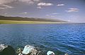
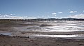
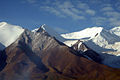
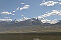
[edit]Since the opening of Qingzang Railway, scenery as viewed from the railway has become internationally famous:[40][41][42]
|
Golmud to Lhasa:
|
|
Gallery
[edit]-

-
-
 Bridge over the Tongtian River
 -

-
 Tanggula railway station
5,068 meters above sea level -
-
 Bridge on permafrost horizon
 -

-
-


.jpg)


See also
[edit]References
[edit]- ^ "CHINA TODAY". www.chinatoday.com.cn. Retrieved 20 August 2023.
- ^ 李松. "High-speed trains to run on Qinghai-Tibet line soon - Chinadaily.com.cn". epaper.chinadaily.com.cn. Retrieved 11 March 2024.
- ^ "Why did China build Railway to Tibet ? A documentay [sic] on Building Qinghai-Tibet Railway". Tibet Travel and Tours - Tibet Vista. Retrieved 11 March 2024.
- ^ "Qinghai-Tibet Railway Begins Operation | Congressional-Executive Commission on China". www.cecc.gov. Retrieved 11 March 2024.
- ^ "Tibet train". Tibet Travel and Tours. Retrieved 11 March 2024.
- ^ "Shanghai strives for straight train to Lhasa". Access Tibet Tour. Retrieved 28 June 2009.[permanent dead link]
- ^ "The Train to Lhasa, Tibet - What You Can Expect on the Ride". 7 June 2017.
- ^ "Qinghai-Tibet Railway World Records". Qinghai-Tibet Railway World Records. 11 August 2006. Archived from the original on 12 March 2024. Retrieved 12 January 2024.
- ^ Briginshaw, David (24 May 2022). "China to electrify 1136km Golmud - Lhasa line".
- ^ International2022-05-24T08:06:00+01:00, Railway Gazette. "Tibet railway electrification announced". Railway Gazette International. Retrieved 12 March 2024.
{{cite web}}: CS1 maint: numeric names: authors list (link) - ^ Goodman, David S. G. (June 2004). "Qinghai and the Emergence of the West: Nationalities, Communal Interaction and National Integration". The China Quarterly. 179 (178): 379–399. doi:10.1017/S0305741004000220. hdl:10453/6047. JSTOR 20192339. S2CID 55915069.
- ^ "开拓雪域高原的梦想之路——来自青藏铁路的蹲点报告" (in Chinese). Xinhua News Agency. 12 June 2019. Archived from the original on 24 May 2022. Retrieved 6 February 2020.
- ^ The first train rumbles on highest railway // Xin Dingding (China Daily), Updated: 1 July 2006
- ^ Xinhua News Agency (24 August 2005). New height of world's railway born in Tibet. Retrieved 25 August 2005.
- ^ Bombardier (25 February 2005). Bombardier "Awarded A Contract For High Altitude Passenger Rail Cars In Tibet". Retrieved 25 August 2005.
- ^ Extension plans. Retrieved 28 June 2006.
- ^ Bin, Sun (3 July 2006). "Sun Bin: Qinghai Tibet railway videos".
- ^ "Qinghai-Tibet railway to get six new lines". China Daily. 17 August 2008. Retrieved 17 August 2008.
- ^ 青藏铁路首条延伸线拉日铁路开工建设_社会频道_新华网. Xinhua News. 26 September 2010. Archived from the original on 29 September 2010. Retrieved 26 September 2010.
- ^ "Tibet railway opens to Xigaze". Railway Gazette. 15 August 2014. Archived from the original on 9 November 2018. Retrieved 16 August 2014.
- ^ "敦格铁路今日全线通车". 西海都市报 (in Chinese). 18 December 2019. Archived from the original on 18 December 2019. Retrieved 2 February 2020.
- ^ 格尔木至敦煌铁路开工. huochepiao.com. 20 October 2012.
- ^ "青藏铁路电气化改造进入可研阶段 - 西藏要闻 - 西藏在线". www.tibetol.cn (in Simplified Chinese). Retrieved 20 May 2019.
- ^ "Shigatse Railway: Shigatse Train Routes to Lhasa, Yadong and Kathmandu". TibetTravel.org. Retrieved 28 April 2024.
- ^ "连线青藏铁路总设计师:沿途尚预留13个车站_新闻中心_新浪网". news.sina.com.cn.
- ^ "China rolls out railway", BBC News.
- ^ "HK man first fatality on Qinghai-Tibet train". South China Morning Post. 29 August 2006. Retrieved 14 July 2020.
- ^ David Wolman, "Train to the Roof of the World", Wired, Vol. 14, No. 7 (July 2006).
- ^ "News on Chinese government website" Archived 16 January 2022 at the Wayback Machine, (in Chinese). Quotation: The vice president of Qinghai Medical University, Dr Gerili, said "Because of proper preventions and treatments, among tens of thousands of workers from low altitude, no one died due to altitude sickness. You cannot deny that it's a miracle."
- ^ ==="Qingzang railway transported .73M passengers, boosts Tibet economy" Archived 4 July 2007 at the Wayback Machine, CN Radio, (In Chinese).
- ^ "News – 青藏铁路使西藏100元不再等于54元".[permanent dead link]
- ^ "Protests as Tibet-China rail link opens – theguardian.com". TheGuardian.com. 30 June 2006. Retrieved 25 April 2022.
- ^ "西藏自治区社会各界共同庆祝青藏铁路通车一周年" (in Chinese). 中央政府门户网站. 1 July 2007. Retrieved 31 January 2020.
- ^ "向巴平措:青藏铁路促西藏进入"铁路经济"时代" (in Chinese). 中国新闻网. 29 June 2007. Archived from the original on 12 June 2018. Retrieved 12 June 2018.
- ^ "News – 修建青藏铁路 造福各族人民". Archived from the original on 5 May 2010.
- ^ "News – 旅客"三急"排泄物会熏臭青藏高原吗?". Archived from the original on 23 November 2012. Retrieved 19 July 2008.
- ^ "Global warming threatens Tibet railway: report". Reuters. Beijing. 6 May 2009. Retrieved 10 April 2010.
- ^ Ramachandran, Sudha (6 December 2020). "Tibet Railway Network Speeding Up to the Indian Border". Jamestown Foundation. Retrieved 6 December 2020.
- ^ 国产机车承担青藏铁路格拉线牵引任务,此前均由美国机车完成. China News Service. 2018-06-23.
- ^ The Good Views of Qingzang Railway from Golmud to Lhasa Archived 27 March 2012 at the Wayback Machine (in Japanese)
- ^ The Good Views of Qingzang Railway[permanent dead link]
- ^ Qingzang Railway (Hudong Encyclopedia) (in Chinese)
36. Xining to Lhasa Train schedule & price - Travel Tibet China
- M.W.H., Railroad in the clouds, Trains March 2002
- Forbes – The Tibet Train: Rocket To The Roof
Further reading
[edit]- Brunn, Stanley D. (6 April 2011). Engineering Earth: The Impacts of Megaengineering Projects Engineering Earth: The Impacts of Megaengineering Projects (Hardcover) (2011th ed.). New York: Springer. p. 2466. ISBN 978-9048199198.
- Lu, Ming; Li, Charlie C. (19 June 2006). In-situ rock stress: measurement, interpretation and application: proceedings of the International Symposium on In-situ Rock Stress (Hardcover). Trondheim, Norway: Balkema; Taylor & Francis. p. 552. ISBN 0415401631. Retrieved 17 December 2014.
- Oberlander, Christian (2008). Die Quinghai-Tibet-Bahn und ihre Auswirkungen auf China und die tibetische Minderheit (Print) (in German). Studienarbeit, München: GRIN-Verl. p. 40. ISBN 978-3-638-92379-8.
External links
[edit]![]() World's highest railway links Tibet to rest of China at Wikinews
World's highest railway links Tibet to rest of China at Wikinews
![]() Media related to Qinghai-Tibet Railway at Wikimedia Commons
Media related to Qinghai-Tibet Railway at Wikimedia Commons
| Government agencies | |||||||
|---|---|---|---|---|---|---|---|
| Road | |||||||
| Rail | |||||||
| Water |
| ||||||
| Aviation |
| ||||||
| Space | |||||||
| Other topics | |||||||
| Completed |
|
|---|---|
Public transportation in Qinghai (QH) | |||||
|---|---|---|---|---|---|
| |||||
| |||||
| Transportation hubs | |||||
Public transportation in Tibet | |||||
|---|---|---|---|---|---|
| |||||
| Overview | |||||||||||
|---|---|---|---|---|---|---|---|---|---|---|---|
| Types | |||||||||||
| Landforms and processes | |||||||||||
| Impact |
| ||||||||||
| Sites and case studies | |||||||||||
| Extremophiles | |||||||||||
| Explorers and scholars | |||||||||||
| Organizations and research |
| ||||||||||
| Related fields | |||||||||||
| International | |
|---|---|
| National | |
| Geographic | |