Rock Run Trails System
| Rock Run Trails System | |
|---|---|
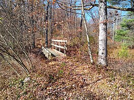 Footbridge on the Junction Trail, in the Rock Run Trails System | |
| Length | 12.2 mi (19.6 km) |
| Location | Centre County, Pennsylvania, US |
| Trailheads | Pennsylvania Route 504 east of Black Moshannon State Park |
| Use | Cross-country skiing, hiking |
| Elevation change | Moderate |
| Difficulty | Moderate |
| Season | Year-round; hiking discouraged during winter months |
| Hazards | Uneven and wet terrain, rattlesnakes, mosquitoes, ticks, black bears |
The Rock Run Trails System (RRTS) is a 12.2-mile (19.6 km) cross-country skiing and hiking trail in central Pennsylvania,[nb 1] consisting of an entrance trail and loop in Moshannon State Forest.[1] It follows several former logging railroad grades, some of significant historical interest.[2] It shares part of its route with the Allegheny Front Trail.
History and route
The Rock Run Trails System was developed for cross-country skiers to the east of Black Moshannon State Park in the early 1980s, by converting several former logging railroad grades.[3] The area is known for its high elevation and significant snowfall, attracting many cross-country skiers,[4] and the area already had several unofficial ski trails.[5] After its completion, the RRTS became popular with hikers during the non-winter months, inspiring calls for the creation of a longer backpacking loop trail now known as the Allegheny Front Trail, which was completed in the late 1990s and which makes use of a portion of the RRTS.[6]
The main trailhead for the RRTS is at the corner of Pennsylvania Route 504 and Tram Road, 4.5 miles east of the state park.[7] The RRTS heads north across a high plateau area, following a path formerly known as the Entrance Trail. This segment is shared with the Allegheny Front Trail. A loop junction is reached at 2.0 miles, where the Allegheny Front Trail departs to the west. Following the RRTS loop counter-clockwise, the trail turns right onto the former Woodland Trail and traverses the east side of a wide valley formed by Rock Run and its tributaries. At 3.7 miles, reach an intersection with a cross-connector known as the Junction Trail, which leads 0.14 mile west to the other side of the RRTS loop, forming a shortcut.[8] Back on the main RRTS loop, the trail crosses the Middle Branch of Rock Run at 5.3 miles and makes a sharp U-turn back to the south, now following the former Forks Trail,[9] which utilizes switchbacks built for an old logging railroad to climb the side of the valley.[10]
The Allegheny Front Trail rejoins the RRTS at 7.4 miles, and the two are concurrent for the rest of their respective distances.[11] The junction with the other end of the short Junction Trail is reached at 8.4 miles. At 10.1 miles, reach the end of the loop at the junction with the Entrance Trail that was encountered earlier.[9] Skiers or hikers following just the RRTS will complete this segment for the second time but in the opposite direction.[12] The two trails continue south until reaching the trailhead on PA 504, with the RRTS ending after 12.2 miles.[9]
Notes
- ^ Distances reflect new measurements made for a forthcoming updated edition to the 2014 guidebook cited, with the updates to be published in 2024.
References
- ^ Thwaites, Tom (2001). 50 Hikes in Central Pennsylvania (Fourth ed.). Woodstock, Vermont: Backcountry Publications. p. 122. ISBN 088150372X.
- ^ Cramer, Ben (2014). Guide to the Allegheny Front Trail (Second ed.). Spring Mills, PA: Scott Adams Enterprises. p. 88-89. ISBN 978-0-9851939-8-0.
- ^ Seeley, Ralph (2014). Foot Trails of the Moshannon and Southern Elk State Forests. Spring Mills, PA: Scott Adams Enterprises. p. 76. ISBN 9780985193973.
- ^ Cramer, Ben, ed. (2008). Pennsylvania Hiking Trails (13th ed.). Mechanicsburg, Pennsylvania: Stackpole Books. p. 146. ISBN 9780811734776.
- ^ Seeley, p. 68-69
- ^ Cramer, Guide to the Allegheny Front Trail, p. 88-89
- ^ Cramer, Guide to the Allegheny Front Trail, p. 34
- ^ Thwaites, p. 124-125
- ^ a b c Thwaites, p. 125
- ^ Seeley, p. 73
- ^ Cramer, Guide to the Allegheny Front Trail, p. 87
- ^ Cramer, Guide to the Allegheny Front Trail, p. 91-93
- v
- t
- e
Hiking trails in Pennsylvania
- Allegheny Front
- Appalachian
- Baker
- Black Forest
- Bucktail Path
- Chuck Keiper
- Conestoga
- Darlington
- Donut Hole
- Eagleton Mine Camp
- Eastern Continental
- Elk
- Fred Woods
- Gerard
- Glacier Ridge
- Golden Eagle
- Great Eastern
- Hickory Creek
- Horse-Shoe
- Jack Paulhamus/Garby
- John P. Saylor
- Laurel Highlands
- Lost Turkey
- Loyalsock
- Mason-Dixon
- Mid State
- Mill Creek
- Minister Creek
- Morrison
- North Country
- Old Loggers Path
- Pinchot
- Potomac Heritage
- Quehanna
- Rachel Carson
- Rock Run
- Rockton Mountain
- Slippery Rock Gorge
- Standing Stone
- Susquehannock
- T-Squared
- Tanbark
- Terrace Mountain
- Thunder Swamp
- Tracy Ridge
- Tuscarora
- Twin Lakes
- Warrior
- West Rim


