Scheyern | |
|---|---|
 | |
 Coat of arms | |
Location of Scheyern within Pfaffenhofen an der Ilm district 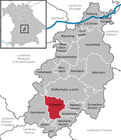 | |
 Scheyern  Scheyern | |
| Coordinates: 48°30′N 11°28′E / 48.500°N 11.467°E | |
| Country | Germany |
| State | Bavaria |
| Admin. region | Oberbayern |
| District | Pfaffenhofen an der Ilm |
| Government | |
| • Mayor (2020–26) | Manfred Sterz[1] (FW) |
| Area | |
• Total | 38.28 km2 (14.78 sq mi) |
| Elevation | 479 m (1,572 ft) |
| Population (2024-12-31)[2] | |
• Total | 4,883 |
| • Density | 130/km2 (330/sq mi) |
| Time zone | UTC+01:00 (CET) |
| • Summer (DST) | UTC+02:00 (CEST) |
| Postal codes | 85298 |
| Dialling codes | 08441 |
| Vehicle registration | PAF |
| Website | www.scheyern.de |
Scheyern is a municipality in the district of Pfaffenhofen in Bavaria in Germany. The Scheyern Abbey is located in Scheyern.
The title the counts of Scheyern originated here (see House of Wittelsbach).
The village of Fernhag lies just outside the town.
References
[edit]- ^ Liste der ersten Bürgermeister/Oberbürgermeister in kreisangehörigen Gemeinden, Bayerisches Landesamt für Statistik, 15 July 2021.
- ^ "Gemeinden, Kreise und Regierungsbezirke in Bayern, Einwohnerzahlen am 31. Dezember 2024; Basis Zensus 2022" [Municipalities, counties, and administrative districts in Bavaria; Based on the 2022 Census] (CSV) (in German). Bayerisches Landesamt für Statistik.
Towns and municipalities in Pfaffenhofen (district) | ||
|---|---|---|
| International | |
|---|---|
| National | |
| Other | |
This Pfaffenhofen district location article is a stub. You can help Wikipedia by expanding it. |