Shevchenkove, Izmail Raion, Odesa Oblast
Rural locality in Odesa Oblast, Ukraine
Village in Odesa Oblast, Ukraine
Shevchenkove Шевченкове (Ukrainian) | |
|---|---|
Village | |
 Orthodox Saint John's Church, built in 1848 | |
 Flag  Coat of arms | |
| 45°33′16″N 29°20′09″E / 45.55444°N 29.33583°E / 45.55444; 29.33583 | |
| Country |  Ukraine Ukraine |
| Oblast |  Odesa Oblast Odesa Oblast |
| Raion |  Izmail Raion Izmail Raion |
| Hromada | Kiliia urban hromada |
| First mentioned | 1776 |
| Founded by | 1790 as sloboda Karamahmed Historical affiliations
|
| Named for | Taras Shevchenko, 1946 |
| Government | |
| • Starosta | Oleksandr Ostapenko |
| Area | |
| • Village | 9,907 km2 (3,825 sq mi) |
| • Land | 98.68 km2 (38.10 sq mi) |
| • Urban | 6.37 km2 (2.46 sq mi) |
| Elevation | 32 m (105 ft) |
| Population (2001) | |
| • Village |  5,625 5,625 |
| • Rank | 5th in Izmail Raion 40th in Odesa Oblast |
| • Density | 883.05/km2 (2,287.1/sq mi) |
| Demonym(s) | Shevchenkivtsi, Karahmedchany |
| Time zone | UTC+2 (EET) |
| • Summer (DST) | UTC+3 (EEST) |
| Postal code | 68332 |
| Area code | +380 (48) 433-7x-xx |
| Climate | Dfa |


Shevchenkove (Ukrainian: Шевче́нкове, IPA [ˈʃɛu̯tʃenkowe] ⓘ) is a village in Izmail Raion of Odesa Oblast of Ukraine. It belongs to Kiliia urban hromada, one of the hromadas of Ukraine.[1] It is located 63 km (39 mi) from the raion center and 28 km (17 mi) from the Dzinilor railway station. The territory has a flat topography. A large cluster of water bodies in the Danube and Northern Black Sea basins is concentrated within a radius of 30 km (19 mi). According to the 2001 census, 5,625 inhabitants lived in the village, the territory is 6.37 km2 (2.46 sq mi), with the agricultural land measuring 98.68 km2 (38.10 sq mi), and by both indicators it is the largest village in the district.
The village was founded in 1790 as a Karamahmet sloboda of the Ottoman Empire. Renamed to Shevchenkove village in 14 November 1945 in honor of the poet-kobzar Taras Shevchenko. As of 17 July 2020, as part of the administrative reform in Ukraine, Shevchenkove became part of the Izmail Raion after the abolition of the Kiliia Raion.
Places of interest
-
 Palace of Culture
 -
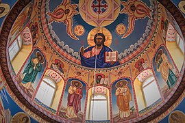 The dome of St. John's Church (since 2023 — Orthodox Church of Ukraine)
 -
 Facade of the Baptist Church, also called the House of the Gospel


History

In 1776, next to the estate of the general of the Ottoman army, Kara Mahmet (Ottoman Turkish: Kara Mehmet), on the bank of the Techia stream, the first Ukrainian settlement [fr] appeared, founded by Cossack families from Zaporozhian Sich. 23 April [O.S. 12 April] 1790, the settlement was transformed into sloboda. In 1812, following the Treaty of Bucharest, became part the Bessarabian Oblast of the Russian Empire. In 1856, according to the results of the Treaty of Paris, village became part of states under Ottoman Empire suzerainty: Principality of Moldavia (1856–1859), United Principalities of Moldavia and Wallachia (1859–1862), Romanian United Principalities (1862–1866), Principality of Romania (1866–1878). Sloboda became a village and labor obligations and taxes were introduced for the inhabitants. In 1878, according to the Treaty of Berlin, the village returned to the Bessarabia Governorate of the Russian Empire, and the Principality of Romania gained its independence. In 1917, after the collapse of the Russian Empire, the village became part of the self-proclaimed Moldavian Democratic Republic, formed in the former Bessarabia Governorate. In 1918, the Kingdom of Romania introduced romanian troops into the Bessarabia Governorate (including the village) and the decision was made to join Bessarabia to the Kingdom of Romania. In 1940, according to the Molotov–Ribbentrop Pact, the Soviet Union annexed Bessarabia to the USSR, and the village belonged to the Ukrainian SSR. 1941, after the start of Operation Barbarossa by the fascists, the village is under the occupation of the Kingdom of Romania. In 1944, during the second Jassy–Kishinev offensive, the Soviet Army liberated the village from the fascists, and in 14 November 1945 it was renamed Shevchenkove.[2] In 1991, after the dissolution of the Soviet Union, the village became part of Ukraine.
Administrative subordination
- Since 1873 — Karamahmet Volost, Akkermansky Uyezd, Bessarabia Governorate, Russian Empire
- Since 1904 — Karamahmet Volost, Izmailsky Uyezd, Bessarabia Governorate, Russian Empire
- Since 1925 — Karamahmed Commune, Chilia Nouă Plasă, Ismail County, Kingdom of Romania
- Since 1938 — Karamahmed Commune, Chilia Nouă Plasă, Ismail County, Ținutul Dunărea de Jos, Kingdom of Romania
- Since 28 June 1940 — The last king of Romania, Karol II, agreed to hand over Bessarabia to the USSR.
- Since 7 August 1940 — Karamahmet Volost, Akkerman Oblast, Ukrainian SSR, USSR[3]
- Since 11 November 1940 — Kiliia Raion, Akkerman Oblast, Ukrainian SSR, USSR[4]
- Since 19 July 1941 — Romanian military occupation zone of USSR
- Since 4 September 1941 — Karamahmed Commune, Kiliia Plasă, Chilia County, Bessarabia Governorate, Kingdom of Romania
- Since 24 August 1944 — Kiliia Raion, Akkerman Oblast, Ukrainian SSR, USSR
- Since 7 December 1940 — Kiliia Raion, Izmail Oblast, Ukrainian SSR, USSR[5]
- Since 15 February 1954 — Kiliia Raion, Odesa Oblast, Ukrainian SSR, USSR[6]
- Since 30 December 1962 — Izmail Raion, Odesa Oblast, Ukrainian SSR, USSR[7]
- Since 4 January 1965 — Kiliia Raion, Odesa Oblast, Ukrainian SSR, USSR[8]
- Since 24 August 1991 — Kiliia Raion, Odesa Oblast, Ukraine
- Since 12 February 2018 — Kiliia urban hromada, Kiliia Raion, Odesa Oblast, Ukraine[9]
- Since 17 July 2020 — Kiliia urban hromada, Izmail Raion, Odesa Oblast, Ukraine[10]
Until 17 July 2020, Shevchenkove belonged to Kiliia Raion. The raion was abolished in July 2020 as part of the administrative reform of Ukraine, which reduced the number of raions of Odesa Oblast to seven. The area of Kiliia Raion was merged into Izmail Raion.[11][12]
Population
According to the 2001 census, the majority of Shevchenkove's population was Ukrainian-speaking (96.85%).
References
Notes
- ^ "Килийская громада" (in Russian). Портал об'єднаних громад України.
- ^ Указ Президії Верховної Ради УРСР від 14 листопада 1945 "Про збереження історичних найменувань та уточнення і впорядкування існуючих назв сільрад і населених пунктів Ізмаїльської області"
- ^ Decision of the Politbureau of the CC of the VKP(b) dated August 6, 1940 and the decree of the Politburo of the Central Committee of the CPSU(b)U dated August 7 "On the formation of the Akerman and Chernivtsi Oblasts as part of Ukrainian SSR."
- ^ Decision of the Politbureau of the CC of the VKP(b) dated October 4, 1940 "On the formation of raions within the Akerman and Chernivtsi Oblasts of the Ukrainian SSR" and the Decree of the Presidium of the Supreme Soviet of the Ukrainian SSR dated November 11."
- ^ Decree of the Presidium of the Supreme Soviet of the USSR dated December 7, 1940 "On the transfer of the center of the Akkerman Oblast of the Ukrainian SSR from the city of Akkerman to the city of Izmail and the renaming of the Akkerman Oblast to the Izmail Oblast."
- ^ Decree of the Presidium of the Supreme Soviet of the USSR dated February 15, 1954 "On the liquidation of the Izmail Oblast of the Ukrainian SSR""
- ^ Decree of the Presidium of the Supreme Soviet of the Ukrainian SSR dated December 30, 1962 "On consolidation of rural areas of the Ukrainian SSR"
- ^ Decree of the Presidium of the Supreme Soviet of the Ukrainian SSR dated January 4, 1965 "On making changes to the administrative zoning of the Ukrainian SSR"
- ^ Рішення Кілійської міської ради від 12 лютого 2018 року № 663-VII-32 «Про добровільне об’єднання територіальних громад»
- ^ Regulation of the Verkhovna Rada of Ukraine No. 807-IX of July 17, 2020 "On the formation and liquidation of raions"
- ^ "Про утворення та ліквідацію районів. Постанова Верховної Ради України № 807-ІХ". Голос України (in Ukrainian). 18 July 2020. Retrieved 3 October 2020.
- ^ "Нові райони: карти + склад" (in Ukrainian). Міністерство розвитку громад та територій України.
External links
Wikimedia Commons has media related to Shevchenkove (Izmail Raion).
- Embassy of Ukraine to the State of Israel[permanent dead link]
- Ukraine Industrial
- v
- t
- e
- Ananiv
- Andriievo-Ivanivka
- Artsyz
- Avanhard
- Balta
- Berezivka
- Bilhorod-Dnistrovskyi
- Biliaivka
- Bolhrad
- Borodino
- Chohodarivka
- Chornomorsk
- Chornomorske
- Dachne
- Dalnyk
- Dobroslav
- Dolynske
- Dyviziia
- Fontanka
- Horodnie
- Ivanivka
- Izmail
- Karolino-Buhaz
- Kiliia
- Kodyma
- Konopliane
- Krasnosilka
- Krynychne
- Kubei
- Kuialnyk
- Kulevcha
- Kurisove
- Liubashivka
- Lyman
- Lymanske
- Maiaky
- Marazliivka
- Moloha
- Mykolaivka
- Nerubayske
- Novoborysivka
- Novokalcheve
- Odesa
- Okny
- Ovidiopol
- Pavlivka
- Petropavlivka
- Petrovirivka
- Pishchana
- Plakhtiivka
- Podilsk
- Raukhivka
- Reni
- Rozdilna
- Rozkvit
- Safiany
- Sarata
- Savran
- Serhiivka
- Shabo
- Shyriaieve
- Slobidka
- Stari Maiaky
- Starokozache
- Stepanivka
- Striukove
- Suvorove
- Tairove
- Tarutyne
- Tatarbunary
- Teplodar
- Teplytsia
- Tsebrykove
- Tuzly
- Usatove
- Uspenivka
- Vasylivka
- Velyka Mykhailivka
- Velykodolynske
- Velykoploske
- Velyky Dalnyk
- Velykyi Buialyk
- Vyhoda
- Vylkove
- Vyzyrka
- Yasky
- Yuzhne
- Zakharivka
- Zatyshshia
- Zelenohirske
- Znamianka
 | This article about a location in Odesa Oblast is a stub. You can help Wikipedia by expanding it. |
- v
- t
- e


