South West Khasi Hills district
District of Meghalaya in India
25°18′N 91°12′E / 25.3°N 91.2°E / 25.3; 91.2 (2011)
Southwest Khasi Hills is an administrative district in the state of Meghalaya in India.
History
The Southwest Khasi Hills district was carved out of the West Khasi Hills district on 3 August 2012.[1]
Geography
The district headquarters is located at Mawkyrwat. The district occupies an area of 1,341 km2. The district is compose all the villages of two Community & Rural Development Blocks viz. Ranikor and Mawkyrwat are Community & Rural Development Block, including 18 (Eighteen) Villages under Warsan Lyngdoh Gram Sevak Circle of Nongstoin in Community & Rural Development Block.
Administrative divisions
South West Khasi Hills district is divided into two blocks
| Name | Headquarters | Population | Location |
| Mawkyrwat | Mawkyrwat |  | |
| Ranikor | Ranikor | 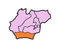 |
References
- ^ Official circular regarding Mawkyrwat Archived 2013-11-05 at the Wayback Machine
External links
- Official website
Places adjacent to South West Khasi Hills district | ||||||||||||||||
|---|---|---|---|---|---|---|---|---|---|---|---|---|---|---|---|---|
| ||||||||||||||||


