Springfield metropolitan area, Illinois
Metropolitan Statistical Area in Illinois, United States
Springfield Metropolitan Area Springfield, IL Metropolitan Statistical Area | ||
|---|---|---|
Metropolitan Statistical Area | ||
 Downtown Springfield and the Illinois State Capitol | ||
 Springfield–Jacksonville–Lincoln, IL CSA
| ||
| Country |  United States United States | |
| State |  Illinois Illinois | |
| Time zone | UTC−6 (CST) | |
| • Summer (DST) | UTC−5 (CDT) | |
The Springfield Metropolitan Statistical Area, as defined by the United States Census Bureau, is an area consisting of two counties in Central Illinois, anchored by the city of Springfield. As of the 2000 census, the MSA had a population of 201,437 (though a July 1, 2009 estimate placed the population at 208,182).[1]
Metropolitan Springfield is southwest of Chicago, south of Peoria, southwest of Bloomington and Champaign, and west of Decatur.
Counties
Communities
Places with more than 100,000 inhabitants
- Springfield (Principal city)
Places with 10,000 to 20,000 inhabitants
Places with 1,000 to 10,000 inhabitants
|
|
Places with 500 to 1,000 inhabitants
Places with fewer than 500 inhabitants
Unincorporated places
|
Townships (Sangamon County)
|
Precincts (Menard County)
- Athens North
- Athens South
- Atterberry
- Fancy Prairie
- Greenview
- Indian Creek
- Irish Grove
- Oakford
- Petersburg East
- Petersburg North
- Petersburg South
- Rock Creek
- Sand Ridge
- Sugar Grove
- Tallula
Demographics
As of the census[2] of 2000, there were 201,437 people, 83,595 households, and 54,361 families residing within the MSA. The racial makeup of the MSA was 88.11% White, 9.08% African American, 0.21% Native American, 1.04% Asian, 0.03% Pacific Islander, 0.37% from other races, and 1.16% from two or more races. Hispanic or Latino of any race were 1.04% of the population.
The median income for a household in the MSA was $44,777, and the median income for a family was $53,448. Males had a median income of $37,283 versus $27,912 for females. The per capita income for the MSA was $22,379.
See also
References
- ^ "Table 1. Annual Estimates of the Population of Metropolitan and Micropolitan Statistical Areas: April 1, 2000 to July 1, 2009 (CBSA-EST2009-01)". 2009 Population Estimates. United States Census Bureau, Population Division. 2010-03-23. Archived from the original (CSV) on June 15, 2010. Retrieved 2010-03-29.
- ^ "U.S. Census website". United States Census Bureau. Retrieved 2008-01-31.
- v
- t
- e
Springfield (capital)
- Index
- African Americans
- Buildings and structures
- Census areas
- Climate change
- Crime
- Communications
- Culture
- Delegations
- Earthquakes
- Economy
- Education
- Energy
- Environment
- Geography
- Government
- Health
- History
- Homelessness
- Languages
- Law
- Music
- People
- Politics
- Portal
- Protected areas
- Society
- Sports
- Symbols
- Tourism
- Transportation
- Windmills
- American Bottom
- Bloomington–Normal metropolitan area
- Central Illinois
- Champaign–Urbana metropolitan area
- Chicago metropolitan area
- Collar counties
- Corn Belt
- Driftless Area
- Forgottonia
- Fox Valley
- Illinois–Indiana–Kentucky tri-state area
- Metro East
- Metro Lakeland
- Mississippi Alluvial Plain
- North Shore
- Northern Illinois
- Northwestern Illinois
- Peoria metropolitan area
- Quad Cities
- River Bend
- Rockford metropolitan area
- Southern Illinois
- Wabash Valley
- Alton/Granite City/Edwardsville
- Arlington Heights/Palatine
- Aurora/Naperville/Oswego/Plainfield
- Bartlett/Hanover Park/Streamwood
- Belleville/East St. Louis/Collinsville/O'Fallon
- Berwyn/Cicero
- Bloomington/Normal
- Bolingbrook/Romeoville
- Buffalo Grove/Wheeling
- Calumet City
- Canton
- Carbondale
- Carol Stream/Glendale Heights
- Centralia
- Champaign/Urbana
- Charleston/Mattoon
- Chicago
- Chicago Heights
- Crystal Lake/Algonquin
- Danville
- Decatur
- DeKalb/Sycamore
- Des Plaines/Mount Prospect/Park Ridge
- Dixon
- Downers Grove/Woodridge
- Effingham
- Elgin/Carpentersville
- Elmhurst/Lombard/Addison
- Evanston/Skokie
- Freeport
- Galesburg
- Glenview/Northbrook
- Harrisburg
- Jacksonville
- Joliet
- Kankakee/Bradley/Bourbonnais
- Lincoln
- Macomb
- Marion/Herrin
- Moline/East Moline/Rock Island
- Mount Vernon
- Mundelein
- Oak Lawn
- Oak Park
- Orland Park/Tinley Park
- Ottawa/Streator/LaSalle/Peru
- Peoria/Pekin/East Peoria/Morton/Washington
- Pontiac
- Quincy
- Rochelle
- Rockford/Belvidere/Machesney Park/Loves Park
- St. Charles
- Schaumburg/Hoffman Estates/Elk Grove Village
- Springfield
- Sterling/Rock Falls
- Taylorville
- Waukegan/North Chicago/Gurnee
- Wheaton
- Adams
- Alexander
- Bond
- Boone
- Brown
- Bureau
- Calhoun
- Carroll
- Cass
- Champaign
- Christian
- Clark
- Clay
- Clinton
- Coles
- Cook
- Crawford
- Cumberland
- DeKalb
- DeWitt
- Douglas
- DuPage
- Edgar
- Edwards
- Effingham
- Fayette
- Ford
- Franklin
- Fulton
- Gallatin
- Greene
- Grundy
- Hamilton
- Hancock
- Hardin
- Henderson
- Henry
- Iroquois
- Jackson
- Jasper
- Jefferson
- Jersey
- Jo Daviess
- Johnson
- Kane
- Kankakee
- Kendall
- Knox
- Lake
- LaSalle
- Lawrence
- Lee
- Livingston
- Logan
- Macon
- Macoupin
- Madison
- Marion
- Marshall
- Mason
- Massac
- McDonough
- McHenry
- McLean
- Menard
- Mercer
- Monroe
- Montgomery
- Morgan
- Moultrie
- Ogle
- Peoria
- Perry
- Piatt
- Pike
- Pope
- Pulaski
- Putnam
- Randolph
- Richland
- Rock Island
- Saline
- Sangamon
- Schuyler
- Scott
- Shelby
- St. Clair
- Stark
- Stephenson
- Tazewell
- Union
- Vermilion
- Wabash
- Warren
- Washington
- Wayne
- White
- Whiteside
- Will
- Williamson
- Winnebago
- Woodford
 Illinois portal
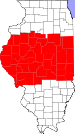


39°48′N 89°39′W / 39.800°N 89.650°W / 39.800; -89.650


