Stora mossen | ||||||||||||||||
|---|---|---|---|---|---|---|---|---|---|---|---|---|---|---|---|---|
| Stockholm metro station | ||||||||||||||||
 Station platform, 2007 | ||||||||||||||||
| General information | ||||||||||||||||
| Coordinates | 59°20′05″N 17°57′54″E / 59.33472°N 17.96500°E | |||||||||||||||
| Owned by | Storstockholms Lokaltrafik | |||||||||||||||
| Platforms | 1 island platform | |||||||||||||||
| Tracks | 2 | |||||||||||||||
| Construction | ||||||||||||||||
| Structure type | At grade | |||||||||||||||
| Depth | 0 m (0 ft) | |||||||||||||||
| Accessible | Yes | |||||||||||||||
| Other information | ||||||||||||||||
| Station code | SMO | |||||||||||||||
| History | ||||||||||||||||
| Opened | 26 October 1952 | |||||||||||||||
| Passengers | ||||||||||||||||
| 2019 | 2,650 boarding per weekday[1] | |||||||||||||||
| Services | ||||||||||||||||
| ||||||||||||||||
| ||||||||||||||||

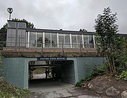
Stora Mossen metro station is a station on the Green line of the Stockholm metro. It is located on the border between the districts of Ulvsunda and Stora mossen, which are part of the borough of Bromma in the west of the city of Stockholm. The station is on an embankment and has a single island platform, with access from a pedestrian subway under the line linking Drottningholmsvägen and Stora Mossens Backe.[2][3] The distance to Slussen is 9 km (5.6 mi).[citation needed]
The station lies on the route of a line known as the Ängbybanan that formerly linked Alvik and Islandstorget. The Ängbybanan was designed and built for use by the future metro, but was operated from 1944 as part of line 11 of the Stockholm tramway. Stora mossen station was inaugurated as part of the metro on 26 October 1952 with the conversion of the Ängbybanan and its extension to form the metro line between Hötorget and Vällingby.[2][4]
Gallery
[edit]-
 The subway, 2017
 -
 Entrance from subway, 2017
 -
 inside the station, 2017
 -
 Station from the east, 2010


References
[edit]- ^ "Fakta om SL och regionen 2019" (PDF) (in Swedish). Storstockholms Lokaltrafik. p. 51. Archived (PDF) from the original on 27 December 2020. Retrieved 1 April 2021.
- ^ a b Schwandl, Robert. "Stockholm". urbanrail. Archived from the original on 23 April 2019. Retrieved 7 May 2019.
- ^ "Stora mossen". Google maps. Retrieved 10 March 2022.
- ^ Jacobson, Per (1998). En spårväg till Bromma [A tramway to Bromma] (in Swedish). Oslo: Baneforlaget. ISBN 82-91448-25-6.
| Green line |
| ||||||||||
|---|---|---|---|---|---|---|---|---|---|---|---|
This article about a Swedish railway station is a stub. You can help Wikipedia by expanding it. |
This Stockholm Metro article is a stub. You can help Wikipedia by expanding it. |