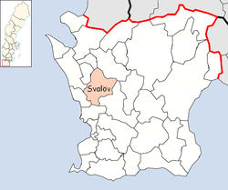
Svalöv Municipality
Svalövs kommun | |
|---|---|
 Municipal Hall | |
 | |
| Coordinates: 55°55′N 13°07′E / 55.917°N 13.117°E | |
| Country | Sweden |
| County | Skåne County |
| Seat | Svalöv |
| Government | |
| • Mayor | Teddy Nilsson (Sweden Democrats) |
| Area | |
• Total | 388.62 km2 (150.05 sq mi) |
| • Land | 387.3 km2 (149.5 sq mi) |
| • Water | 1.32 km2 (0.51 sq mi) |
| Area as of 1 January 2014. | |
| Population (30 June 2025)[2] | |
• Total | 14,402 |
| • Density | 37/km2 (96/sq mi) |
| Time zone | UTC+1 (CET) |
| • Summer (DST) | UTC+2 (CEST) |
| ISO 3166 code | SE |
| Province | Scania |
| Municipal code | 1214 |
| Website | www.svalov.se |
Svalöv Municipality (Swedish: Svalövs kommun) is a municipality in Skåne County in southern Sweden. Its seat is located in the town Svalöv.
The local government reform of 1952 grouped the 15 original entities into six larger municipalities. In two steps, 1969 and 1971 they were amalgamated to form the present municipality.
The most common housing category is one-family houses.
There are local pågatåg trains connecting Teckomatorp, in the south of the municipality, with Malmö, Lund and Helsingborg. To get to the town of Svalöv, one can take a bus (approximately 15 minutes) from Teckomatorp.
The villages Röstånga, Kågeröd, Teckomatorp, Svalöv itself and parts of Söderåsen National Park are located in the municipality. The villages are all connected via local buses.
Knutstorp Castle is situated in the municipality along with the Ring Knutstorp race track. The famous astronomer Tycho Brahe was born there.
Urban areas
[edit]There are 6 urban areas (also called a Tätort or locality) in Svalöv Municipality.
In the table they are listed according to the size of the population as of December 31, 2005. The municipal seat is in bold characters.
| # | Locality | Population |
|---|---|---|
| 1 | Svalöv | 3,344 |
| 2 | Teckomatorp | 1,644 |
| 3 | Kågeröd | 1,413 |
| 4 | Billeberga | 948 |
| 5 | Röstånga | 846 |
| 6 | Tågarp | 434 |
Demographics
[edit]This is a demographic table based on Svalöv Municipality's electoral districts in the 2022 Swedish general election sourced from SVT's election platform, in turn taken from SCB official statistics.[3]
In total there were 14,398 residents, including 10,158 Swedish citizens of voting age.[3] 38.7% voted for the left coalition and 59.6% for the right coalition. Indicators are in percentage points except population totals and income.
| Location | Residents | Citizen adults |
Left vote | Right vote | Employed | Swedish parents |
Foreign heritage |
Income SEK |
Degree |
|---|---|---|---|---|---|---|---|---|---|
| % | % | ||||||||
| Billeberga-Tågarp | 2,335 | 1,689 | 35.5 | 62.7 | 82 | 81 | 19 | 26,378 | 37 |
| Kågeröd-Stenestad | 2,337 | 1,709 | 33.7 | 65.0 | 81 | 86 | 14 | 25,657 | 33 |
| Röstånga - Konga-Ask | 1,920 | 1,422 | 42.0 | 56.6 | 80 | 84 | 16 | 25,042 | 44 |
| Svalöv N | 1,888 | 1,285 | 40.0 | 57.8 | 74 | 65 | 35 | 22,747 | 30 |
| Svalöv V | 1,741 | 1,262 | 36.8 | 61.6 | 87 | 79 | 21 | 27,053 | 34 |
| Svalöv Ö | 1,521 | 947 | 44.8 | 51.5 | 71 | 64 | 36 | 20,928 | 27 |
| Teckomatorp-Norrvidinge | 2,656 | 1,844 | 40.5 | 58.5 | 79 | 76 | 24 | 25,240 | 36 |
| Source: SVT[3] | |||||||||
References
[edit]- ^ "Statistiska centralbyrån, Kommunarealer den 1 januari 2014" (in Swedish). Statistics Sweden. 2014-01-01. Archived from the original (Microsoft Excel) on 2016-09-27. Retrieved 2014-04-18.
- ^ "Folkmängd och befolkningsförändringar - Kvartal 2, 2025" (in Swedish). Statistics Sweden. 21 August 2025. Retrieved 21 August 2025.
- ^ a b c "Valresultat 2022 för Svalöv i riksdagsvalet" (in Swedish). SVT. 11 September 2022. Retrieved 13 January 2024.
External links
[edit]- Svalöv - Official site
- Coat of arms
