Támara, Casanare
Municipality and town in Casanare Department, Colombia

Flag
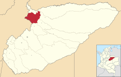
Location of the municipality and town of Tamara, Casanare in the Casanare Department of Colombia.
 Colombia
(2016-2019)
(2015)
Támara is a town and municipality in the Department of Casanare, Colombia. The urban centre is located at an altitude of 1,156 metres (3,793 ft) at a distance of 95 kilometres (59 mi) from the department capital Yopal. It borders in the north Sacama, in the east Pore and Paz de Ariporo, in the west Socotá of the department of Boyacá and in the south Nunchia and Paya, Boyacá.[1]
History
Támara before the Spanish conquest of the Muisca was an important cotton producing village.[1]
Modern Támara was founded on August 6, 1628, by José Dadey Pey.[1]
Economy
Main economical activities in Támara are agriculture; coffee, yuca, maize, bananas and sugarcane and livestock farming.[1]
References
- ^ a b c d (in Spanish) Official website Támara

5°49′47″N 72°09′48″W / 5.82972°N 72.1633°W / 5.82972; -72.1633


